About Joe Wein

Software developer and anti-spam activist

Outlook Express Error 0x800CCC0B and the End of TLS 1.0 (Deprecated SSL Protocol)

Microsoft Outlook Express (OE) is an obsolete mail client that was available in Microsoft Windows XP, Windows 2003 Server and older Microsoft operating systems. It was no longer available on Windows Vista and later, though Windows Live Mail is relatively close in user interface and appearance.

Despite being obsolete and only working on operating systems no longer supported or updated by Microsoft, it still has some users who prefer its simple but powerful user interface. Some of those users will have had a frustrating experience recently, when various mail servers stopped working for outbound mail in OE. Specifically, these are mail servers that use SSL on submission port 465 or 587 for SMTP.

Secure Socket Layer (SSL) is a mechanism for encrypting data between a client and a server. You may know it from website URIs starting with “https:” and web sessions displaying a padlock symbol next to the URI. There are various protocol versions that can implement this encryption layer. One of these, TLS 1.0 which was conceived in 1999, has now been officially deprecated (made officially obsolete) as of the end of June 2018. Software now has to use more recent protocols, such as TLS 1.1, TLS 1.2 or the recently defined TLS 1.3.

Unfortunately, TLS 1.0 is all that OE will speak. It does not understand TLS 1.1 or later. Therefore it can not pick up mail from a POP server using SSL on port 995 or an IMAP server on port 993 or send mail to an SMTP server on port 465 (or 587) with SSL enabled.

Workaround
The only workaround I am aware of (other than switching to a more modern mail client) is to use Stunnel, a tool for Windows or Linux that acts as a proxy. You can configure it to establish an SSL connection to a given host and port when a connection to a given local port is made. Thus you could configure OE to connect to port 9465 on the machine running Stunnel, which might then connect via SSL to smtp.example.com:465 using a more modern TLS version supported by Stunnel (but not directly by OE).

Example
Let’s say Outlook Express was configured to submit outbound mail to smtp.outboundmailserver.com, port 587 via SSL/TLS. This is our SMTP server. Once this server refuses to allow TLS 1.0 connections, Outlook Express will no longer work. Let’s say we also have a simple Linux server mylinuxserver.com. This could even be something like a Raspberry Pi single board computer booting off flash memory. It can run on a local IP in our LAN, if you don’t need to have access from outside your building (OE running on a desktop). On this server we install the stunnel package:

sudo yum install stunnel

Please read the documentation on how to enable the service and have it auto-start when the Linux server reboots.

Next we configure stunnel to act as a client on our behalf and configure it to accept TLS 1.0 connections from us and forward them to the real POP3, SMTP or IMAP server using the latest TLS on our behalf. We will create lines like these in /etc/stunnel/stunnel.conf:

client = yes

;cert = /etc/pki/tls/certs/stunnel.pem
;sslVersion = TLSv1
;chroot = /var/run/stunnel
;setuid = nobody
;setgid = nobody
;pid = /stunnel.pid
;socket = l:TCP_NODELAY=1
;socket = r:TCP_NODELAY=1

[smtp-outboundmailserver]
accept = 1587
connect = smtp.outboundmailserver.com:587

Create other entries for the services that you need TLS support for and restart the stunnel service. Then reconfigure Outlook Express to access the Linux host and the port number listed with “accept = ” in place of the original server that refused your Outlook Express TLS 1.0 connection. You should be good to go!

Long term you will still need to migrate to another mail client such as Thunderbird, Windows Mail or OE Classic, but this workaround will buy you some time for that.

Chichibu Adventures: Mitsumine Shrine and Gelateria Hana

“The best way to be a frugal traveler is to learn to truly love the things that don’t cost a lot of money, like eating honest, simple food, gazing at unfamiliar scenery or making new friends.”

(Matt Gross, New York Times)

Almost every year I’ve been doing a bike ride in Chichibu, a rural basin surrounded by mountains in the west of Saitama prefecture, to see the autumn leaves there, but I also enjoy it in other seasons. A week ago I had planned to head back there, but changed my plans due to the rainy Saturday forecast, as the rainy season was still not over. Since then the summer heat has invaded us with high humidity and temperatures of over 30 C every day.

Instead of that Saturday ride I joined two friends on Monday for my first true summer ride this season. The temperature hit the high 30s. I drank plenty of water, but was still exhausted when I got home. In the latter part of the ride I passed Senzoku-ike, a lake in Tokyo that I had never visited before. I took pictures at a Shinto shrine (Senzoku-ike Benzaiten) on a small island accessible via a bridge. There were ajisai (hydrangeas) growing at the park and the bright red shrine looked relatively recently renovated. I enjoyed discovering a new spot I had not seen before.

The following weekend my friend Jack, with whom I had ridden in Chichibu several times before, announced he would head back there for a some cycling with a friend, so I decided to join him. We initially wanted to do the old “Ghost Town Loop”, a ride past a deserted mining town, but then found out the road leading there was closed due to repair work on some tunnels. A phone call to the office in charge in Chichibu confirmed that the repairs would still take a couple more months. Our friend Mike suggested we might head to nearby Mistsumine shrine instead, which neither of us had been to before.

On Saturday morning I loaded my Elephant NFE into my Prius and drove out to Chichibu. Unlike with my Bike Friday, I still don’t have a good way of taking my NFE on trains, due to its front rack and fixed fenders that don’t make for easy disassembly to get a smaller package that’s easier to carry on.

After a 2 hour drive I parked the car in the parking lot of the Michi-no-Eki (Road Station), which has ample space and is not far from Seibu-Chichibu station, where Jack and his friend would arrive. After unloading the bike, changing into my SPD shoes and putting on my helmet, I filled up my water bottles at the tap of nearby public toilets. Next to the toilets there was a public fountain where people were filling up as many water containers as would fit into the back of their car. You see this kind of thing a lot. Even though tap water in most places in Japan is very good, some people swear by specific sources in the mountains and use the water from there for making tea or cooking soba noodles, for the very best taste. They will even drive there regularly, like every week.

Next I stopped at a nearby convenience store to get some food and have a cup of coffee, as I was still early: I had left enough time, just in case the roads were congested but they hadn’t been. It was only the second time I had taken to the car to Chichibu for cycling and the first time on this particular route (via National Route 299 from near Hanno).

Then I cycled the last km to the station and looked for Jack. He and his friend soon arrived. It turned out to be Kuba, who I had known online for years, but who now lives oversees. He had been a very strong cyclist in the past but recently he had not been riding much. Consequently we picked a very moderate pace, which suited all of us fine in this heat. It was a sunny day, with a forecast high of 34 C, but usually with the tarmac soaking up the sun the air temperatures above the road will be hotter than the forecast, unless the road happens to be shaded.

We followed the familiar route west out of town towards the ghost town, avoiding the main road as much as possible in favour of small back roads. That made it easier to ride side by side and to talk. After about 24 km we got to the t-junction where a right turn used to take us to the ghost town and for the first time we turned left, unto an unknown road signposted for Mitsumine Shrine.

At a shaded place up the road with one of the ubiquitous drinks vending machines we stopped and filled up our water bottles and talked for a while while we cooled off again.

Soon we got to Futase dam and Chichibu lake behind it. After taking a few pictures we followed the road across the top of the dam and started climbing on the other side. It was a steady uphill, some of it quite exposed to the sun. We all climbed at our own pace but reassembled every now and then, to cool off in the shade together and talk. It was around 35 C and not even noon yet. There were quite a few cars and the odd bus heading up towards the shrine, which we knew was a major tourist attraction.

The distance numbers on the road signs were getting smaller and finally the climb leveled off as we got close, now at about 1,000 m elevation, about 750 m above where we had started. The shrine was not visible from the road, only a big car park with cars, motorcycles and buses. We headed in there to use the toilets and to fill up our water bottles again.

We discussed visiting the shrine, but Jack was also interested in visiting Gelateria Hana after we’d get back to Seibu-Chichibu station. On several rides to the ghost town he always made it back too late to still be able to do that. So we decided we’d give the shrine a miss and instead head on, to increase our chances of ice cream, pizza and espresso at Hana.

There was almost no traffic on the road beyond the shrine (I had heard that side was closed to cars but saw no sign prohibiting entry to motor vehicles and we did actually encounter a handful of cars). After 2.5 km we reached a tunnel through the mountains at about 1150 m above sea level. The cool air inside felt so pleasant. We could almost have staid there, but then we wouldn’t have seen the views that awaited us… Such as the stunning panorama presenting itself after the tunnel exit!

We were high above the valleys below, near the peak of Kirimogamine (霧藻ケ峰), and could see the Chichibu basin spread out to the north. For me this one view alone was worth riding a 70 km loop and riding uphill 10 km on a hot day 🙂

As we continued, there was a lot of sand on the road, perhaps still left over from the winter service. I proceeded very carefully until the road was clear again, as I didn’t want to wipe out in a corner. My companions got ahead of me but I knew they would wait for me somewhere.

This side of the mountain was beautiful, very green and shaded. After a while the road joined a mountain stream which then merged into the wild Ochi river. We descended for over 10 km, giving up about 750 m of elevation.

Climbing up this way would be scenic but hard. I’ll try a reverse loop one day!

Eventually we crossed the Arakawa and rejoined the main road. Since it was almost all downhill from there to Chichibu, we could keep going pretty fast and didn’t take the same back roads. Still, Jack concluded that by the time we got back to the station, if he were to visit the ice cream shop before taking the train back, it wouldn’t leave enough time for their existing evening plans, so he dropped Gelateria Hana — again.

Meanwhile, I was intrigued enough about it that when we finally made it to the station after 16 km in the sun on the main road, I told my friends that I’d give the cafe a try.

Chichibu is famous for its many temples and shrines, which inspire both pilgrimages and shrine festivals (o-matsuri). I passed a shop displaying traditional masks used at shrine festivals.

Route 11 to the cafe was easy to follow and flat until the last few km, but once it started climbing, it also entered the shade of the forest and the air felt pleasantly cool. Nice!

Soon I arrived at the cafe, which is popular with cyclists. There was a bike rack in front. I got a table on the deck outside in the back with a view of the river.

I tried some blend coffee with plain waffles and their chocolate-mint ice cream. It was a nice treat after the ride.

The staff was very friendly. The waiter had asked me where I was from. When I went to pay, his colleague expressed regret about Germany’s misfortune at the football (soccer) world cup 🙂

His sympathy for my country’s team was a nice gesture, but to be honest I’m not actually interested in football. This is not as uncommon in Germany as the stereotypes would have you believe: According to consistent annual opinion poll results, of the German-speaking population aged 14 and over some 36% are “not particularly” or “not at all” interested in football, outnumbering both the less than 35% that are “especially” interested in it and the not quite 30% that are “also but not that much” interested.

There you have it, only a minority of Germans has a strong interest in football and that’s whether their country’s team wins or loses!

The ride back to the car was easy. There I changed back into my non-cycling shoes and got into the car. I decided that, before I drove home, I’d still visit Mt Buko, the tall mountain that dominates Chichibu city. One side of it is scarred by a huge limestone quarry. It really stands out in the mountainous skyline of Chichibu from far away and it looks like something out of The Lord of the Rings to me… It was an interesting drive, but I’ll save that report for another time 🙂


2018 AJ NishiTokyo 400 km Fuji Big Loop

On Saturday/Sunday, May 12/13, 2018 I finished BRM512 (BRM512富士大回り400km), at 400 km my biggest brevet of the year. After having abandoned the 300 km BRM414 AJ NishiTokyo brevet around Mt Fuji due to atrocious weather conditions on April 14/15, 2018 (see report here), I had been a bit nervous about this one. It does an even bigger loop with more elevation gain (3500 m vs. 3000 m) and in my case, because I’m a slow cyclist, more time spent not sleeping.

I love the splendid Fuji views and the great variety of scenery that AJ NishiTokyo’s 400 km brevet offers. It covers 4 prefectures (Tokyo, Kanagawa, Yamanashi and Shizuoka). In both years in which I had completed the 400 previously (2015 and 2016), I pre-rode it as a personal ride on my own two weeks before the event, which really helped to prepare myself (2015 and 2016 reports).

On the day of this ride my father, who passed away from cancer about 5 years ago, would have turned 80. As a keen hiker, he would have appreciated the views and the camaraderie of this event. I was thinking of him a lot this day.

Preparing for the ride

The abandoned 300 km in April shook my self-confidence, since it was the first time I had abandoned a brevet on a course that I had successfully completed before, even if it was due to an external influence such as extreme weather. I then decided on a crash course to get into shape for the May ride, still doing only one long ride a week, but picking difficult ones.

Cycling legend Eddie Merckx is often quoted as having advised: “Don’t buy upgrades, ride up grades!” Personally I somewhat doubt he would have said that, given this English play on words would not work well in other languages, that Eddie was from the Dutch-speaking part of Belgium and back in those days he was far more likely to be interviewed by French, Italian, Dutch or German-speaking journalists than English-speaking ones. Nevertheless, as advice it is spot on 🙂

There are a couple of courses that I tend to ride only infrequently (such as once a year or less) because they’re so hard. One of those is the Oume Temple Loop, a mountainous course near Hanno conceived by my friend Deej. Most years I only rode it once, if at all, but then in 2017 I ended up doing it twice just one week apart, each time with a different friend. I really thought that exercise helped me on my subsequent Fuji 300 brevet, which I finished with a personal best time despite insanely hot temperatures.

So for this year I put the Oume Temple Loop back on the menu. One week after the rained-out Fuji 300 I cycled to Oume to pick up six other people and we rode the course. One highlight is the Takayama climb, a big climb of 8 km that gets steeper and steeper and tops out at over 20%.

You will pay for this effort on all subsequent climbs on the ride. The scenery is beautiful though. Many of the rindo (forest roads) are exceptionally quiet. It’s a world apart from Tokyo.

Two days later I announced a repeat of the ride for the next weekend and was rejoined by one of the participants from the first time and three others. Again it was very hard. I don’t know if the memory of the previous ride helped or discouraged, but we did it.

The next weekend I organised a ride up the Kazahari rindo, a forest road in Hinohara with up to 19% that has a reputation for being painfully steep, followed by a visit to the Nippara Limestone Cave.

Altogether I did 5 rides of 178 km or more on the 5 weekends before BRM512. I think especially the Temple Loop rides were excellent training, both physically and mentally.

In the week before the ride I tried to avoid staying up too late and took a nap on some days if I had got too little sleep for some reason. I also watched the weather forecasts for Saturday and Sunday for several locations around Mt Fuji, to make sure there was no chance of rain.

The Monday before the brevet I took my Elephant Bikes NFE to Tim of GS Astuto to install new brake pads and check the rotors as I knew the pads were pretty worn out. It turned out the rear pads were actually worn down to the metal. With fresh resin pads the brakes are fantastic again.

On Friday evening I loaded up the bike to cycle 29 km to Sagamihara, where I had booked a room for the night at Toyoko Inn, so I could get plenty of sleep and would only have to cycle 3 km to the start of the event. Despite having rested the whole week I didn’t feel particularly energetic on the way to the hotel, but it always depends on how you feel the day of the ride. A good night’s sleep can make a lot of difference.
25 hours of adventure

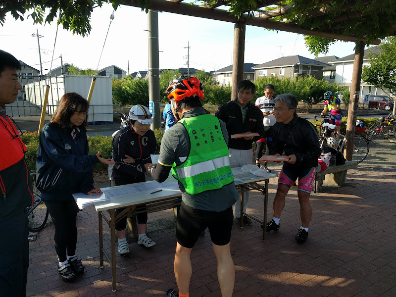
My alarm went off at 05:40 in the morning. I had gone to bed around 22:00 the night before, but woke up twice during the night. I took a quick shower, got dressed and picked up my things to check out. Soon I was on the road. 10 minutes later I arrived at the park for the brevet start. I greeted old friends and picked up my brevet card at the AJ NishiTokyo reception. A lot of the conversations as we were waiting for the briefing were about the last brevet, the washed-out Fuji 300 km. 57 people who had signed up were sensible enough to not even start. I met two of only 8 finishers out of 23 starters. Fortunately the forecast for BRM512 was much more favourable – no rain, a high of about 27 C and a low of about 13 C.

After the briefing and safety check we were off. I think there were about 70 of us. Before we got out into the countryside, we had to stop for a number of traffic lights. At one of them, the lead cyclist wanted to turn left following the course of the brevet in previous years, while the new course went straight. As I pulled up next to her, I pointed out the three areas where the route had changed from the years before. Perhaps she had not studied the new route in detail. I had sat down in front of two computers with two monitors, comparing the old and the final new route side by side about a week before the ride.

I also always make sure to download the route as a GPX file to my GPS so I can follow a breadcrumb trail on its screen, a virtually foolproof way of navigating a course.

Despite the length of the course, even out in the countryside I was often within sight of other cyclists, and sometimes drafting or leading someone. That’s always reassuring, as it tells you that your performance is reasonable enough.

The organisers had replaced one untimed check on the way to Yamanakako with a timed check point near Kawaguchiko, at about 900 m above sea level. Previously PC1 (point de contrôle 1) had been only after the descent from Motusoku, at much lower elevation again, which allows one to make up time lost climbing from sea level to the elevation of the Fuji Five Lakes.

I stopped at one convenience store before entering Doshi road (national route 413) to buy food and some bottled milk tea, then again at the Doshi road station (Michi no Eki Doshi) around km 51. The climb from there to the tunnel felt hard. I was feeling my legs, but I knew the biggest climb would be out of the way and if I could only maintain any time buffer ahead of the required minimum speed that I was left with by then, I could finish the ride by maintaining slightly less than a 15 km/h average, as long as I didn’t get too sleepy.

I saw the first Fuji view around Doshi village and was surprised how clear it looked, because there were some clouds in the sky. Nevertheless, on the other side of the pass, the views got even better.

On the shore of Yamanakako (Lake Yamanaka) I could see the snow-capped peaks of the Japanese Southern Alps, which is actually fairly rare. Half the time you can’t even see Mt Fuji from the lake that lies right in front of it! It was a gorgeous day for views.

From the north side of the lake we followed a minor route, away from national routes 138/139 that we had taken in 2015/2016. The roads were much more quiet. We passed forests and a flower park. Most of it was downhill too. Finally PC1 came up, around km 82. I was 41 minutes ahead of schedule, which was not bad. I bought some food and kept the receipt as proof of the passage.

This 7-11 store was right in front of the entrance to a 2.4 km long tunnel. As I was eating and talking to staff and other cyclists, I saw two cyclists in reflective randonneur vests enter the tunnel without stopping for the PC. Later, as I had almost crossed the tunnel, I saw them come back towards the PC inside the tunnel as they must have realized their mistake.

After the tunnel the route followed the north shores of Kawaguchiko and Saiko, again offering beautiful Fuji views and opportunities for photographs. Then the road climbed to meet up with Rt139, but only followed it for 6.5 km, with the Aokigahara forest on our side.

I was looking forward to the national route 300 turnoff for Motosuko (Lake Motosu). There’s a famous spot facing Mt Fuji where you get the exact same view of it as you see on a 1,000 Japanese yen bank note (well, except for the seasonal amount of snow and the reflection of the mountain on the lake surface depending on how smooth it is with wind, etc). Everybody stopped here to take a picture.

Right after that we entered the tunnel for the Motosu road descent, the biggest and fastest descent on the entire course. On a previous event one of the participants had a bad accident here and had to be airlifted to a hospital, so AJ NishiTokyo staff will always point out to be careful on this descent.

There are some nice views on this descent too and I stopped again for pictures. After the steepest part we turned off for Yamanashi prefectural route 9, which crosses over to an adjacent valley, then another long descent all the way to PC2 near km 133. After the time gained on the fast descent, I was now 1:25 (85 minutes) ahead of the minimum pace.

There were no big climbs on the way to the untimed checkpoint near Minami Alps at km 156, so progress was good. In fact, we even had a nice tailwind. Though this would turn into a headwind on return, the return route also starts with a fair bit of descending that initially more than compensated for the headwind.

I passed a TDK factory in Minami Alps that had beautiful rose bushes facing national route 52.

The checkpoint on top of a loop-shaped ramp provided a nice view of the wide mountain valley at the heart of Yamanashi prefecture, including Mt Fuji. Though it was still almost another 50 km to the half-way point of the ride, it felt like we were already half way there.

There I met my friend Mr O., usually an extremely strong rider, who was resting and looking exhausted. He had not had enough chance to cycle this year to prepare himself. He decided to do the safe thing and retire from the ride.

The return route passed through small towns with a nice descent.

I could still enjoy the Fuji views from the Minami Alps side, which were as clear as from Yamanakako and Kawaguchiko.

Gradually the road became more level and the wind more noticeable, especially after we rejoined Rt52 along the Fujikawa river to the coast. Then we crossed the river near Minobu and followed the Minobu railway line. The road became more hilly and evening approached. There’s a lot of construction going on for the Chūbu-Ōdan Expressway that will connect Chūō Expressway to Shin-Tōmei Expressway when completed.
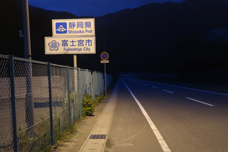
I don’t really like those hills along the Minobu railway, especially after dark when there are no more views, so I was glad when about half an hour after sunset I reached PC3 in Shibakawa (219 km from the start), 2 hours and 14 minutes (134 minutes) ahead of closing time.

From here it wasn’t far to the coast and I crossed the river, now heading east towards Numazu.

At daytime there would have been more Fuji views, but at night it was just city streets. Every now and then I came across other cyclists who passed me.

I was just keeping a steady pace, every now and then yawning or standing up to relieve my bottom, which was starting to complain about the amount of time spent on the bicycle saddle.

In Numazu the route turned south into Izu. After Shuzenji it became more rural. I was looking forward to the tunnel at the top of the pass and the descent towards Ito. I made it to PC4, 290 km from the start, a little after midnight, now 2 hours and 15 minutes ahead of closing time. I took a 5 minute nap on a chair inside the convenience store. Others were sleeping too.

For the night ride I was wearing long johns under my shorts and also a base layer under my jersey, but no windbreaker which remained unused for the entire ride. It never got cold enough.

It felt great to descend to the east Izu coast line and to finally hear the ocean waves. It was still dark and I could admire the many stars above the ocean, since there was a lot less light pollution than in Tokyo.

Even after the descent there are four significant climbs between Ito and Odawara, the biggest one being for the road high above Manazuru which lasts for about 4 km. I was feeling safe in the knowledge of having made good time so far. I did yawn every now and then, but the nap had helped. My legs felt OK, not particularly strong but not suffering either and my bottom was OK as long as I made frequent efforts to stand instead of sitting throughout.

It was still dark in Odawara but dawn gradually arrived on the ride east to Chigasaki.
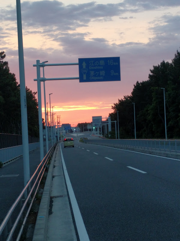
I saw newspaper motorbikes deliver morning papers and the odd surfer heading to the beach already. Soon after Rt 30 split off the coastal road I saw the 7-11 sign that announced PC5, the final control (367 km from the start). To get my receipt and to use the toilet, I bought a cup of coffee and a sandwich.

I had only 36 km left and was 2 hours and 4 minutes ahead of closing time. I basically had 4 1/2 hours to get to Machida. Two years ago, I had been one hour ahead of closing time at PC5 and still made it despite a puncture 16 km from the goal that chewed up most of the time buffer.

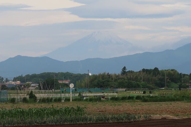
There were still more Fuji views on the way to Machida. Rain was forecast for the late afternoon and I could see clouds and occasionally feel raindrops, but rain was still a long way off.
Sunday morning traffic and traffic lights slowed me down but looking at the remaining distance and time, I figured I had a chance to make the goal by 08:00, a full two hours before goal closing time at 10:00, so I pushed harder. It was not easy after 24 hours on the road, but I tried anyway. I didn’t know if I would make that time until the very end. It was only when I rolled up in front of the Cherubim Bike Shop, greeted by AJ NishiTokyo staff who confirmed 08:00 as my arrival time, that I knew I had completed the course the full two hours under the limit!

I parked the bike and got out my brevet card and receipts to have them checked. After signing for the result, I opted for the medal (1,000 yen extra). Then I had some coffee and snacks and chatted with staff members and fellow participants about the course and about bikes.

About riding long distances

It’s hard for normal people to comprehend how someone can ride 200, 300 or 400 km in a single ride, but each of these rides builds on previous rides in physically and mentally conditioning you for the next challenge. We dare to do more challenging rides only because we successfully rode other, initially also intimidating rides.

Any road cyclist who has done 50 km rides can do 100 km rides, and anyone who has done 100 km rides will find 200 km rides within reach. As long as you keep the effort sustainable and keep eating and drinking and ride a bike that fits you, you can keep on going for a very long time. At some point, sleep will become the limiting factor, which then becomes a question of average speed vs. control closing times and your tolerance for sleep deprivation.

This 400 km course may actually be becoming my favourite AJ NishiTokyo course, rivaling even the 200 km West Izu (Shiokatsu) course that I also love for its views.

Though it’s longer than the smaller 300 km Fuji ride, I don’t think it’s necessarily any harder. Certainly, in recent years I’ve been able to finish the 400 km with more spare time than in the case of the 300. Perhaps that’s because the effort in the 400 is more concentrated in the first part, when the legs are still fresh, while the 300 saves its biggest climb for halfway into the course. Also, while the 400 has one third more distance than the 300, it only has about one sixth more climbing. This should allow for a higher average speed.

Beyond the 400 km brevet

I won’t be riding the AJ NishiTokyo 600 km brevet to Lake Suwa and back in early June because I’ll be away on a business trip. So there probably won’t be any brevets for me until September or so. Instead I’ll be just riding with friends again, maybe explore some new routes.

Again this year I won’t go for Super Randonneur (SR) status, which involves riding 200, 300, 400 and 600 km distances all in one season. 600 may be beyond reach for me under all but the most favourable conditions, because it’s hard for me to build up enough spare time to sleep enough to keep functioning. Gaining SR status in 2019 is also the qualifying condition for participating in the 1,200 km Paris-Brest-Paris event next August, which I am not currently aiming for.

I very much enjoyed my bicycle tour in Italy with my son Shintaro a year ago, where we only covered about 90 km each day, but had nice meals in little restaurants in the countryside.
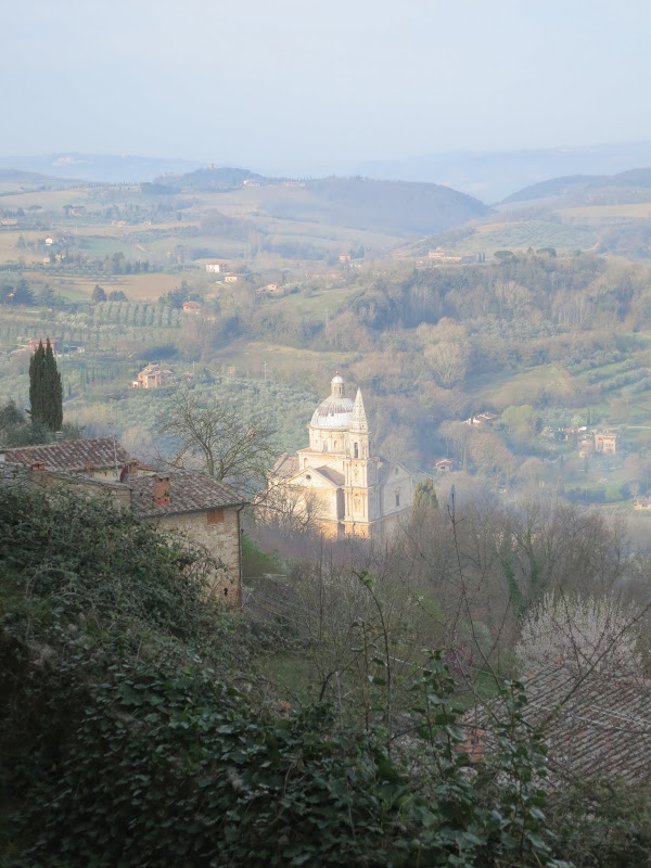
If I were to try more cycling in Europe or elsewhere overseas, this is more like what I would like to try, while keeping up randonneuring as a challenge here in Japan.


BRM414 300 km Fuji, Wet and Windy Edition

On Saturday/Sunday I cycled in the 300 km brevet around Mt Fuji organised by AJ NishiTokyo, like in the six previous years. Last year I set a personal best time of 18 hours 51 minutes, which is 1 hour 9 minutes under the 20 hour time limit. This year I was not so hopeful. As the day approached, the weather forecast had turned increasingly worse, finally predicting heavy rain and very strong winds on the course between midnight and about 10:00 on Sunday morning. As it turned out, that forecast was spot on!

I had done the 300 km Fuji brevet in the rain once before, in 2014 (see pictures here), but this time turned out far worse.

After getting a couple of hours of rest on Saturday afternoon, I cycled 28 km to Machida for the late night start (22:00). In 2014 I had taken the train there and it had already started raining on the way from Machida station to the event starting point. We then had the pre-ride briefing inside the Cherubim bike shop. This year the rain held off until almost 40 km into the brevet, on the way to Enoshima.

At the start

The crowd at the start was much smaller than usual. As it turned out, most signed-up would-be participants had chosen not to start (DNS) due to the weather conditions. I had cycled to the start in my rain wear, but took it off at a convenience store near the start because I was starting to sweat in it. Four years ago I had worn my Polaris rain jacket, which is even warmer. For fear of overheating I went with a lighter jacket this time.

At the briefing we were told about two of the bail-out options, should we chose to retire from the ride. Both Odawara and Gotemba have train stations, but by the time we were to arrive there, the last trains would have left. Nevertheless there would be places around the stations where we could take shelter from the weather until the first morning train.

After the bike inspection we set off. It was quite windy, but no rain yet. Up to Enoshima on the coast I rode more by myself than in a group.

A couple of km before we reached the coast the first rain drops started falling and it steadily picked up. The first check point was a 7-Eleven store about 2 km east of Enoshima. I got there about 10 minutes to midnight.

When I came out of the store again the wind was fierce, whipping up sand off the beach which hit our faces and got on our teeth and into the eyes. The road was narrowed for some roadworks, so being pushed around while cars were passing wasn’t pleasant.

I was worried I’d be cycling into a headwind on the way to Odawara, but the wind pattern wasn’t very consistent. Whichever way it shifted though, it did slow us down. Also, there was little chance for riding with others.

When I reached PC1 (point de controle) in Odawara, 72 km from the start and 100 km from home for me, it was 40 minutes later than last year. I knew I had to get well ahead of the 15 km/h average that dictates control closing times and the overall time limit while I was on the flat part of the course to make it to PC3 in time, after hours of climbing on the west side of Mt Fuji later in the day.

After Odawara I put on my do-it-yourself shoe covers, fashioned out of some plastic bags and tape, to keep my shoes and socks dry. Nevertheless, as I started climbing up to Gotemba, which sits on a saddle between the Fuji and Hakone volcanoes, gradually I was getting soaked more and more. My long sleeve jersey and my uniqlo long johns were absorbing cold rain that leaked through the rain gear. I think my Polaris rain jacket would have done a much better job at keeping me dry.

I cycled with another participant for the middle part of the climb, but then stopped at a convenience store for food and a toilet break. My eyes started getting irritated. Either the rain was washing sweat into my eyes, or it was sand stuck to my face since Enoshima that got washed into my eyes. Taking off my glasses and wiping my eyes with the back of my gloves or the fingers didn’t help much.

The climb leveled off near Gotemba but the wind and rain were still picking up in intensity. At this wind speed the rain drops felt like pin pricks to the skin. At dawn the atrocious weather and the near absence of people gave the scenery an almost apocalyptic feel. From here it was about 25 km downhill to Numazu, but with no prospect of the weather improving soon. This was perhaps the coldest part of the course due to of the combination of rain, early morning hours and wind chill while descending. I was already shivering with cold while alternating between closing my left and my right eye to avoid the burning feeling.

Checking my notes, I was now running about an hour behind my 2017 times. The lack of a time buffer already made it questionable if I could make it to PC3 in time even if I could make it to PC2 OK. On this course my time buffer usually decreases significantly from PC2 to PC3 due to the time loss on the long west Fuji climb.

More importantly, the combination of eye trouble, hypothermia symptoms and the strong wind made me think about the risks of continuing. Even if I could coast down to Numazu, if I had to abandon the ride after that I would have to climb back up to Gotemba to get back home or ride the full course. That’s when I, remembering the advice at the pre-ride briefing, decided to find shelter from the storm in Gotemba and to head back to Odawara once things had improved.

Two or three other cyclists passed after I turned around and I shouted out to one of them that I was retiring. I found a McDonald’s on Google Maps that was open 24h and not too far away. I locked up my bike outside and walked in with my front bag. I bought myself some breakfast with coffee and sat down in a corner. I could take off my rain jacket to let my jersey dry. After eating I took a nap. When I woke up again it was still raining hard. Around 08:00 I called the organizers and let them know I was retiring from the event and would cycle home by myself.

An hour later it looked like the rain had eased a bit. I cleared my table and headed outside again. It got warmer as I descended towards Odawara. I took pictures of the muddy, swollen rivers I passed.

After about another hour the rain stopped. The black and grey rain clouds against the sunlight at the coast were beautiful.

I joined the coastal road and headed east, past Enoshima to Kamakura.

There I crossed the mountains over to the Tokyo bay side of Miura peninsula, then up to Yokohama and Kawasaki. I got home about 24 hours after I had set off, with 283 km of cycling. I hadn’t caught a single glimpse (let alone taken a picture) of Mt Fuji, but I was glad to be home safely.

This definitely wasn’t the most fun bike ride I have done, but unlike other difficult rides I have done, I also didn’t get much of a feeling of achievement out of it — the first time in 7 years that I didn’t complete the Fuji loop. Perhaps this is one time I should have decided to stay home when I saw the consistently bad weather forecasts. It would have been the rational thing to do. But for me, long distance cycling is not that rational a thing to do. Much of it is a mental challenge as much as a physical one.

I do long rides because I love the views, but partly I also do long rides so I won’t be afraid of doing long rides. They can be intimidating. I can take on bigger challenges only because I have faced smaller challenges before. You overcome fear of being stranded in a strange place by venturing out there and facing the challenges. Sometimes I learn something about myself from the experiences. It can be a balancing act. I am never 100% committed to achieving my immediate goal, because there are more important objectives. To be able to continue doing long rides, I can’t get seriously injured or worse, so I need to decide what risks to take and when to cut my losses.

My next brevet will be BRM512 AJ NishiTokyo 400 km Fuji Big Loop (BRM512富士大回り400km), a course I also rode in 2015 and 2016. Hopefully with nicer weather than last weekend 🙂

Links:


PC Closing Times in Randonneuring

Brevets / Randonnees are timed events in which cyclists ride a pre-determined course, passing a number PCs (points de controle) and completing the overall course under a time limit. It’s not a race and results are not published ranked by completion time. The overall time limits are:

  • 200 km – 13:30 h
  • 300 km – 20:00 h
  • 400 km – 27:00 h
  • 600 km – 40:00 h
  • 1000 km – 75:00 h

These limits mostly correspond to an average speed of 15 km/h, including all breaks for rest, food, sleep, etc.

Each PC also has a defined closing time. Before a recent brevet, I took a look at the PC closing times in a cue sheet and it seemed the first PC was open too late, i.e. later than what would correspond to a speed of 15 km/h from the event start time to the PC, but it turned out to be the correct time.

Today I had a look at the official regulations and found out why. Basically, the 15 km/h equivalency only applies above 60 km and until 600 km. For any PC in the first 60 km of the course, the closing time is one hour after when you would arrive there at 20 km/h (both formulas arrive at the same result at 60 km: 4 h * 15 km/h = 60 km; 3 h * 20 km/h = 60 km). This provides a sensible rule for participants who start later than the course opening time, for example because they arrive late or because the event has so many participants that it takes a significant amount of time for all of them to cross the starting line. A ride starting at 7:00 could have a final starting time of 8:00 and people can still make check points as long as they maintain an average of 20 km/h, making up the time within the first 60 km.

The average speed required after reaching the 600 km mark also drops, to 11.428 km/h between 601 km and 1000 km. In a 1000 km brevet, participants have 35 hours for the final 400 km vs. 40 hours for the first 600 km. This provides more time for sleeping on longer events.

Participants at Paris-Brest-Paris (1200 km) also have more time for the return journey from Brest than they have on the way out. In the slowest category, participants have 90 hours for the complete trip, vs. 40 hours for the first half, leaving up to 50 hours for the second half.

I understand the rules for control closing times a bit better now.

Personally, I am too slow to leave enough time for more than extremely short naps on a reasonably hilly course, such that I am unable to complete anything over 400 km because I end up with too much of a sleep deficit after about 27 hours. Therefore I will probably never experience the benefit of the more relaxed control closing times that kick in after the 600 km point.

I’ll be riding a 300 km brevet coming Saturday / Sunday and the trick, as always, will be to get enough sleep upfront to be able to make it through the (20 hour maximum) course without getting too sleepy during the event 🙂

Getting ready for BRM414 NishiTokyo 300 km Fuji

A week from now I’ll be riding BRM414 NishiTokyo 300km Fuji (BRM414西東京300km富士), a 300 km clockwise loop around Mt Fuji from Machida to Machida (Sat, 22:00 -> Sun, 18:00).

In May 2012 this course was my introduction to randonneuring and I’ll be riding it for the 7th consecutive year.

This year the course has been updated in a couple of places. The checkpoint at Enoshima has moved from the public toilets near Katase-Enoshima station to a 7-11 further east. PC1 in Odawara has also been moved to a 7-11 with better toilets. PC2 in Shibakawa is in the same place, but has switched from being a Circle K to a Familymart. Around Kawaguchiko-Fujiyoshida the route has been moved from N139 to smaller roads nearer to the lake, avoiding some of the notoriously rough road surfaces there. The rest of the route is the same as last year.

The 22:00 start followed by 7 hours of riding through the night makes it essential to get plenty of sleep before the start. I’ll take a good nap in the afternoon before I ride 28 km to the start. Some rain is forecast for Saturday. Hopefully the ride itself will be dry, but I have once done this course with it raining for the first 150 km, which is not much fun (and it’s a pity if Mt Fuji is obscured by rain clouds).

This weekend I will be riding another century distance (160.9 km or more) as my last preparation ride before the event. This should make April my 68th consecutive month with at least one century ride.

Picasa: “Failed to download album list”

If you are still using the Picasa 3 desktop application by Google and got the above error message, here’s some bad news for you: Google has finally killed this app. On March 26, 2018 they announced that it would no longer be able to upload new albums. So this error message is not temporary and there is no direct fix.

I think it’s very regrettable that Google has been killing off Picasa step-by-step. This is only the latest nail in the coffin. I had been using Picasaweb and Picasa since 2010 and they were great products.

The good news is that you can still create albums from folders using a web browser. Say you have a folder named “2018-03-26 Cherry Blossom Party”. Just follow these steps (for Windows and Chrome):

1) Select its parent folder in Windows Explorer, then slowly click on the folder that you want to upload, twice: Once to select it, then once more to enable you to edit the folder name as if to rename it. When the name becomes editable, press Ctrl+C to copy the folder name, then press Esc to keep the name unchanged. This stores the folder name in the copy-and-paste clipboard, which will save you from having to manually retype the name later.

2) In Chrome, go to https://photos.google.com/ and click on “Upload” (on the top right). A file selector dialog will open up. Click through to the contents of the folder you want to upload. Select all files in the folder using Ctrl+A and click “Open” to confirm the upload.

3) The browser will upload all files and give you a choice of “Add to album” or “Shared album”. Select “Add to album”. To create a new album with the name of the folder, select “New album”. Click on the album name showing as “Untitled” and use Ctrl+V to paste the name you copied in step 1. Hit Enter and click on the check mark to confirm creation of the new album.

Voila, you have a new album online, with the same name as the local folder. Repeat as needed for multiple folders. This is as simple as it gets without the old Picasa app.

Strava Cycling Climbing Challenges

Strava is a popular service for logging bike rides and other activities, which provides a way of comparing one’s achievements with those of other cyclists and runners. Competition is a powerful stimulant and a main driver behind the success of the service. Monthly “challenges”, such as a Gran Fondo (a ride of at least 100 or 130 km, depending on the time of the year) or a monthly cumulative distance or elevation gain challenge, are particularly popular on Strava.

While I regularly participate in the Cycling Distance and Gran Fondo Challenge, I do not normally sign up for the Cycling Climbing Challenge, which is meant to encourage you do ride hilly courses. I love hilly courses. In fact, most of my weekend rides are hilly, usually going from close to sea level to over 900 m and back.

Last year I averaged one century ride (at least 160.9 km / 100 miles) about every other week, so the Gran Fondo challenge is not really that much of a challenge for me. My typical centuries are about 170-190 km with 1800-2100 m of elevation gain. Yet at 7500 to 8000 m the goal for the Cycling Climbing Challenge is set so high, I could do a hilly century ride four Saturdays in a row and still miss the climbing goal. So how do other people, who do not ride 170 km into the hills every other weekend complete the climbing challenge?

I think the Strava climbing goals are designed for people who record their rides with phones or other GPS devices that rely only on satellite data for elevation. GPS-based elevation data is much less precise than lattitude-longitude data. Other popular GPS units like the Garmin Edge 1000, Garmin Edge 520 (or my o_synce Navi2coach) use a barometer for more precise elevation tracking. The problem with GPS-based elevation is that it’s noisy, it will go up and down pretty randomly but all those little ups will be added up by Strava, resulting in a considerably inflated climbing total. If you’re using a GPS device measuring relatively accurate barometric elevation, you can’t really compete against all that noisy data 🙁

I could confirm this in group rides with other people who were using mix of equipment, where I had a chance to compare the posted stats on Strava afterwards. The iPhone or Android-app recorded totals were often 50-100% higher than the Garmin-recorded totals, for one and the same course.

Here is one random example of 4 people doing the same course up a volcano in Tenerife, Gran Canria yesterday. Note, this not my ride, I just randomly stumbled on it while looking at high scorers in the March Cycling Climbing Challenge on the Strava website. Two of these cyclists were using the Strava iPhone app, the other two were using a Garmin Edge 520:

Strava iPhone App:
https://www.strava.com/activities/1437744625
5,080m

Strava iPhone App:
https://www.strava.com/activities/1437728113
4,635m

Garmin Edge 520:
https://www.strava.com/activities/1437709764
2,847m

Garmin Edge 520:
https://www.strava.com/activities/1437730812
2,556m

As you can see, the two cyclists using the phone app posted almost double the total climbing for the course as the Garmin users, despite riding the very same roads and posting the same elevation profile for the activity (i.e. no hill repeats).

Based on evidence like that, I don’t think elevation gain competitions on Strava are happening on a level playing field! 😉

2018BRM120 Miura Peninsula

I rode my third century of January and my first randonnée of the year on Sunday. After completing the 204 km ride (finished in 12:04) I rode home, for a total distance of 233 km. I had done the same event in 2015 – with only minor route changes – and almost the same time (12:06).

The main difference was that on Sunday it was not quite as chilly. Perhaps that was because it was overcast, which preserved more heat from the day before than if the night sky had been clear. It also meant that the sun wasn’t in our faces (and the faces of drivers coming up behind us) when we cycled towards Kawasaki around sunrise. I felt a lot safer because of that.

This brevet is the flattest by far of any events that AJ NishiTokyo (my local club) organizes. On the other hand, the first third and the last quarter had a fair number of traffic lights. Still, there was less pressure to make closing times than on any other brevet I rode.

I had to be at the start by about 5:20 to pick up the brevet card and attend the safety briefing, so the night before I rode 30 km from my home to a cheap hotel near the start where I spent the night. This I could still get almost 7 hours of sleep. Perhaps I’m getting soft in my old age 🙂

After passing by the Yokohama harbour near Chinatown, I took the optional route over the hills. This is where a lot of foreigners set up their homes when Japan opened to the world after the arrival of Commodore Perry’s Black Ships. On the Yamate district up on a hill you see many western style villas, a great view of the harbour and the historic Foreign Cemetery.

From Kawasaki to Yokohama down to Yokosuka the roads were urban, with traffic lights slowing you down. Yokosuka is home to the US Seventh Fleet. Not far from it is where William Adams (the Miura Anjin of James Clavell’s “Shogun”) had his fief back in the 1600s. The peninsula turns rural thereafter.

It was too overcast to see the mountains of Boso peninsula in Chiba, on the opposite side of the mouth of Tokyo bay. At Kurihama I passed Perry Park, a memorial to Commodore Perry who landed here in July 1853.

Following the coastline the route passed through seaside towns and fishing villages. Miura peninsula is one of the vegetable gardens of Tokyo, with mainly cabbage and daikon (radish) being grown.

After PC2 in the southwest corner of the peninsula, the route headed up the west coast. This is my favourite part, particularly in the late afternoon, with the sunlight reflected in the ocean, or when it’s cloudy and the sky can be very atmospheric. We passed the Imperial villa at Hayama. Emperor Yoshihito, father of WW2-era emperor Hirohito, died here in 1926.

A couple of km to the north we passed by Kamakura, one of the 4 historic capitals of Japan (Kyoto, Nara, Kamakura and Edo/Tokyo). In summer it’s popular for its beach, but even in winter there are many windsurfers (see picture at the top).

The next major town was Enoshima, which offers great views of Mt Fuji when it’s sunny, but not that day. Before the mouth of the Sagami river we turned inland, heading up north to loop back to the start. About 5 km later we reached PC3, that final control before the goal.

By this time I was about 1:15 ahead of closing time, so I could have made it to the goal even with an average of 10 km/h. I still kept up the speed to cover as much distance as possible before the sun went down. I only rode about the last hour in darkness, plus the ride home after the event.

Due to business travel my February distance will be lower than my January distance, but I’ll try to get one century in on the first February weekend, weather permitting. Today it’s snowing here in Tokyo. Usually we only have a couple of days of snow a year and this makes CaM a lot easier here than in many other parts of the planet.

Swisscoin (SIC) Crypto-Currency Spam

When crypto-currencies like Bitcoin (BTC) were first introduced, they were claimed to offer the potential of a low-cost, frictionless international payment system. This has not really happened, as BTC turned out to be severely restricted on the volume of transactions it could handle. From then on, it increasingly became a vehicle for criminal transactions (including fraud) and speculation.

In the past twelve months, people have been buying BTC and other crypto-currencies primarily because of the expectation that they could later sell them at a profit. This has allowed existing holders of crypto-currencies to do precisely that. This is very much how “pump and dump” scams operate, usually involving unlisted (OTC) stocks.

“Pump and dump” scams used to involve selling by phone, but in recent years many switched to email spam. Now we are seeing crypto-currencies being advertised via spam. One example is Swisscoin (SIC), as in this email received on 2018-01-16:

It’s probably not news to you at this point if I tell you that bitcoin has made tons of people tons of money. Something else you probably already know is that it will never go up like crazy again. Its time to shine is long gone. That’s why we must look into what the next big thing is, and the truth is that there have been plenty over the last few months. Can you jump on the next huge one before it soars? Swiss coin {SIC} is the most likely candidate for a fifty thousand percent return this year. It has the support of the Switzerland government. It is already considered as legal in the country. It’s the type of coin that you can buy a thousand bucks of right now, sit on for a small period of time and you could make out crazy wealthy when all is said and done. SIC has already doubled since Saturday. This long Martin Luther King weekend could bring you even more upside if you act quickly. For those of you who know what this means- you can get it for under 50 satoshi right now. And if you have no clue what this means, it basically means that you can get in on the ground floor How do you get some? You just need an account at coinexchange. Read the currency’s official page to find out more info: https://swisscoin.eu/sic-deposits.html

The truth is, far from “having the support of the Switzerland government”, Swisscoin / swisscoin.eu is listed on a warning list by FINMA, Switzerland’s independent financial-markets regulator. The Swiss company listed in the FINMA warning did not have an office there. It was founded with a capital of only CHF 20,000. Its officers are based in Leipzig, Germany.

There is no “ground floor” opportunity for Swisscoin. It has been marketed via MLM since 2016 and various people called it a Ponzi scheme. The Dynamoo blog writes in a recent post:

There are questions as to whether Swisscoin is actually a cryptocurrency or a Ponzi scheme. Honestly, I don’t know and I’d advise you to do your own research. However, this has all the markings of a pump-and-dump scheme, so it’s quite possible that someone who bought Swisscoins at their peak wants to pump the price up so they can sell off their holdings. Given that the spam is being sent out from a network of hacked machines and does not comply with anti-spam laws, you can pretty much guarantee that this is not legitimate and should be avoided.

Never buy anything advertised via spam!