400 km in 26 hours on a Bike Friday

On April 18/19 I rode the BRM418 Fuji Omawari (“Fuji Big Loop”) 400 km brevet by AJ NishiTokyo. It was part of my quest to complete 200-300-400-600 km brevets in one year for the Super Randonneur title. Those four are also needed to qualify for Paris-Brest-Paris this August, which I’m not seriously planning for.

The course had a 27 hour time limit, from 07:00 on Saturday to 10:00 on Sunday. The total elevation gain of the course is about 3700 m over an official distance of 402.4 km. There were five check points (PC1-5, point de contrôle), all of them convenience stores from which we needed to get receipts, plus one quiz check point halfway to PC1.

As for most AJ NishiTokyo events the start and finish were at the Cherubim bike shop in Machida. From there the course heads out via Doshi michi (Rt413) to Yamanako (Lake Yamanaka), past Motosuko (Lake Motosu) to Minami Alps city, then down to the coast, across Izu to Ito, Atami, Odawara and back to Machida.

Though it might look like most of the climbing was in the first quarter because of the highest elevation there, there is more total elevation gain yet to come after the big descent from the Fuji five lake area.

I had tried this event last year but around the half-way point started to fade badly from lack of sleep . There was no way I could make the remaining control closing times. Even after sleeping some time I decided not to cycle all the way back but to take the train from Odawara station, so I didn’t even do the full distance.

To prevent a repeat of this outcome I decided to:
1) get more sleep upfront and
2) not to bring a rinko bag on the ride 🙂

I also rode the complete course as a personal ride without time limit two weeks before the event, Tokyo to Tokyo (460+ km total). This gave me a better feel for the course, for how my body would react and what clothes would be appropriate this season. And it worked!

On Friday night I checked into a cheap hotel near Machida so I would have a quiet early night and wouldn’t have to take the bike on the first train in the morning to make it to the registration desk by 06:00, before the briefing at 06:30. At 5000 yen the hotel was cheap, but the supposedly non-smoking room reeked of cigarette smoke. It was hot and stuffy too, so I woke up several times. Unfortunately the similarly priced but much nicer Toyoko Inn in Sagamihara where I had staid before BRM110 in January was full…

Saturday morning started out sunny, but I had packed my rain gear in case of rain on Sunday and as an extra layer if it got too cold at night. I never needed it during the ride: A wind breaker was enough for the cold and it didn’t start drizzling until Sunday afternoon.

On the way to the start I bought some bananas for breakfast. At the briefing we were told about some course changes in the latest version of the cue sheet, then a safety check and we were off. I think I was the only one at the start without leg warmers.

Doshi michi has a lot of ups and downs before it reaches the 1114 m pass before Yamanakako, so you actually climb something like 1700 m up to that point and we also faced head winds. I think I was passed by almost all participants by the time I reached the lake.

Unlike at the ride two weeks earlier Fuji was visible this time.

I was wearing my shorts and no wind breaker. For that it was chilly, especially at Motosuko which was covered in low clouds with only 7 degrees C according to a road side display. The coldest point of the ride was not before sunrise in Izu but at noon at Motosuko.

Due to the amount of climbing I was running about 20 minutes behind the minimum average speed for PC closing times by then. Not coincidentally though, PC1 had been placed after a long fast descent at much lower elevation, so we could make up a lot of lost time. It was extremely windy on the steep Rt300 descent the other side of the Motosuko tunnel, but temperatures also got much milder again.

I made it to PC1 (a Seven 11 at 125 km) 20 minutes before closing time, then on to PC2 (a Lawson) in Minami Alps at 152 km, also with only 20 minutes spare.

After PC2 came a long downhill stretch, which was great for recovery. The Yamanashi side of Mt Fuji staid in full view for a long time.

As the sun set we joined Rt52 towards the coast, a fast flat road with a fair amount of traffic.

I passed a few other cyclists before we got to the hilly section leading to PC3 (a Circle K at Shibakawa, 217 km). This is where it started to get difficult last year, but not this time: After riding this section in the rain after midnight two weeks earlier, it felt downright comfortable in evening hours in the dry.

I was wondering where I would get really sleepy. I didn’t think I was so well prepared after that hotel stay, but my pace didn’t drop. At the Ministop that served as PC4 in Izu (km 275) I found myself an hour ahead of closing time. Several others took a nap at the conbini. I was too excited to nap and had a cup of coffee instead.

In the dark on the pass over to the east coast of Izu I startled a small deer and later some racoon-like animal, but nothing scary.

There are four climbs on the coastal road before Odawara, each one several km long. I didn’t take any pictures in the early dawn. It was cool and overcast, not clear and warm as when I passed there last year:

Near Atami I stopped for my third cup of coffee at a conbini as I was feeling sleepy, when an accident happened outside. A group of Randonneurs who were part of a different event had passed and one of them had his front wheel caught in a gap in a sewer grate. He had landed head first on the road, cracked his helmet and probably broke his nose. When I got there he was lying flat on his back on the side walk, with a handkerchief covering his face, not moving but conscious. There was blood on the road. His friends had called an ambulance which soon arrived. The other cyclists then asked us to continue. That situation kind of woke me up again. Ours is a dangerous sport indeed! Drafting in a group does have aerodynamic benefits, but only the lead man gets an unobstructed view of the road ahead.

I made it to the last big climb before Odawara as the sun came up and knew I was looking good on time. There were several other randonneurs that I kept seeing as we stopped at different times but were basically at a similar pace. At PC5 (366 km) I knew I could make it to Machida even if I only averaged 15 km/h, with only 36 km and no real hills to go in light Sunday morning traffic.

“You’re riding 400 km on THAT?” asked a female cyclist, pointing at my Bike Friday as I was having milk tea and sandwiches outside the last conbini. The people who see me regularly at AJ NishiTokyo events are no longer surprised that I do these long distance rides on a road bike with small wheels that happens to fold, but many others still find it hard to believe you don’t have to pedal more. Thankfully somebody back in the 1880s invented something called the “safety bicycle” with gears and a chain, a novel design that broke the 1 pedal revolution = 1 wheel revolution link of the “ordinary bicycle” that had preceded it. So I can assure them that on a 400 km ride I don’t need to pedal any more than somebody riding the same event on a 700C bike and the relative position of the contact points (seat, pedals, handle bar) is the same too.

I got to Machida with a big grin on my face, rolling up in front of Cherubim at 09:01, 59 minutes before the 10:00 closing time. I had my brevet card checked, showed my receipts and the quiz point photograph, then sat down for refreshments and a chat. More cyclists arrived, one or two at a time. The very last one still on the course literally made it at the last minute, arriving at 09:59 to general cheers 🙂

My next brevet will be BRM530 to Suwako (Lake Suwa in Nagano) and back, a 600 km ride. Going without sleep for its entire 40 hour time limit won’t be an option there, but I’ll try to prepare well. I’ve cycled most of the route in 2013 and 2014 already.

A couple of days before the brevet I ordered N+1, an Elephant Bikes NFE frame set. It’s basically a low trail geometry randonneur bike with disc brakes. Production will start next month and I should receive it in August.

So this autumn I’ll probably be doing the “Kintaro” (Ashigara) and “Shiokatsuo” (West Izu) 200 km brevets on new 650B wheels with a dynamo hub and discs that Tim (GS Astuto) will be building for the new green bike.

A Ride With A View

Woody Allen once remarked that showing up is 80 percent of life. One of my passions is taking pictures while out on bicycle rides and from my experiences there, I can’t help but agree with him: If you want nice pictures, you got to show up where and when you take them. Over the years I have returned with some great shots that I could share with friends and people on the WWW, but owning a decent camera and knowing how to compose a shot are useless unless you put yourself in a position where great shots can actually happen.

Specifically that means:

  • being in the right place at the right time,
  • bringing your camera and
  • actually taking a picture of something.

That may sound trivial, but many cyclists I know either limit where and when they take pictures, don’t carry a camera or pass too many nice views without bothering to stop for a picture.

A bicycle is almost the ideal means of getting around to take pictures. It combines the wide reach of motor vehicles with the close-up view of pedestrians. On a bike you can easily cover 100-200 km in a day, much more than on foot, but still at a pace where you can see things in detail. Once you see something interesting it’s very easy to stop (or turn back a bit if you’ve passed it already), unlike in a car.

So my first advice is to go out and explore. Roam around and seek out new places. I particularly like mountains because of how far you can see from high up, or from how far away you can see them, as well as the coast line.

It’s not just about where but also when: Some of the best shots presented themselves in the early morning or at sunset, where the light is warm and soft. Get up early and don’t be afraid to return after dark. My bike has a powerful dynamo hub-powered headlight and I often complete rides several hours after sunset.

Nothing brings out colours more than bright sunlight. Don’t miss clear, sunny days if you want to capture views of autumn leaves, flowers or distant mountains.

Don’t be put off by a chance of rain. While overcast skies may dull colours, sunlight breaking through clouds or evening light after rain can be wonderfully atmospheric.

I always carry two cameras on my rides, sometimes three. I also carry charged spare batteries. Most cyclists these days probably carry a camera-equipped mobile phone, but I only use mine for immediate sharing on a ride (e.g. in WhatsApp) or as a backup. If I shoot the same image with both the phone and the camera I will rarely make any use of the shots taken on the phone, besides sending some to friends before I return.

My main camera is a Canon S100 (and before that an S95) which is compact enough to fit into a jersey pocket. I normally keep it in my handle bar bag, within easy reach when I stop. Recently I have also been travelling with a DSLR (Nikon D3300) that I carry in my Ortlieb seat post bag. Both the Canon and Nikon provide much superior image quality compared to my Samsung phone.

Last but not least, you need to take the time to stop. This is one reason why I enjoy riding either by myself or with other slow-ish cyclists. If in doubt, stop for a shot. And if it’s worth taking a shot, try a couple of slightly different ones and later pick the one you like best. It’s a simple matter of what your priorities are. To me enjoying views is more important than maintaining some average speed or Strava ranking or whatever. If I go for as much as 100 km without taking a picture, something must have badly gone wrong 😉

Here are some of my favourites from the last three years.

Sensible gearing for non-racing road bikes

The vast majority of cyclists who ride road bikes never compete in bicycle races. Nevertheless, the gearing of the bikes they ride is optimized for racing and not for the kind of cycling the bikes are actually used for.

Typical road bikes come with a double chain ring at the front, with a 50/34T or 52/36T (compact double) or 53/39T combination. The cassette at the rear will come with a smallest sprocket of 11 or 12T, with the large sprocket ranging anywhere from 23T to 30T. A highest gear of 52×12 or 50×11 is essentially useless to the vast majority of cyclists. Crank sets of 46/30T, 44/28T, 42/26T or 40/24T would make more sense for most cyclists who are using a double.

A typical trained amateur can sustain an output of about 3 W per kg of body weight for one hour. At 70 kg that’s about 210 W, enough to sustain 35 km/h for that hour. That’s about the 4th tallest gear on a 700C road bike (50×14 at 80 cadence). Higher gears are only usable for very short sprints during races or downhill or while drafting behind others.

Those high gears do make sense in races. Pro athletes can sustain 5-6 W per kg of body weight for an hour and much more for a few minutes or seconds, such as a sprint finish in which they may hit speeds in excess of 60 km/h.

During road races cyclists ride in a large bunch known as the peloton that provides considerable aerodynamic benefits. While the peloton at the Tour de France will cruise for half a day at speeds of around 45 km/h, few cyclists I know will cruise faster than 30-35 km/h in group rides, less than that when they ride longer distances or individually. On rides of more than 100 km on my own I will spend very little time exceeding 25-28 km/h on flat terrain.

When Eddie Merckx set his famous 1 hour record, he used a 52×14 gear combination, which is 18% shorter (i.e. lighter) than 50×11. His average cadence was 102 rpm. At 50×11 it would be 83 rpm. Even with a typical cyclocross top gear of 46-11, his average speed corresponds to a cadence no higher than 90 rpm. So why does Shimano sell heavier gears for amateur cyclist use than Eddie Merckx used when he was at his peak? That isn’t what they need at all.

People buy bicycles not just because they enjoy riding them, but also for status. That’s how they are marketed. Road bikes that look similar to what the pros ride command higher prices and are more profitable. Selling racing-optimized components to non-racers is a way of getting customers to spend more money on things to be seen with rather than on things to use.

One downside of the high, racing-oriented gearing are unnecessarily high lowest gears. With a 20-speed bike you shouldn’t have to get out of the saddle and stand on the pedals to be able to make it up a steep hill. If you can’t maintain a cadence of 70 rpm, your current gear is too tall. Same if you have to get off and walk or if your legs cramp up. A large outer chain ring that makes the smaller sprockets on your cassette unusable also forces you to sooner switch to the inner chain ring on slight climbs or to drop cadence to avoid front switches.

It doesn’t have to be that way. Lower gearing can be achieved via smaller chain rings at the front, larger cassettes at the rear, smaller wheels or a combination thereof. Yet road cyclists are offered few of these options. Shimano, SRAM and Campagnolo, the big three bicycle component makers, provide very little choice when it comes to derailleur geared road bikes. Still, there are some options.

Let’s take a look at them.

Mountain Bike Cranks

Mountain bikes and trekking bikes are available with double and triple chain rings, with large rings as small as 36T and small rings as small as 22T. For example, the Deore XT FC-T781-S is available as a 44-32-24, which provides low enough gearing for grades of 14% and more and high enough gears for 30+ km/h cruising. MTB cranks are readily available and affordable.

One problem is that MTB cranks have a wide Q factor (pedal-to-pedal distance), which some cyclists have a problem with. Also, their chain line is wider than that of a road double or triple, which can cause problems when trying to use a road derailleur as it may not reach out far enough. Shimano MTB front derailleurs on the other hand are not compatible with Shimano road shifters because of different pull ratios and MTB shifters are not designed to be used on drop bars.

If you are able to make the MTB crank chain line work OK with road shifters and don’t have problems with the wider Q factor, good for you!

Road Cranks With Large Cassettes

Shimano road cranks use a 130 mm bolt circle diameter (BCD) for the outer ring and 110 mm for the inner ring, which limits the smallest inner ring to 34T. Your only option of getting a lower lowest gear is a bigger cassette. Cassettes are limited by what number of teeth your rear derailleur (RD) can handle. Medium and long cage RDs handle bigger cogs as well as bigger differences between the small and large gears than do short cage RDs. A 9 or 10 speed road RD can also be replaced with a 9 speed MTB RD for more capacity, as they are pull compatible. This allows cassettes up to 36T. The drawback of bigger cassettes is extra weight and less closely spaced gears that require bigger cadence changes when changing gears.

Cyclocross Bikes (CX)

Cyclocross bikes usually come with 46+36T cranks, which avoid the big jumps in chain ring size of road compacts (10 vs. 16T difference). The 46T is more usable than a 50 or 52, but because of the 110 mm BCD of both rings, no inner chain ring smaller than 34T can be installed. So with a CX crank, larger cassettes are the only option for lower gearing, just like with road cranks.

Road Triples

Typical road triples offer 50-39-30T combinations, but manufacturers have gradually been getting rid of them. SRAM completely stopped making road triples. Except for their MTB group sets, they only sell doubles now. Shimano dropped the triple option for Dura Ace with 7900. Next in line was Ultegra, where 6703 was the last triple, followed by 11 speed double 6800. Finally it was 105’s turn, which went to 11 speed double-only when 5800 came out. Now Tiagra 4603 is the only group still offering a triple. Older 105 5703 and Ultegra 6703 parts are still available, but not on new bikes. None of the electronic shifting group sets from any manufacturer, such as Shimano Di2, support triple. Ultegra 6770 support 10 speed doubles, while Ultegra 6870 supports 11 speed doubles.

With both the 105 and Ultegra triples the small chain ring uses a 74mm BCD and can be replaced with smaller 74mm BCD rings down to 28T, 26T and even 24T, for example the TA Zelito range. This is not possible on the current Tiagra 4603, where the inner is bolted to the middle ring.

Some people remove the 50T of road triples and change the middle to a different size, to convert the road triple into a “compact plus” double such as 44+28T or 42+26T. Having only two chain rings then, this can even be combined with an electronic FD. I have heard from at least one person who uses Di2 with a 105 5700 triple-derived 44+28T double.

Triple cranks are still made by several other players besides the big three. One of the most well known and respected is Sugino. For 9 speed there is their XD-2, which is good value. You can get in 46/36/24T. For 10 speed there is the Alpina 2 triple, which can be a bit hard to find with the right ring sizes. The 110/74 mm BCD means the inner can go as low as 24T while the middle can be no smaller than 34T (technically, 33T but nobody uses those).

If you’re using STI shifters then ramped and pinned rings work best for the middle and outer rings. Some purists still use down tube shifters or bar end shifters, which will work with any rings, but having used STI I simply can’t go back to the 1970s for shifting. The ability to use both the brakes and the shifters from the hand position in which I spend most of my riding is invaluable, especially when riding in populated areas.

Compact Plus Doubles

Sugino also makes doubles using 110/74 mm BCD that allow you to use inner rings smaller than the 34T limit of typical road and cyclocross doubles. The Sugino OX801D, which Sugino calls a “compact plus” does not suffer the 34T limit for the inner ring. It combines the chain line and narrow Q factor of a double with the ability to use smaller inners of a triple.

A trekking bike-oriented variant, the ZX801D aka ZX110 OX801D can be had with smaller rings from 44/28T down to 40/24T. It’s chain line is MTB-like and it uses spacers when used with a 68 mm bottom bracket. Both the OX801D and the ZX801D are compatible with 9 and 10 speed drive trains, with modern ramped and pinned chain rings for STI compatibility.

Internal Geared Hubs (IGH)

Just like single speed bikes, hub geared bikes are relatively flexible in their gearing because there is only a single sprocket at the front and the rear, the selection of which moves the internally available gear range up or down as needed.

The Rohloff Speedhub 500/14 gives you 14 equally spaced gears covering a total range of 526%. It is robust, low maintenance and efficient. On the other hand it’s very costly, fairly heavy and not compatible with drop handle bars or with electronic shifting. It’s a good match for high end touring bikes.

A cheaper alternative to the Speedhub is the Alfine 8 speed and 11 speed by Shimano. The Alfine 8 offers a gear range of 308% while the Alfine 11 covers 409%. A good touring bike should have a gear range of 450% or more. There the Alfine 8 falls short, while the 11 comes close. From what I hear, something as simple as fixing a puncture can be quite unpleasant with the Alfine.

Alfine IGH can now be combined with electronic shifting. For the mechanical version there are the Shimano STI-like Versa brifters.

The Alfine models are more expensive and heavier than derailleur gears but neither as expensive nor as efficient as the Rohloff Speedhub. Pick your poison!

Smaller wheels

When I bought my Bike Friday, a road bike with 20″ wheels that will fold, the low gearing was almost by accident. Yes, I did specify it as a triple (50/39/30T with 11-28T cassette), but the smaller wheels (451 mm vs/. 622 mm on a 700C) make for 33% lighter gears on top of that. That means my road triple gearing works more like a MTB 44-32-24 than triple setups available for 700C road bikes. That suits me fine. I can still pedal downhill at 45 km/h in my top gear if I feel like it, but I can also climb the steepest climbs at 6 km/h at 60 rpm.

It was only when I started looking at what kind of gearing I would need to maintain my comfortable climbing ability on a 700C or 650B that I realized what a blessing the smaller wheel size can be for gearing options.

The triple has also worked well for me. Because the middle ring has significant range overlap with both adjacent rings, the jumps either way are easy (about 30%), which encourages you not to postpone front shifts and to always use the most suitable ring. On flat roads I mostly ride in the big rings, except where the road is busy and I may have to stop a lot, or if I’m tired or facing a head wind. The middle works for almost anything when I’m not in a hurry and not on steep hills. On wet roads I’m more likely to encounter traction problems with the rear wheel before running out of gears on the inner. I use the inner with the lighter half of the cassette and never feel guilty about dropping into it, because it keeps my cadence high enough. In a car you wouldn’t think twice about reving the engine to go up a steep mountain, so why not on a bike?

I may not be a fast climber, but I have never suffered from leg cramps or walked up a mountain road because it was too steep. Having sensible gearing is part of the reason.

Further reading:

A 242 km January bike ride

On January 10 I rode my first brevet of 2015, “BRM110 Miura peninsula 200 km” by AJ NishiTokyo. The 204 km course started and finished in Machida while the middle portion followed the Kanagawa coastline around Miura peninsula. Total elevation gain was a little over 900 m, far less than the more typical 2000-3000m in other AJ NishiTokyo 200 km events. It was also far less windy on the Miura coast than on most of my winter rides there. There were about 70 participants and I rode with others for most of the route.

The previous evening I cycled to a cheap business hotel near the start (Toyoko Inn in Fuchinobe) and went to bed early. I got up at 04:00, left at 05:00 and attended the pre-ride briefing at 05:40.

With the clear night sky, temperatures were close to freezing when we set off at 06:00, almost an hour before sunrise. The dawn was pretty along the Tamagawa, but when the sun rose it was right in our faces, which must have made it challenging for cars and trucks passing us.

After 40 km we left the river and turned onto major Rt15. We reached PC1 (Point de Controle #1, in this case a convenience store) at km 43. Here are some bikes of fellow participants, ranging from a custom built Japanese Cherubim bike with Rohloff Speedhub to a mamachari (shopping bike). Most cyclists at Japanese brevets ride regular carbon or aluminium frame road bikes.

My next stop was at Yamashita koen in Yokohama. From there to near the Yokosuka naval base the road has many traffic lights so even though it’s mostly flat, you can’t maintain a fast pace. The real scenic peninsula starts south of Yokosuka. I love the views across Tokyo bay to Boso peninsula on the opposite side. You can see many boats, from container ships to oil tankers to LNG tankers, on their way to and from Tokyo, Kawasaki and Yokohama.

After 119 km I reached PC2 in Misaki, where I got my brevet card signed by a staff member (at PC1 and PC3 we needed to collect shopping receipts).

Heading north from there towards Zushi and and Kamakura on the west coast of the peninsula I was treated to one stunning Mt Fuji view after another. January is really the best time for them, because the air is so dry. At other times of the year the mountain is often obscured by clouds, even if you could see far enough.

Here are some guys preparing a bonfire for a shrine festival:

Near Chigasaki we turned away from the coast and soon reached PC3 near Samukawa (km 168). I was told I was #38, so around the middle of the field. With only 36 km to go to the finish and 1 1/2 hours ahead of cut-off time I felt really good. Furthermore, I still had over an hour of daylight. I had worked really hard for the first three hours, then dropped the pace a bit but overall made good time. So I enjoyed my first cup of coffee of the day, then headed on.

Another participant decided to follow me and my GPS to save himself navigating by his paper maps and notes. Once we got closer to the finish and he found himself in familiar territory he decided to drop off the back while I continued at my pace. I arrived at the finish at 18:06, 12 hour and 6 minutes from the start, which is my best 200 km time ever.

After handing in my brevet card and having my receipts checked I hung out with other finishers with food and drinks, chatting for a while. Then I headed on, riding another 30 km back to Setagaya/Tokyo in the dark. My winter gloves turned out too cold from the sweat, so I stopped at another convenience store to defrost my hands and pick up some cheap knit gloves for the ride home. Strava reported a total of 242 km for the day.

That makes January my 29th consecutive month with at least one Century ride (160+ km).

Koyo, three toge and a curry

With my nephew’s visit over and a sunny weekend forecast, I wanted to ride some distance again, which I finally did yesterday (196 km with 2234 m of climbing).

On Saturday night I set my alarm for 04:30, still undecided between 4-5 courses. Though I had planned to leave for wherever by 05:30, I didn’t actually head out until an hour later, having checked work email etc. (flexibility is one of the things I like about riding on my own). By the time I was ready to roll I had more or less settled on a clockwise Tsuru toge loop.

RideWithGPS:

I had done a similar ride before, but not during the autumn leaves season, and heading out via Wada toge instead of Musashiitsukaichi and the Route 33 tunnel from Hinohara that I took on Sunday.

It felt like the first winter ride of the season for me: Cold air, a constant need to keep warm, but clear skies and many Fuji views to make up for that:

Within about 10 minutes of leaving home, the temperature readout of the navi2coach GPS dropped to 8 C. I was wearing uniqlo long johns and underwear under my long sleeve TCC kit, plus my Bicycle Line “Eternity” winter jacket, winter gloves and my nylon rain pants as an extra layer to keep the legs warm. Somewhere on the Tamagawa I took off the winter jacket and rain pants and switched to the half gloves as the morning sun raised temperatures above 10 C.

When I wanted to load up the map for @Half-Fast Mike’s excellent Akigawa route from Rt16 to Musashiitsukaichi on Google Maps, I was surprised to get a “No My Maps found” error. Google Maps 7.x.x came out a year and a half ago without the “My Maps” feature. You could keep using it by disabling automatic updates and sticking with 6.x.x, but Google recently announced they would drop support for it, which has now happened. Alas, I’ll finally have to find an alternative for following courses on Android on long rides.

The assistance wasn’t really needed, as I remembered enough from previous rides to get all the way to Musashiitsukaichi without making one wrong turn. I stopped at the new Familiymart one km before the 7-11, as somebody had recently mentioned it favourably. They have a cafe corner with chairs, with wall sockets for charging mobile gadgets. So I could enjoy my caffeine and second breakfast sitting down with a view of the blue sky outside from a place with room temperature 🙂

Somewhere around Hinohara I came across a Harley-Davidson enthusiasts’ get together. I took some pictures, was asked where I’m from and was offered to have my picture taken:

The climb up to the tunnel on Rt33 towards Uenohara was not as long or steep as I remembered it, perhaps because I wasn’t climbing in summer. This is where I passed the first of only two cyclists on the whole 196 km ride who were slower than me (the other one was on the climb from Okutama-ko to Kazahari-toge).

Route 18 to Kosuge village is only 23 km from the junction beyond the tunnel, but it was a very long 23 km, especially the last third. But it was also very pretty and old fashioned.

Old fire fighting pump:

After the repeated climbs and descents to Kosuge village, I knew I was at the half way point. Only one climb to go, even though it was the biggest one. I changed back into my winter jacket for the descent to Okutama. It was only 12 C now and mid-afternoon. I felt tired from the climbing, but it was hard to enjoy the descent to the lake with the chilly air. I was actually looking forward to the next climb to get warm again.

The roads between Hinohara and Okutama-ko are still a playground for weekend racers, by car and by motorbike.

As almost every weekend there was a police speed trap in the forest near Hinohara. On the climb from the lake I passed two police vans with more than half a dozen bikers standing around. On the descent past Tomin no Mori two police cars, then a fire truck and finally an ambulance came up the mountain. I passed two or three spots with flowers by the road side where someone must have died. I think the road gets closed at night to minimize accidents after dark (and related need for emergency vehicle trips).

The 16 km climb from the lake to the summit with over 600 m of elevation gain seemed easier then Rt18, not only because it’s fewer km, but also because it doesn’t go up and down, so you can always feel you’re working towards a known goal, elevation-wise.

I got to the top around sunset:

With only 6 C at the top and the sun gone, the descent towards Musashiitsukaichi was long and cold. I wore every piece of fabric I was carrying, but it still wasn’t enough. Finally I made it to the same Familymart where I had had breakfast and grabbed more food and coffee to warm up.

After some rest I decided to miss the scenic Akigawa backroute and simply followed boring Rt7 back towards the Tamagawa. Fortunately it wasn’t too busy that time of the day.

I got back to Setagaya a little before 22:00 and dropped into a local Nepalese restaurant for a curry and naan take-away. Needless to say, I slept really well that night 🙂

====

(*) Koyo = autumn leaves (viewing)
Toge = mountain summit

Google Maps Engine brings back custom routes

Last year I stopped updating Google Maps on my Android phone because Google had dropped important functionality with Google Maps 7.x. Google Maps 6.x for Android was a great tool for following mapped routes on long bicycle rides, especially randonnes of 200 km and more. After an update I had to revert to Google Maps 6.x to get it back. This also meant I could no longer allow Android to install all available updates in one go. I always had to manually confirm all updates except Maps to not lose 6.x again.

Finally Google has brought this functionality back. There are still missing bits, but at least the product seems usable again for my purposes.

On Android there is an app called Google Maps Engine, which supports loading custom maps. Select “Open a map” in the menu. You’ll get a list of maps created by you or shared with you.

This menu can be populated from a desktop machine. There you can import existing maps created for Maps 6.x. Go to https://mapsengine.google.com/map/ and select “Open a map” (you need to be logged in to your Google account). Select “Classic My Maps”. You’ll be able to select one of your existing maps and import it in to Maps Engine. After that it will become available to the Google Maps Engine app on your Android and you can use it for navigation. The route will show as a blue line and special locations, such as my brevet PCs (“points de controle”, route check points) will show marked with a pin.

One drawback of Maps Engine on the Android compared to the old Google Maps 6.x is that it doesn’t seem to support displaying a ruler on a map yet. Thus when you zoom in or out you won’t be able to tell how far you are from any point you see on the map, whether one cm on the screen corresponds to 100 m or 10 km on the map. This is the same problem that Google Maps 7.x had when it was launched last year. Hopefully it will be fixed soon. Still, it is disconcerting that Google misses out such basic functionality when launching products. Are all their eyes on monetization these days?

Road bike rentals in Tokyo

Yesterday I visited the new Astuto Continental shop in Akasaka, Tokyo (map link). GS Astuto is a local wheel builder and bicycle shop run by long time Japan resident Tim Smith.

Besides selling high quality wheels and road bikes, it is now also filling a void in the market in this metroplis of 13 million people: road bike rentals. While there are several companies here renting out “mamachari” (simple utility bikes) and city bikes, it has been difficult for locals and visitors to find road bikes for weekend rides or to explore the country on short stays.

A couple of weeks ago, GS Astuto announced on the Tokyo Cycling Club forum that they were building up a stable of rental bikes in various sizes and shapes, including lightweight road bikes, TT/aero bikes and cyclocross/CX bikes. Tokyo and surroundings are a great place for cycling all year round, whether you prefer flat rides along the major rivers and the coast line or the hills to the west and around Mt Fuji.

The Astuto Continental shop is based in Akasaka Mitsuke not far from Aoyama dori, right next to the Akasaka police station.

Address: 1,2F Akasaka TO Building, 4-9-19 Akasaka, Minato-ku, Tokyo 107-0052 (〒107-0052東京都港区赤坂4-9-19赤坂TOビル1,2F)
Facebook: https://www.facebook.com/astutoconti
Contact form: Road Bike Rental in Japan

The joy of six hundred (My first 600 km randonnée)

Sagamihara, Kanagawa prefecture. The GPS recording goes as far as Sagamihara. My bike is in Sagamihara. I fail to grasp what these statements have to do with me. They feel like answers in a TV quiz show that I am watching or something in a book I’m reading. I look at my gray rinko bag. Normally cylindrical in shape, my bike bag for train rides is squashed slightly flat. That’s because I used it as a pillow when lying down on the asphalt of the parking lot on which I am now sitting. The smartphone on my bike handle bar makes that sound alerting me that a message has just arrived. I get up and check it. “Are you OK?” It’s from my son. It’s night time and I am not sure how long I have been napping, but I am feeling a little better than I did before I slept. “I took a nap. I am in Sagamihara,” I write back.

Ah yes, I’m on this long bike ride. Gradually all the pieces fall into place in my brain. I was getting really sleepy riding back towards Tokyo on Doshi michi (Doshi road, Rt413), a rural mountain road from Yamanakako (Lake Yamanaka) to Sagamihara, so I decided to take a nap. I have done over 500 km already. Now it’s after 23:00. From here I still have three hours to go to get home. At least three hours! I get on my bike again and ride on.

How did I get there?

It all started in May, when I did the 300 km Fuji randonée (brevet ride) with AJ NishiTokyo. At the finish the organisers mentioned an event they were planning for September, their first 600 km ride ever. Individually, many had done 600 km rides and even 1200 km such as Paris-Brest-Paris, but the club had only ever organized 200, 300 and 400 km events. A full “super randonneur” (SR) series consists of rides of 200, 300, 400 and 600 km. Before putting on an official event open to the general public, they were planning to do a test run, like a dress rehearsal, for Audax Japan members only.

I didn’t get around to do the 400 km event in June, but riding to and from the 300 km event in May I had done a total of 360 km that time, so I felt this wasn’t too different. 600 km was the next step up. Scheduled for September 21/22, the event was labelled “BRMpre” as it wasn’t an official “Brevet des Randonneurs Mondiaux” event, only in preparation for one, though it was run under the same rules regarding time limits, safety precautions, etc.

In the following months I increased the number and difficulty of my weekend rides, increasing my monthly distance. When the signup for BRMpre-921 opened on the web in August I went ahead and signed up with my credit card. Next I told everyone, so I’d have to live up to the challenge. Eventually I even told my wife 😉

Preparing for the event

On August 11 I was going to do a 280 km run including the first 130 km and the last 70 km of the course, but my rear shifter cable broke less than a km from home and I had to turn back. The following weekend I went for it again, with a new shifter cable installed. It was a sizzling hot August weekend and by the time I got to the convenience store down in Izu which was going to serve as PC1 (point de contrôle 1, check point 1), I was already 1 hour behind the minimum average pace of 15 km/h. I headed on another 20 km to a train station, took a train from there to Machida station and cycled the last 30 km home.

My expectation was that I would probably run up against the time limit at one of the 7 PCs or at the finish, but I wanted to go the whole distance if possible. I did many shorter rides working on my speed, from fast 25 km rides to Shinjuku and back to 120 km double-crossings of Wada summit near Hachioji. I wasn’t sure it was going to be enough, but it should help.

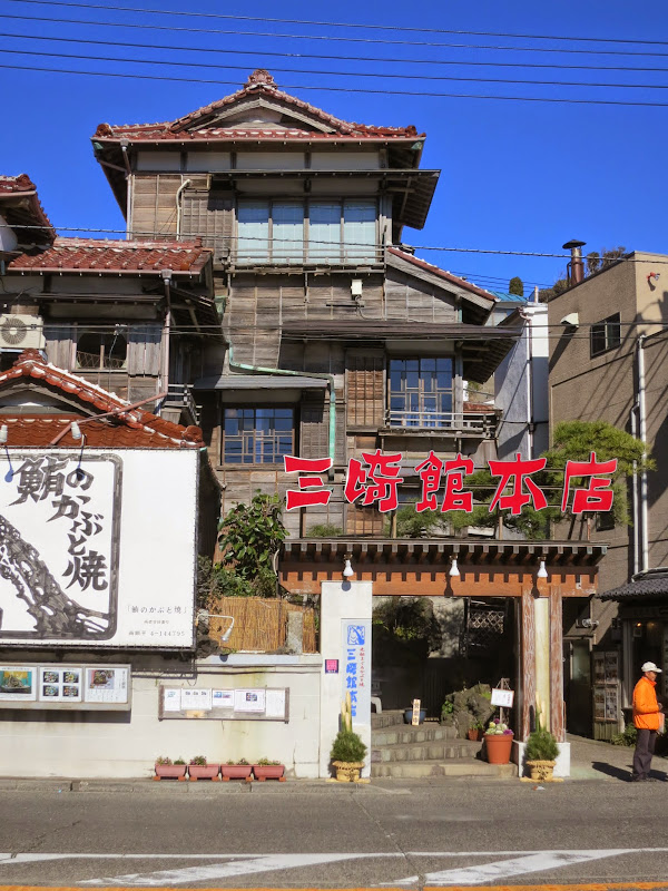
After a last hard weekend a week before the event, I took it easy, just allowing my body to recover. My friend Richard who lives near the event start at Machida generously offered to let me stay over night at his place, so I could easily get to the reception for receiving the brevet card, the safety check and the ride briefing before the 05:00 start, before any trains run. I went to bed at 20:00, setting my alarm for 03:00. At 04:00 I left Richard’s apartment and headed into my adventure.

Machida to Izu

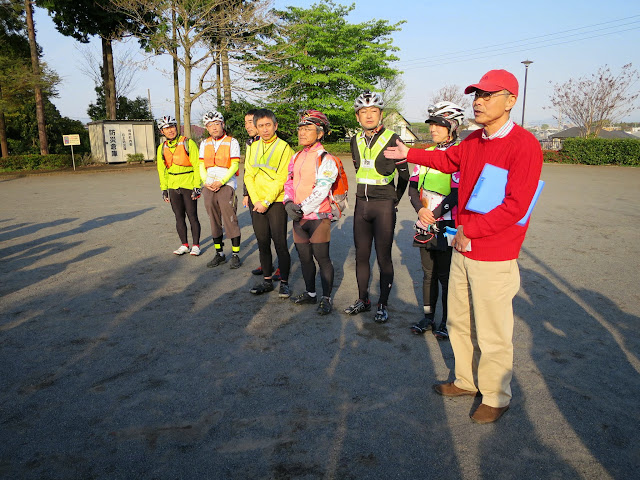
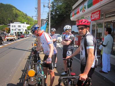
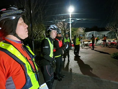
A group of 13 riders had turned up for the ride, several of them seasoned veterans who had done other 600 km, 1000 km and 1200 km rides, including Paris-Brest-Paris (PBP, 1200 km). We handed in our consent form and received our brevet cards. At around 04:45 we had our bikes checked for compliance. Two lights were needed at the rear and two at the front, as well as a reflective vest and the legally required bicycle bell. Then we were sent off into the moonlit night.

For the first couple of km the pace is always moderate as people just warm up. Once we turned into the major road leading south towards the coast, the pace picked up a bit. I found myself following behind two faster riders, mostly doing 31-33 km/h on the flat in between traffic light stops, with a couple of people behind me. It wasn’t too hard to keep the pace drafting behind them. I did keep an eye on the heart rate monitor readout of the Garmin Edge 500.

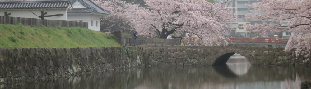
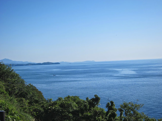
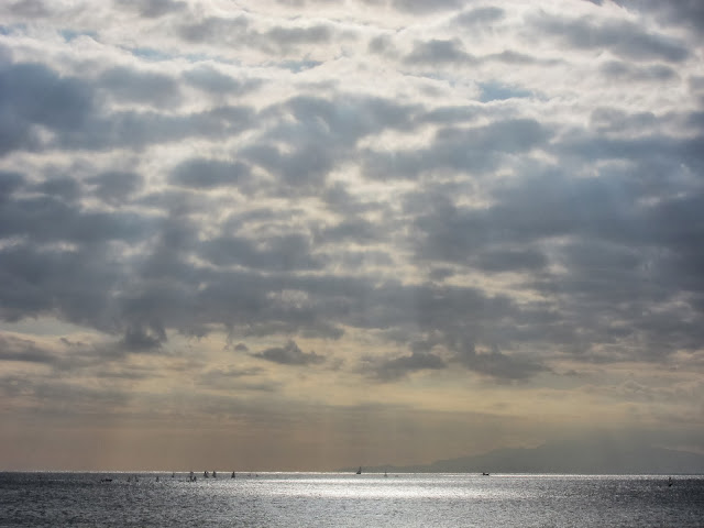
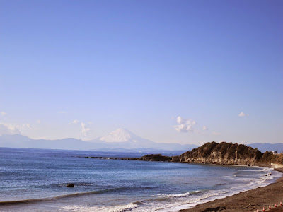
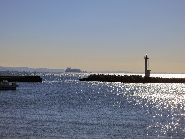
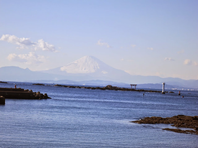
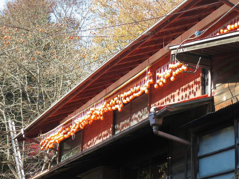
After 20 km, both riders got ahead at lights and I now found myself at the front of a group of 5 people. I kept the pace between 28 and 32 km/h, with up to 37-40 km on downhill stretches. Navigation wasn’t too difficult. There were only a few turns that I checked on Google Maps and I had used the same route on other brevets and personal rides before. Saturday morning traffic was lively as the sun rose into a cloudless sky. I felt we were drafting off all the trucks and cars heading towards the coast with us. We hit the ocean at Enoshima and turned onto the coastal road.

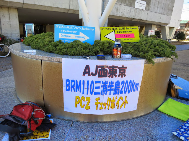
Soon we got to the first stop, a public toilet where I filled up both my water bottles. This was an un-timed quiz checkpoint. We had to write down the price of the most expensive item at one vending machine, as evidence we had passed through. For all seven check points (PC1-PC7) we had to buy an item (such as food) and keep the cash register receipt, which has the time and date of the purchase printed on it.

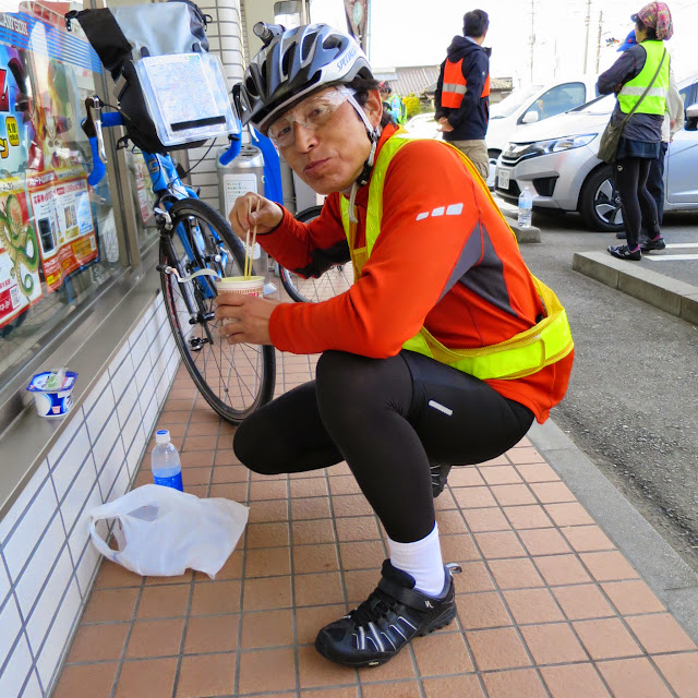
It got warmer as the sun rose higher, from 19 C at the start to 31 C by the time we were in Izu. I drank to thirst. When I think I have ridden another half an hour or so, I have another banana from my jersey pockets. When I’m out of them I stop at another convenience store, refill my water bottles from the tap and and buy another bunch of bananas again. I put 2-3 each in the left and middle jersey pockets. Every now an then I get VanHouten cocoa. Sometimes I got onigiri (rice balls wrapped in sea weed) or yoghurt or some bread, but primarily I ran on bananas.

By the time we were in Numazu, Shizuoka the heat and the early start took its toll. I caught up with riders who had passed me on the climbs between Ito and Mishima. A short pace line formed between 4 of us as we rode west on the coastal road, including the couple who had done PBP before, who I had also met at the Izu brevets (BRM309) and the Kintaro brevet (BRM413). I followed them for a while, then they dropped back and I took the pull. Until we hit more traffic lights near Fuji river we were cruising at around 30 km/h. We rode together until we reached PC2. After the break they were determined to stay with me because we made such good progress. We were over 2 hours ahead of the minimum pace.

I had expected to be left behind by most riders before Enoshima and to struggle to make the cut-off time at PC1 like in my personal ride, but the combination of the slightly lower temperatures, the ease of higher speeds in a pace line and the effects of recent training was totally unexpected for me. We set off together again as we headed up Fuji river towards PC4. At some point the couple told me to go ahead. Later I saw them again as I came out of a Daily Yamazaki store with a new bunch of bananas. They stopped there for a nap, as their 02:30 start caught up with them. We didn’t meet again until near Chino.

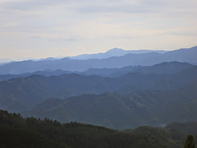
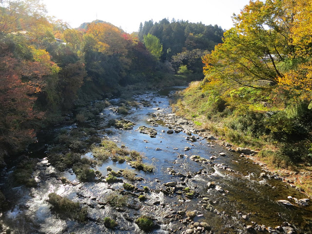
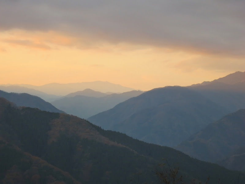
Fuji river looked wild and muddy, fed by streams from the nearby Minami Alps. We rode through farmland and villages, where farmers were busy with the rice harvest.

Night time

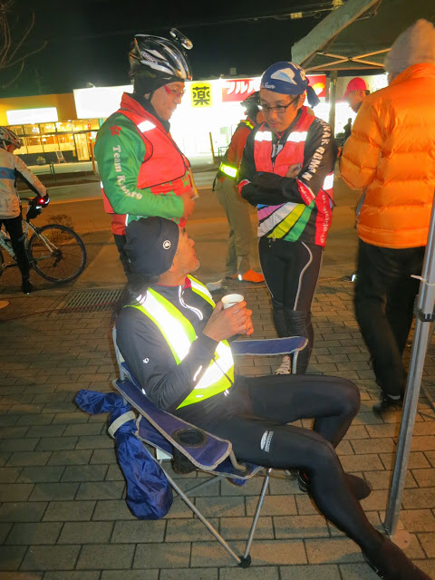
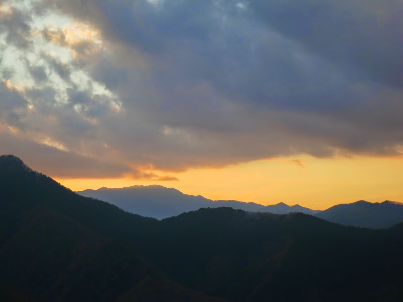
After 240 km from Machida I was 3 hours and 9 minutes ahead of the minimum pace. After sunset I arrived at PC3, 260 km from Machida. I sat down in the camping chair offered to me by the event leader and we talked while I ate some food. He told me from here it would be quite hilly, on Rt17. It would be tough from here to the lake. Knowing how much of a time buffer I had, this didn’t scare me too much.

In his opinion, the most difficult part would be the mostly downhill ride on Rt20 in Yamanashi on the way to PC5, during the second half of the brevet. He explained that it would be in the early hours of the morning when riders get sleepy and it’s the coldest. The combination of the wind and not having to pedal chills you and it makes you even more sleepy. Ooops! I had bought leg warmers and brought a wind breaker and even the set of non-cycling underwear that I had used as pyjamas at Richard’s place, so I hoped I would be all right.

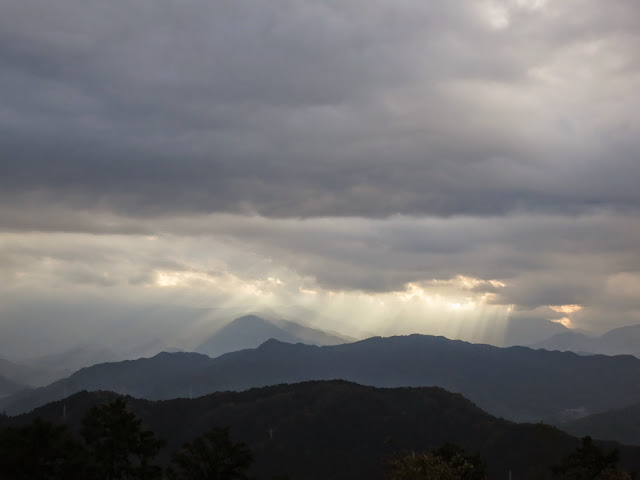
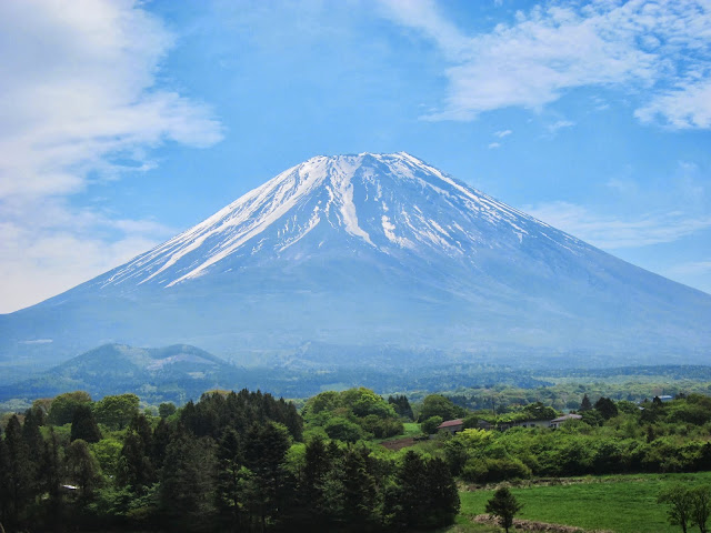
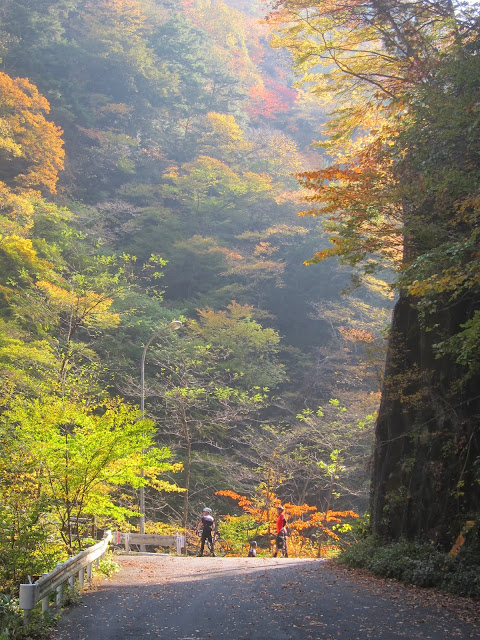
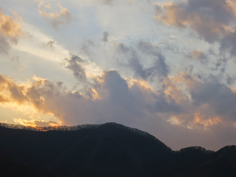
He didn’t promise too much. The climbs started soon. It reminded me of the long uphill route from Odawara to Gotemba that runs in parallel to Rt246, that I knew from the Fuji brevet. I was slow, but 3 hours of time buffer is very comforting. The route wasn’t all uphill, numerous times it descended again, only to have to regain the altitude again. I put on my leg warmers and wind breaker to deal with the cold. I could see stars and at this altitude the temperature dropped rapidly. It was just me and my bike cycling past nightly fields and trees, with the occasional car or truck passing on the otherwise deserted back road. I was passed by a few other cyclists.

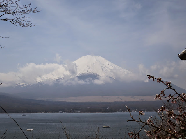
It seemed to take forever to get closer to Chino. I started yawning and feeling the chill. Even when I was past the worst climbing, near the lake my speed had dropped from the sleepiness and the cold. I met the couple again and they told me they were ending their ride here, checking into a hotel at Chino without going to PC4. DNF (Did not finish). I headed on towards the lake. It is about 700 m above sea level, surrounded by high mountains. Nearby Yatsugatake is popular for skiing in the winter.

I had been hoping for 24 hour restaurants such as McDonald’s to warm up and take a short nap but there were none. Finally I stopped the bike next to a metal bench, because it was the closest thing to a bed I could find. I used the rinko bag as a pillow and passed out almost immediately after I lay down. It was only about 14 C.

When I woke up again, I checked the map. I still had about 10 km to PC4 and it was around midnight. Finally I got to a busier part of the lake shore, with fast food places, but by then I was close to PC4. When I got there, the organiser was waiting outside the convenience store in his thermal clothes. Apparently, except for people who had phoned in to announce their DNF, there was no one behind me. I was still over two hours ahead of the pace, but it was 80 km to PC5, quite a bit of it chilly downhill and over 5 hours until sunrise. I would suffer hypothermia and sleep deprivation all the way. This was no way to continue. I announced my DNF. Meanwhile he had 7 hours to get some sleep and get to PC7, where the faster riders would be arriving later on.

“There are no trains now. You can get together with O.-san over there and wait until the morning at a Mac,” he helpfully explained. He woke his colleague who was sleeping in the car and then introduced me to O.-san, who had also DNFed. He rode a brand new Cherubim bike and was a software developer like me. We headed back about 3 km to the nearest 24 hour McDonald’s, ordered some food and coffee and settled in for the night. He was going to rinko back to Tokyo on one of the first trains, while my plan was to continue on the original route once it got warmer. Then I would head for a train station somewhere, maybe Otsuki or Numazu.

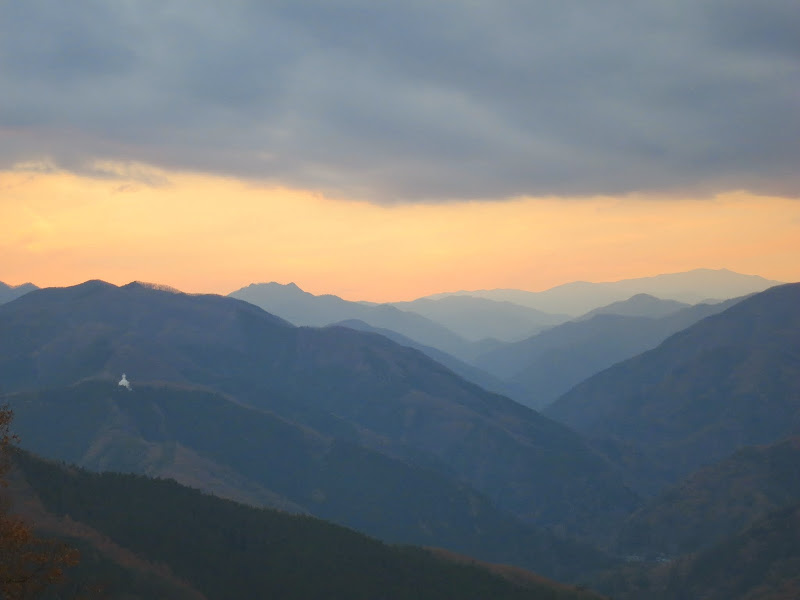
Luckily, O.-san knew Yamanashi prefecture very well. We discussed various roads. He explained that the course headed south almost down to the coast and then climbed back up north towards the “Fuji 5 lakes” (Fujigoko) because the organisers wanted to avoid the steep climbs necessitated by any more direct routes. The route was gaining about 800 m of altitude between PC6 and PC7, when riders already had 450 km in their legs.

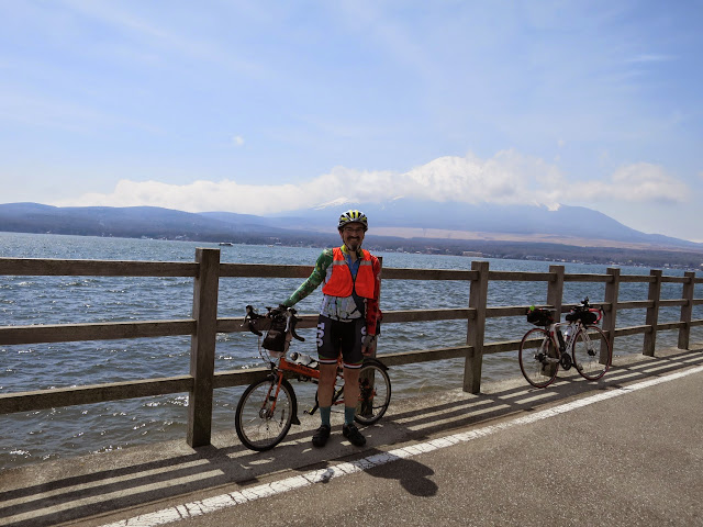
I checked maps and posted on Facebook. Finally we both slept, then woke up in the morning, had some breakfast and got ready. We took some pictures at the lake, exchanged contacts and went our separate ways.

The return trip

80 km from the next PC with only 1 1/2 hours before its cut-off time the pressure was off for me, as I couldn’t make that anyway, even if I hadn’t announced my DNF. I could follow any route I chose. I still wanted to make it a decent distance, since this was probably going to stand as my longest personal ride distance for perhaps a year, assuming I were to ride a 600 km brevet next summer or autumn. Numazu was further than Otsuki, and I guessed there wouldn’t be any big climbs once I got beyond the rolling hill portion of Rt20. So I continued on the original course following Rt20, then Rt52 which joined Fuji river again. Except for the downhill coasting my speed was low. At Fuji river I left the course, staying on the big road down the river, which was fast and flat, though quite busy with cars and trucks.

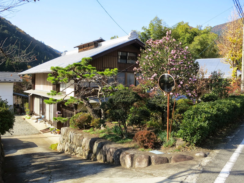
I thought the busy road wasn’t really much fun, when I suddenly saw a signpost for Motosu. That was one of the short, steep climbs to get up to the Fuji 5 lake elevation and I knew the 5 lakes were nice. So I turned off onto the small road. Back through villages again, past playing kids and working farmers. I still had enough bananas for what I expected to be 2 hours of climbing.

The first steep climb took me up to a tunnel, then right down again to the starting elevation. The Motosu turn-off had been one valley too early. A bit shorter, but with bonus elevation for cyclists. I didn’t really mind. The idea of exploring new territory excited me.

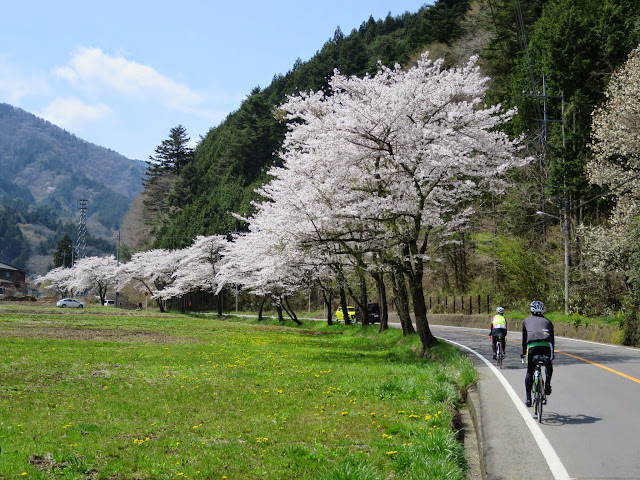
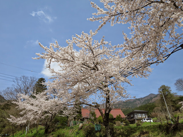
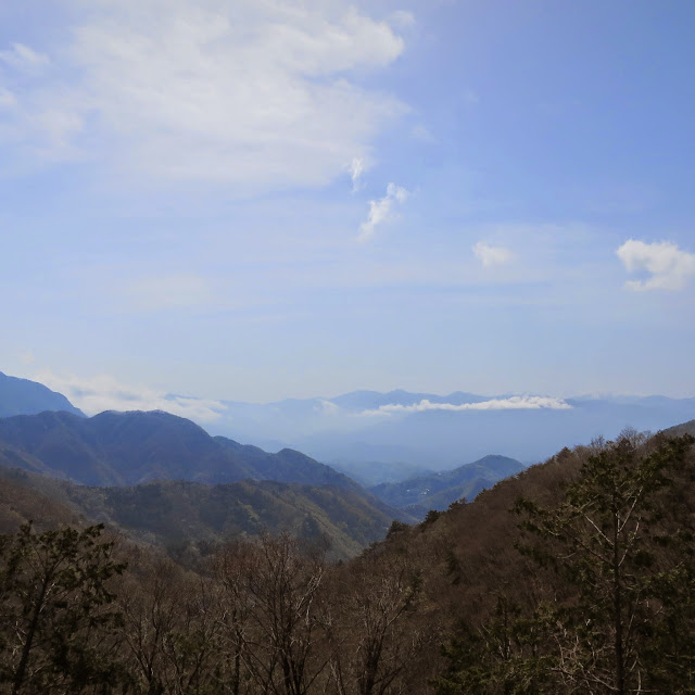
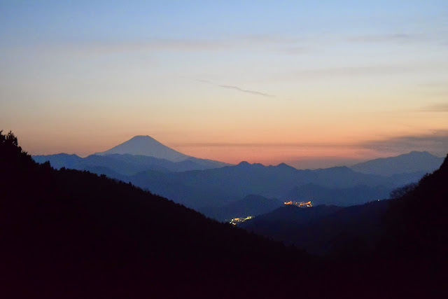
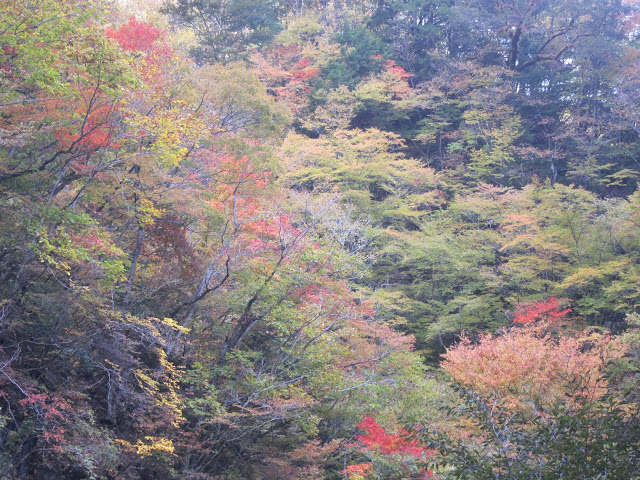
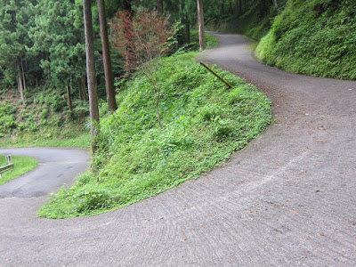
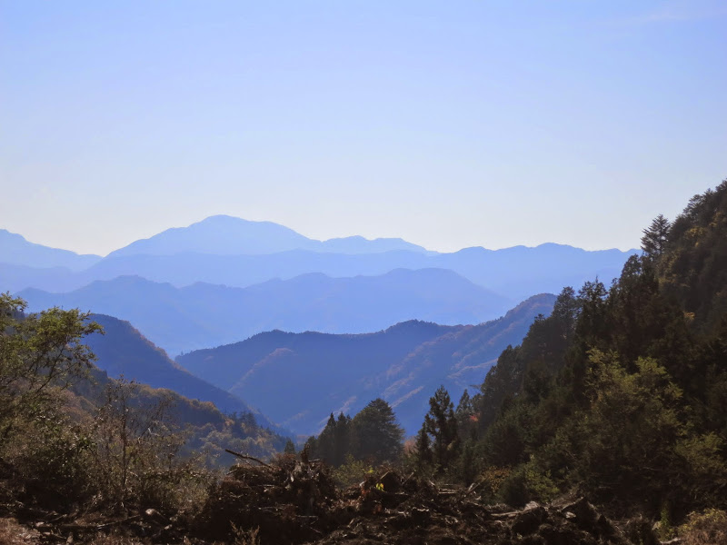
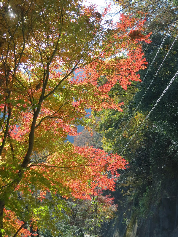
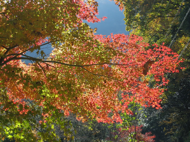
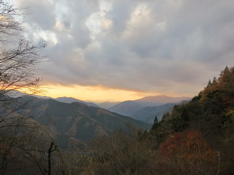
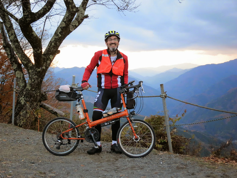
The Motosu michi climb (Rt300) turned out to be pretty nice. While it was quite sunny and hot in places, there were many streams and water falls. I seemed to be surrounded by the sound of running water everywhere. Nice! I wasn’t sure how high I had to climb and I wasn’t fast, but I didn’t hit the wall either and wasn’t sleepy. It was steady progress. As I got closer to the tunnel at the top I took pictures of the valley below and the views.

Finally I reached the tunnel that took me over to the lake side. It was about 15:00. The other riders were already on Doshi michi, after Yamanakako (Lake Yamanaka).

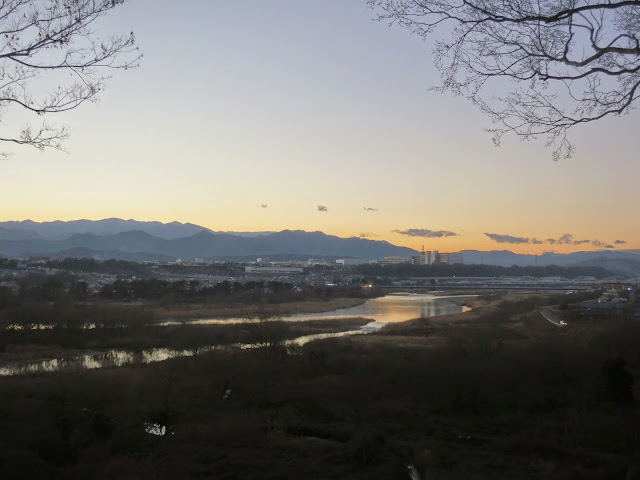
Rt139 from Motosuko to Yamanakako was jammed with cars. It was basically one big traffic jam, as is typical on weekends. I got to Yamanako around sunset. I was glad to be off Rt139. Now I was down to the final 100 km. I was pretty confident now I could make it back home without any train ride, though I would get sleepy again.

I was surprised just how many cars were heading east from Yamanakako on Doshi michi. The climb to the toge is mercifully short, then comes a long fun fast descent. Every now and then I let a car pass me. They were only a little faster than me on the steeper sections. Two of them were police cars. I filled up my bottles again at the Michi no eki, then headed on.

To be honest, Doshi michi was too busy for me at night. I like Doshi michi at daytime, but everybody seemed to be driving really fast and I couldn’t help wondering how many drivers had had something to drink. Towards the Sagamihara side the road has a lot of ups and downs. I climbed many hills in a low gear, just wanting to get home. I started yawning again. Finally I found a convenience store with a car park and decided to stop for a nap, because I wanted to stay safe.

This wasn’t my last nap. I was OK again through Sagamihara and Machida and took pictures at the Cherubim bike shop (the official finish line), as I had completed the loop, though with only 540 km by then and outside the time limit.

From there I headed to Onekansen. Since the afternoon I felt like I had taken some kind of mushroom that makes every hill look 2-3 times steeper than it normally is. I still got up there, but always conserving my energy. Not far from the Tamagawa bridge I had to lie down once more, taking another nap on the sidewalk. I bought a cup of coffee at a convenience store and felt OK for the final 10 km. My heart rate stayed at a mere 74 bpm while cycling on flat roads. Around 04:00 I unlocked my front door back in Setagaya. 570 km with 4949 m on the GPS. I took a shower, washed my hair and went to bed.

What I learnt from the experience

I would do it again. I plan to do the full SR series next year, with the aim of completing all ride distances within the time limit. That may mean multiple rides of each length, depending on weather conditions. I know I can ride the distance. I can manage eating and drinking and navigating for this long.

My biggest problem this time was not having brought either my winter gear or at least my rain gear as an extra thermal layer. I would have been OK temperature-wise. Lack of sleep was the other problem, but it was partly related. I couldn’t really take nap breaks outside at the higher altitudes when I wasn’t dressed warm enough.

I had no problems managing power on my Garmin Edge 500 and the phone. I kept both going with a single 8000 mAh USB battery and two sets of cables, including a special host mode cable to allow simultaneous recording an charging on the Garmin 500. The 570 km ride came out as a single FIT file recorded over 47 hours, excluding only a couple of hours where the Garmin was paused while I was inside the McDonald’s. Normally the Garmin battery will last no more than 16 hours.

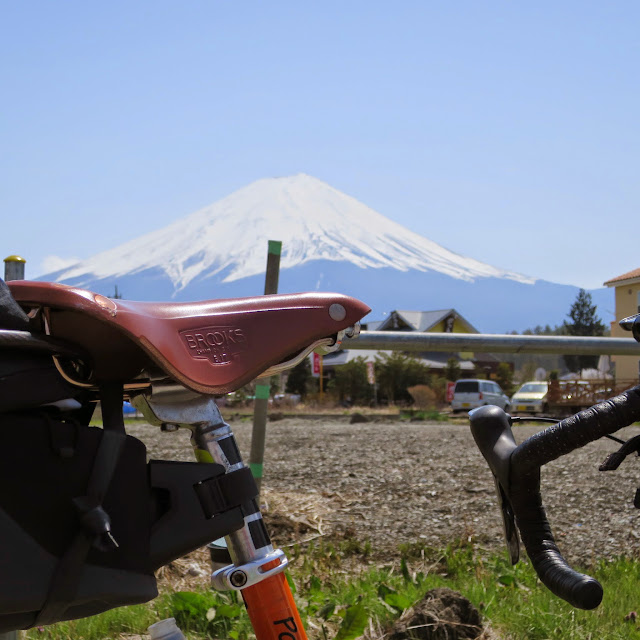
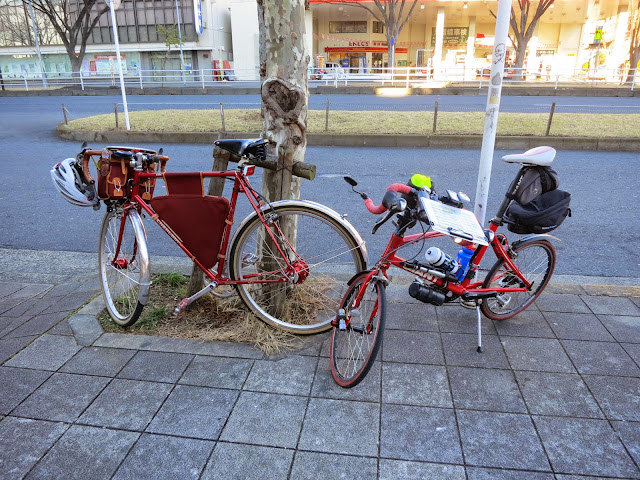
Instead of using my large Carradice saddle bag, I just bundled up my things into a pastic bag, covered it in a rain cover from a rucksack and tied it to the back of the saddle with rubber bands made from cut up old bicycle tubes. I am sure it was a lot lighter and more aerodynamic. The Carradice is great for touring, but for brevets with a time limit something more streamlined will work better.

The bananas were great. They are the ideal riding fuel for me. They never upset my stomach and I don’t get tired of them.

Besides carrying the right clothes, managing sleep will be essential on brevets beyond 200 km. Lack of sleep affects me badly and I’ll need to deal better with it. Part of the solution will have to be to be able to ride faster, so I can stay ahead of the cut-off time throughout the ride even if I take enough sleep breaks to keep functioning.

Tim Smith of GS Astuto said after the Haute Route 2013 cyclosportive, if it feels like the worst day in your life, you didn’t train enough. The BRMpre-921 was not the worst day (or two days) in my life, far from it. It definitely had its ups and downs, figuratively and literally. The last 50 km were the hardest, primarily due to sleep deprivation. I was happy about my performance on the first day and I am glad I got all the way back to Tokyo after the DNF without riding a train, seeing a lot of new places.

Next time I try a 400 km or 600 km ride it will feel less intimidating. I will know what to expect and what works for me. Last but not least, I will keep working on my performance, so I can go not only further but also do it faster, which in a timed event can be a precondition for going further.

Some advice I received and discussed

Talking to other participants and organisers, I received some advice that should help me on the next 600 km or longer brevet.

Treat brevets of 600 or 1200 km as series of 300 km day rides, with sleep breaks of 3 hours or more, depending on your speed.

Organisers often lay out the course with night stops near the 300 km points in mind. Sometimes there are Kenko Land bathhouses around there, where you can take a bath and lie down for a couple of hours in the rest area. There was no 24 hour Kenko Land in Chino (some of them close after 22:00). Other people make reservations at business hotels or minshuku, though it’s relatively expensive for the short stay.

Even love hotels can be an option, as they tend to have a cheap flat rate (“stay”, not by the hour) for the night after 22:00, which is lower than a single person business hotel rate, but covers two people. The short term room rate for between 2 and 5 hours (“rest”) is cheaper than a single person minshuku rate.

Newspaper stuffed down the front of the jersey and the bib tights can help keep the cold wind off the body. This should help on cold night rides and descents.

For sleeping outdoors, a mylar blanket (space blanket) is recommended. It conserves heat but is extremely light weight.

A cap and fleece neck warmer conserves heat around the head and neck, which are like the radiator of the body. I used a cotton handkerchief tied around my head and ears for that purpose on winter rides.

Google does an “Apple Maps” to its own Maps

Last night Google proved to me that you don’t have to be Apple to shoot yourself in the foot with a major Maps application release.

Naturally, online maps are a big feature on mobile devices, which is why it’s important to get them right.

Not too long ago Apple ended up with egg on their faces when they introduced their own Maps application to replace Google Maps. Google has just done the same. They rolled out a completely new Maps app starting from the middle of July and yesterday it landed on my Android phone. I was just preparing for a 280 km bicycle trip and had mapped out the route to follow, which I usually use Google Maps for. Imagine my surprise when I found that following an externally mapped route file was no longer supported on the latest Google Maps app: It doesn’t support the “My Maps” feature any more. With “My Maps” you can map a route using a number of third party products and highlight key locations, such as restaurants or shops on the map and assign a name to this. Google Maps then marks these points of interest with asterisks and highlights the route with a coloured line that you can follow easily. Simple but powerful. Well, that’s how it used to be before the “upgrade”.

This is what they say on their official blog:

Finally, My Maps functionality is not supported in this release but will return to future versions of the app.

Sounds to me like they were keen to release a new version of the product, even thought it wasn’t ready yet — just like Apple. Interestingly enough, the iOS version of Google Maps didn’t have the “My Maps” feature either. So what Google has done is to dumb down its flagship product to the level of the inferior version it ships on its competitor’s operating system!

Another annoying omission was the ability to display a scale bar (ruler) illustrating distances on the map, at whatever zoom level. This option has gone. It was quite useful to be able to estimate distances on the map. Without it, I simply don’t have a clue about distances unless I’m totally familiar with the area, in which case I presumably wouldn’t be using Google Maps in the first place.

My temporary fix was to uninstall Google Maps, reverting back to the factory installed version of Google Maps. This gets Google Maps working again, but it’s not sticky. After uninstalling it, the “upgrade” (i.e. downgrade) was back again the following day. Therefore it is important to disable automatic updates in the Google Play settings. Once you do that you will have to manually confirm all updates for apps other than Maps (and you need to avoid confirming Maps updates, which will still be offered).

Other problems that caused user complaints:

  • No more offline maps – the new version only supports map viewing with a mobile data or WiFi connection
  • Removal of +/- (zoom buttons) – zooming in and out now takes two fingers
  • Fewer and less relevant local search results
  • No more green/red/yellow lines along roads to indicate congestion levels
  • Removal of Google Latitude (which I never used)

UPDATE (2013-08-16): Version 7.1.0 appears to have brought back the scale bar. However, I won’t be installing it until My Maps also comes back.

The myth of the deadly marathon run

Every couple of months I seem to see another article in a major newspaper about how exercise can be a killer if it is a bit more than a moderate amount. The most recent example: “Over 40? Rethink your next triathlon” (Sydney Morning Herald, 2013-06-24).

About a year ago a study in the journal Mayo Clinic Proceedings made some waves and its lead author, James O’Keefe now keeps getting quoted with warnings to avoid doing more than half an hour of exercise per day. No doubt such warnings will comfort a lot of couch potatoes, who do no exercise at all and who will feel confirmed in their reluctance to go out and move their bodies, lest it might kill them. No doubt his study will be good for O’Keefe’s career, as it makes him the man to go to for a quote for this type of article.

The myth of the deadly Marathon run is as old as the first Marathon run itself. The Marathon distance of 42 km / 26 miles commemorates a messenger called Pheidippides who supposedly delivered the news of the Greek victory over the Persians at the Battle of Marathon over that distance to Athens, only to die immediately afterwards. A closer reading of the historical sources however reveals it to be a myth, created from a mashup of several other events, neither of them involving the death of a runner. Herodotos, in his history of the Persian wars, only mentioned Pheidippides running from Athens to Sparta (a distance several times longer than from Marathon to Athens) to request help against the Persians. No mention was made of a run from Marathon to Athens after the battle or a death from running. After the victory at Marathon, the Greek army rapidly marched to Athens to ward off a sea invasion, but this was no run. Only some 500 years after the battle, the modern version of the story was cobbled together:

The first known written account of a run from Marathon to Athens occurs in the works of the Greek writer Plutarch (46–120), in his essay On the Glory of Athens. Plutarch attributes the run to a herald called either Thersippus or Eukles. Lucian, a century later, credits one “Philippides.” It seems likely that in the 500 years between Herodotus’s time and Plutarch’s, the story of Pheidippides had become muddled with that of the Battle of Marathon (particularly the story of the Athenian forces making the march from Marathon to Athens in order to intercept the Persian ships headed there), and some fanciful writer had invented the story of the run from Marathon to Athens.
(Wikipedia article: Pheidippides)

The modern narrative of death by running doesn’t quite match the facts either. While it’s true that the risk of death from a heart attack is higher during a run than while resting, people who regularly exercise have lower mortality than people who don’t.

As a marathon-running friend of mine explains, being a trained runner has the effect of lowering his resting heart rate. Even if his heart beats faster during a marathon, his average year round pulse will be lower, so his heart will wear out less quickly overall.

While the greatest difference in mortality is found between people who don’t exercise at all and people who exercise moderately, even as people exercise more, the negative effects of exercise do not begin to outweigh the positive effects.

There was an interesting reply in Runner’s World (2012-11-28) to O’Keefe’s claims about excessive training, by which he means anything exceeding 30-60 minutes. In the above article he again advises people to run no more than 30 km a week (which would be no more than about 30 minutes a day averaged over a week). One of the major studies quoted by O’Keefe’s study actually found no levelling off of benefits. His advice is based on a misreading of the available data: People who exercised 120 minutes a day actually had even lower mortality than people exercising one hour a day.

Wen and colleagues reply that yes, they do have data — and it doesn’t show what O’Keefe et al. hope:

By 120 min [per day], the hazard ratio for all-cause mortality was around 0·55 [which is better than it was for 60 min per day], with even better hazard ratios for cardiovascular diseases… The adverse effects of strenuous exercise for incremental efforts for more than an hour a day did not seem to outweigh the benefits. We were not able to identify an upper limit of physical activity, either moderate or vigorous, above which more harm than good will occur in terms of long-term life expectancy benefits.

This exchange took place before the recent spate of review articles about the dangers of too much exercise was published. And yet the study is still being cited as evidence that doing more than an hour a day of exercise is bad for you. As a subsequent letter to the journal from Michael Bubb of the University of Florida put it, “The interpretation of the data provided in the review by O’Keefe et al is misleading, particularly given the response of the authors of the original data.”

In the end, articles that discourage exercise that is proven to reduce mortality will end up costing lives.