BRM413 “Kintaro” 200 km brevet

I completed my second official brevet of the year, a 201 km loop across the mountains west of Tokyo. Brevets are long distance cycling events, typically over distances of 200, 300, 400, 600 or 1200 km. More than pure distance, it’s the amount of climbing that can make for a hard brevet. The more total elevation, the harder it gets to meet the minimum average speed requirement of 15 km/h overall and up to each check point (PC). This 200 km brevet had over 3000 m, more than the 300 km Fuji brevet. In January I had already shadowed a 200 km brevet, as an unofficial rider without signup. In March I completed BRM309 in Izu, my first official brevet of the year. I managed to complete all three 200 km brevets under the time limit of 13 1/2 hour.

I got up at 03:45 for a 07:00 start, having had only 5 hours of sleep. Even though I had covered about 60% of the course in a personal ride in February, I was a bit anxious whether I would make the limit limit. Trying to keep up with other riders to save myself the hassle of navigating the course on my own, I worked pretty hard for the first 50 km, with my heart rate above the range I reach in training runs for extended periods. I started eating on the bike about 90 minutes after the start.

About one third of the distance, my rear fender fell off – metal fatigue of the aluminium bracket that attaches it to the frame! I just picked it up again and stuffed in my saddle bag. Fortunately we didn’t have any rain all day. It was relatively cool out there. I was wearing my winter tights and either one or two layers of jerseys. I may try to fix the fender by making a steel bracket to replace the broken aluminium one.

Throughout the ride I was quite happy with my progress relative to other riders. I didn’t feel particularly slow, but half way into the ride I was only 30 minutes ahead of the 15 km/h minimum pace, so I couldn’t feel easy.

The next climb after that I started solo from a convenience store and didn’t see anybody else for a long time. I was starting to question if I was still on the right road. Just like on my previous brevet in Izu peninsula, Google Maps on my Android was quite inaccurate away from the cities, often placing me kilometres from where I was, which is not a good basis to decide where to turn at the next junction. So I enabled the course on my Garmin Edge 500, which worked pretty well, just as it did in Izu. I think that will be my main navigation tool from now even though it looks very basic compared to Google Maps.

After finding the PC on the last big mountain after which the ride was named and having some food there I started to relax, knowing there would be no more big climbs for the rest of the trip. There were still plenty of hills, but nothing too bad. The only problem was dense weekend traffic from people heading home in the late afternoon.

I bumped into some friends of mine on the way back to the start/goal who turned out to be on the same brevet. We rode together for the remainder of the course, mostly me leading the group. On the final 20 km or we counted down every single remaining km. It was great to see we were still ahead of the time cutoff by a comfortable margin.

It was a terrific feeling to arrive after just under 13 hours on a course with over 3,000 m (10,000 ft) of climbing. The total for the day, including getting to and from the event, came to 213 km for me. The next brevet I’m signed up for is BRM518 — 300 km around Mt Fuji.

A hilly 200 km brevet in scenic Izu peninsula

Yesterday I cycled 200 km across the mountains of west Izu (Shizuoka prefecture, Japan) on my Bike Friday folding bike. I had resolved do at least one century ride (160+ km) every calendar month of this year, some of them organised events, but most personal rides. BRM309 200 km by AJ NishiTokyo was my first official brevet of the year. I completed it in an official time of 12:58, i.e. just over half an hour under the 13 1/2 hour time limit.

The scenery was beautiful and the weather perfect but the course tough. With a highest point of 450 m, I first found it hard to believe that this course should really have more climbing (3159 m total) than the 300 km Fuji brevet I did last May (2800 m total), but except for the first and last 10% and some short stretches through the towns on the coast, this was a pedal-powered roller coaster! On the smaller roads grades of 8-11 percent were not uncommon.

I loaded the Bike Friday into the Prius the night before (no need to fold the bike or take off the wheels), went to bed at midnight and got up at 04:00. A little after 06:00 I got off Tomei expressway at Numazu and drove near Mishima station, where I found a 1000 yen ($10.50) a day car park. One couple dressed like randonneurs was already setting up their bikes in there.

An hour from home on the expressway it had suddenly struck me I had left my reflective vest at home. No vest, no brevet! But it was already too late to turn back. Fortunately the organisers had some stock and sold me one for 1600 yen ($17). To start with I was wearing new bib shorts and new jerseys (two layers for the morning and evening chill). GS Astuto’s HauteRoute shorts proved exceptionally comfortable, like wearing your best pair of pajamas at home. I sweated a lot, in fact my cheeks were white with salt afterwards, but the shorts and jersey kept me comfortable. The deep pockets safely stored wallet, camera, keys and some food.

There were 60 riders in two blocks of 30, starting at 7:30 and 8:00. They started us in smaller groups. I was wearing my heart rate belt and wanted to aim for a consistent workout throughout the day, but I worked much harder during the first 50 km than I had intended and less hard later on. When you have some other fast guys to follow (which would save you having to navigate) it is tempting to hang on at whatever cost. We headed through town and along a river to the south. After 20 km the route started climbing, peaking at a tunnel about 450 m above sea level, then down to the coast. We made the first 50 km in 2 1/2 hours, putting me more than half an hour ahead of the pace needed for completing in time, and that is what I also finished with.

I glimpsed Mt Fuji across the bay from near Toi.

The coastal road went to Matsuzaki through many tunnels and a couple of climbs. After Matsuzaki we climbed the second highest pass on a small mountain road and it was very pretty. Plum trees (ume) were in bloom everywhere.

PC1 (point de contrôle 1) was at 95 km, almost at the half way point, but there had also been a safety check at the first tunnel (lights!). We were given pastries baked in the shape of bicycle cranks.

From the control point we headed west to the coast, which we mostly stayed on. As mentioned before, the coastal road goes mostly up and down. It only becomes level again at the north west corner of Izu. The top third of the west coast was the hardest part. There were few villages, no shops and it was gradually getting dark. I had somehow expected the second half of the ride to be easier than the first because the maximum elevations were much lower, but it was actually harder. Between Toi and the north coast there were no flat portions in towns between descents and climbs, because there were no towns (or more appropriately, there were no towns there because there was no flat land).

The following was a sign we had to spot and then write down the Kanji characters, as part of a quiz question. As a Kanji-challenged foreigner, I got dispensation to bring back a picture instead:

Izu used to have a lot of terraced rice fields built into the hills because there wasn’t much flat land. Much of these fields now lie fallow or have been turned into sugi tree plantations contributing to the hay fever epidemic in Tokyo.

Mt Fuji at dusk:

I completed!

Having my brevet card checked at the finish:

Garmin Edge 500 on long rides

Since January I’ve been using a Garmin Edge 500 with heart rate monitor strap for logging bike rides. Garmin quotes a battery life of “up to 18 hours”. After this 13 hour bike ride, it showed a remaining battery capacity of 21%. Extrapolating from this, the battery would have lasted about 16 hours in total.

I was not just logging the ride (GPS data) but also using the heart rate strap and had the Garmin track a course with turn-by-turn instructions, which probably draws a bit more power. I had created the course as a TCX file in RideWithGPS while looking at the course as published on http://latlonglab.yahoo.co.jp.

In any case, 16 hours is enough for a 200 km brevet with its 13 1/2 hour time limit, but not enough for a 300 km brevet with its 20 hour limit, unless you are a really fast cyclist and/or the course is extremely flat. For my 300 km brevet I am planning to use my Garmin Edge 500 power hack, a special USB cable that allows me to charge the device while logging and navigating.

300 km in a day around Mt Fuji on a Bike Friday

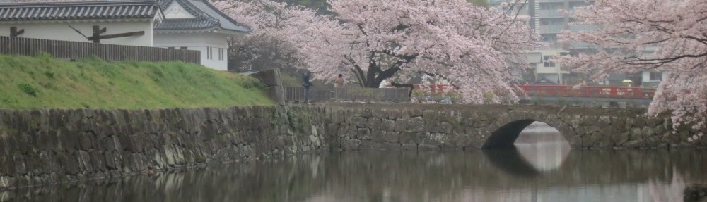
In the evening of last Sunday I returned from my first brevet ride, a long distance cycling event. I was sunburnt, exhausted and dead tired. The event was BRM519 NishiTokyo 300 km Fuji, a 300 km brevet around Mt Fuji staged by Audax Japan NishiTokyo. It was quite a mountainous course, with 2800 m (9200 ft) of climbing (see map). Also participating was my friend Jose, but we rode separately for most of the course because he is faster. In preparation for this event I had done three training rides (227 km, 200 km and 235 km) since March that followed at least part of the route, one of them with Jose, whose company and advice has been invaluable.

From Machida in western Tokyo we rode down to Enoshima on the Pacific coast, followed the coast to Odawara and climbed up to Gotemba. From there we rode down to the coast near Numazu, followed the coast to Fujikawa, then headed north on a long climb on the extended slopes on the west side of Mt Fuji. From over 1100 m on the NW of Fuji the road descends to Fujiyoshida and further down to Tsuru. The final stretch follows mountainous R35 to Sagamiko (extremely steep in places but great descents) and climbs over Otarumi Toge on R20 near Mt Takao (which seems trivial after all the previous climbing).

Though the 15 km/h minimum pace implied by the 20 hour time limit may seem modest, it includes all food and sleep breaks and a course with plenty of climbing. The people who design these courses like back roads and hills. Some of the R35 climbs I was crawling up at 6.5 km/h in my granny gear. You go uphill for 2 hours before Gotemba and 4 hours solid at Mt Fuji, which you can never make up on faster downhills from there. The 22:00 start means the first 6 1/2 hours are at night, so not only do you need proper lights, you also lost a night of sleep.

Lack of sleep proved to be much more of a challenge than distance or elevation. If there was one thing I’d do differently next time, it would be to make sure I get a good few hours sleep during daytime before the night time start. I had meant to do that, but instead spent that time running around looking for extra lights, as I found out from Jose that I needed two lights at the front and two at the rear (one of which could be on the helmet). The first rear light I bought didn’t work when I tried it at home, so I returned it and got a another and finally had only napped 20 minutes before I took the train to Machida.

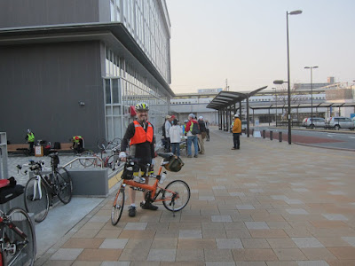
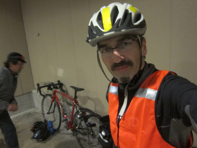
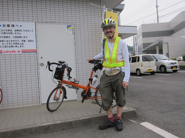
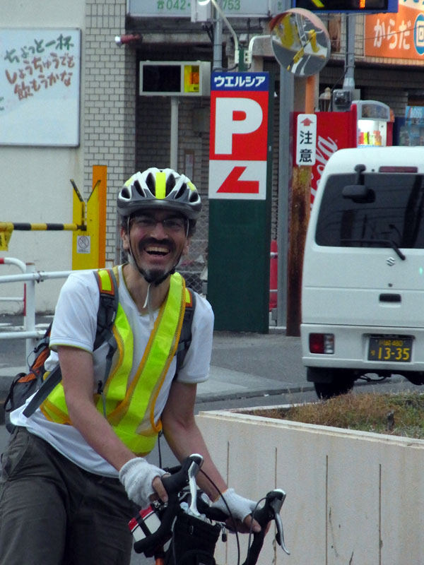
At the brevet reception:

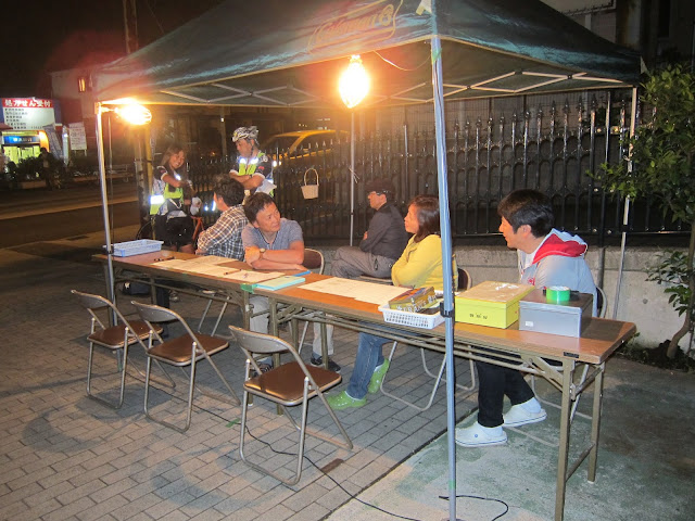
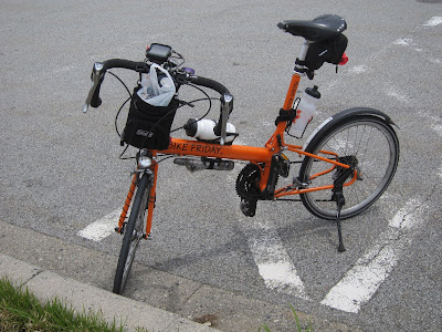
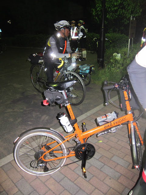
People there were very friendly, though they were quite surprised I wanted to ride the brevet on a small wheeled folding bike. 80 people had signed up for the ride. I received my brevet card and instructions on how to gather receipts at the unmanned checkpoints (PC = point de contrôle).

After a group briefing each bike and rider was checked to make sure we met all the conditions about lights, bells, reflective clothing, etc. Then we were off into the night.

Jose and I were riding together for the first couple of km, but separated soon when I stopped to remove a layer as I was warming up. There were plenty of fellow riders for following a lead rider. With the pace at which we were going towards the coast (except for traffic lights), I was feeling like I was on the Enoshima Express train 🙂 We got there a little before midnight. I got my brevet card signed (this was the only manned checkpoint) and I refilled my water bottles at the public toilet where PC1 was located, then headed off with Jose and another rider after a few minutes. I soon dropped off again and rode by myself until other riders came along around 10 km before Odawara, where PC2 was located.

PC2-PC4 were unmanned, that means they were convenience stores where you buy some food or drink, making sure to keep the receipt to prove when you were there. Nevertheless the ride organisers came by car to join us at each of these stops, to check everyone was doing OK and to offer encouragement.

From Odawara the climb to Gotemba starts very gentle, but continues for 30 km for an altitude gain of 460 m. I was lucky to end up riding in a group of 5 that set a good pace I could keep up with. As the route got steeper though, I had to work harder and harder and drafting made less difference, so I waived the rider behind me to pass and continued on my own. Somewhere along the way I came across Jose, who was just about to lie down and take a nap in a bus shelter. As it got colder during the night I put on my trousers from my rain gear.

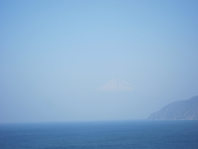
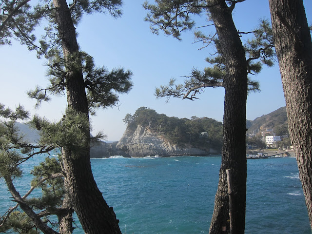
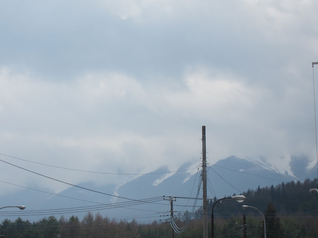
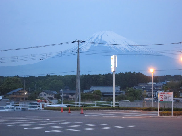
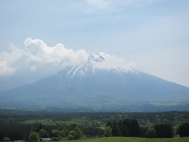
Somewhere along the 25 km route from Gotemba to the coast the sun came up and I could see Mt Fuji:

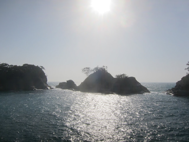
I led another rider at a good speed, but was feeling the lack of sleep as I was cycling along the coast. We crossed Fuji river and headed up inland towards the next unmanned checkpoint (PC3).

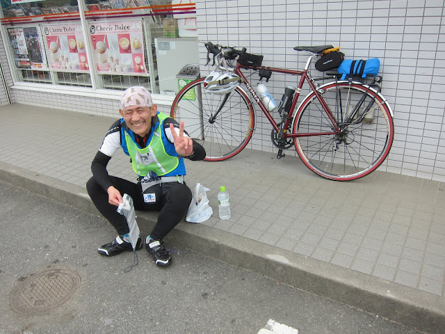
A fellow brevet rider at PC3:

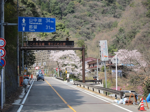
Before the longest climb:

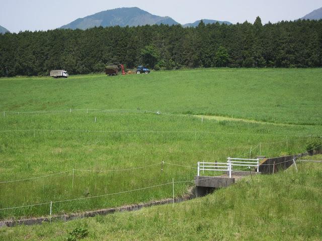
The 1100 m climb from sea level, starting at about the halfway point of the 300 km up to the pass above Lake Motosu was the hardest part of the ride. The scenery is beautiful though, with many dairy farms. The smell of cow dung reminded me of my home village 🙂

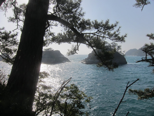
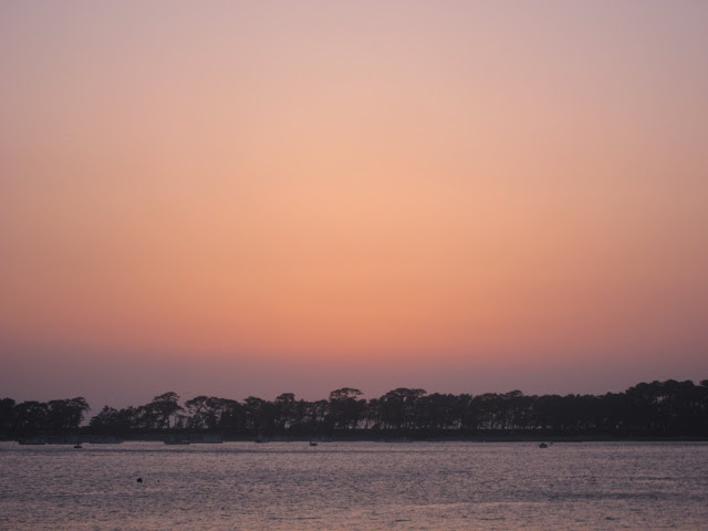
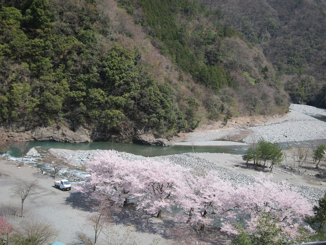
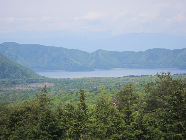
Lake Motosu from the pass:

During the climb I got so sleepy, I had to find a spot to lie down and catch a nap (a slab of concrete next to a rice paddy, with my rinko bag as a pillow), as I felt it wasn’t safe to continue in my state. The same thing happened again on R35 between Tsuru and Sagamiko. I had been 1 1/2 hours ahead of the minimum pace of 15 km/h at PC2 before Mt Fuji, but after those naps didn’t know if I would still make the time limit until almost the very end, when I fought traffic in Machida to make it back by 18:00.

I was so glad when I got back safely and it was all over. I had done well with my training, with eating and drinking and with navigation, but managing naps is definitely something I’ll need to learn if I am to ride brevets again.

I am also looking forward to trying proper cycling shorts which I’ve got on order. Cotton underwear rubbing against certain parts of the male anatomy did become irritating towards the end of the ride. Also, I’ll need something other than a back pack for my stuff, because my shoulders got itchy from the straps, especially with the sweat in warm weather.

They say any brevet over 200 km isn’t much fun and they’re probably right, unless you’re a bit of a masochist. Riding brevets adds a number of challenges beyond personal long distance rides, such as managing time (including sleeping time). It tests planning and self discipline as much as cycling skills. It does give you an excuse for a bunch of long training rides in the mountains. On the brevet itself you’ll meet some extremely nice people who enjoy cycling very, very much. The brevet was almost as hard as my first climb of Mt Fuji last year and “fun” is maybe not the right word to describe it, yet I would definitely recommend giving it a try at least once if you like long rides at a pace that mere mortals can still train for.

Links:

235 km a day on my Bike Friday

A couple of weeks ago I did my longest ride on the Bike Friday yet – 235 km in a day, across the mountains west of Tokyo to a lake near Mt Fuji during the cherry blossom (sakura) season. This was part of my training for a 300 km brevet ride coming up this month. It was a beautiful ride, one of my most enjoyable so far.

Sakura (cherry blossoms) on route 413:

It took me about 16 hours, of which 14 hours were moving time. I had left home at 05:20 and was back in Tokyo at 21:20 (9:20pm). My Pocket Rocket has a Shimano hub dynamo and a Lumotec IQ Cyo headlamp which provided plenty of light on the last stretch after sunset.

Here is my route. I started from my house in Tokyo after sunrise and cycled out to the mountains some 40 km away, then followed Route 413 up a mountain valley and over a pass over 1100 m (3600 ft) high. I was climbing from virtually sea level (45 m or 150 ft) to 1.1 km high. I was cycling almost continually uphill for the first 96 km (60 miles). After 7 hours (including quite a number of brief stops for food, rest and pictures) I reached the highest pass.

More sakura:

I always want to see the remaining distance:

The exit of the tunnel at the end of The Longest Climb: It’s all downhill from here… NOT!

The shores of Lake Yamanaka at the foot of Mt Fuji, over 900 m (3000 ft) above sea level:

It can be surprizingly difficult to sea Mt Fuji (3776 m high) from just a few km away because of its frequent cloud cover. I cycled 235 km and all I saw of Fuji is this (its foot):

Almost home – at the top of the Mt Takao pass:

The humble Bike Friday Pocket Rocket:

and its crazy rider:

The ABC of distance riding: Always Be Consuming!

There is nothing exceptional about cycling this kind of distance. The key is eating and drinking sufficiently. Most people who first try long distances become exhausted not because of insufficient training, but because they simply eat and drink too little. The energy reserves in your body only last so long. Three meals a day will not cover the continuous energy use of long distance riding. You need to consume about 200-300 kcal per hour and sufficient liquids.

I carried water in two bottle holders, which I refilled whenever I could. Throughout the day I ate: 7 bananas, 6 raisin bread rolls, 360 g of yoghurt, a slice of pizza and several other pieces of bread. I drank about 4 litres of water, orange juice, cocoa, yoghurt drink and sports drink. Don’t worry too much about putting on weight while burning 6500 kcal. I am 10 kg (22 lbs) lighter now than I was the year before I got the bike. I’ve been dropping about one kg a month since I got the bike.

Stick to a speed you can sustain. I am not a fast rider, doing mostly 23-25 km/h on the flat (about 15 mph), with down to as little as 9 km/h (6 mph) on steep climbs, but that doesn’t stop me from going out to see nature, lots of it. I don’t go out there to set speed records, but to see the country, smell the trees and the ocean, view the rivers and mountains and bring back some pictures. Why settle for 3-6 hours when I can enjoy it the whole day?

Long rides on a folding bike

I did this 235 km ride a little over half a year after getting the Pocket Rocket, my first road bike in over 30 years. Some people are surprised that I do these rides on a folding bike. I usually point out that my house is small and a bike with small wheels is easier to store indoors. This is not just my touring bike but also my shopping bike. Almost daily I cycle to shops and carry my groceries home in a back pack. Other people may have a garage with several different bikes for different purposes, but I don’t.

The other part of the answer is that the Bike Friday is no ordinary folding bike. It has the geometry of a regular road bike and it rides like one, but also happens to fold and can even be packed into a regular size suitcase (which I’ve not done yet). It may not fold quite as compactly or as quickly as say a Brompton or Bike Friday’s smaller Tikit, bikes optimized for intermodal commuting, but it is much more suitable for going fast and far. Drop handles offer many different hand positions, which keeps your arms and back comfortable for longer. The wide range gearing with triple chain rings on the front and a 9 speed cassette at the back make it possible to climb steep mountains without too much strain on my knees but still go fast elsewhere. I love my Brooks leather saddle which keeps my bottom happy even after a whole day on the bike.

Ultimately however, it is not about the bike, but about you. If you want to ride more and further, you can do it on almost any bike. A bicycle is a tool. I’ve done a couple of 50 km rides on shopping bikes. When my son was still in Junior High School he once went on a 110 km trip (Yokohama to Enoshima and back) with some friends on a single speed folder. If you have a nice bike, you are more likely to ride it more often because it’s more enjoyable, but whether you ride it at all is still up to you. The type of bike makes no difference if you’re too lazy to ride, as I became once I got into cars, back in my 20s.

If you like longer rides, give them a try on whatever bike you have. If you find that you enjoy these tours and would like a more suitable bike, get a good one and you will not regret it.

227 km a day on my Bike Friday

One month after my 155 km bike ride around Miura peninsula, a friend and I got up very early on a Sunday morning and cycled until after sunset. We went from Machida in the west of Tokyo to Mt Fuji and back. My total for the day came to 227 km (see route).

Why this ride? Earlier this month I had signed up for a 300 km brevet ride (randonnée) organised by AJ Nishitokyo for Sat/Sun, May 19/20, 2012. A randonnée is not a race, but individual riders do have to clear certain checkpoints within prescribed time limits. There’s an overall limit of 13 1/2 hours for 200 km rides and 20 hours for 300 km. For more ambitious riders there are also 400 and 600 km events. The most famous randonee is the 1200 km Paris-Brest-Paris that takes place every 4 years. I would have started with 200 km, but all events near Tokyo were already closed for signup, so I went for the next one up. Given that 300 km was almost twice the distance of my longest ride until then, I knew I needed some training to prepare.

My plan was to follow the 300 km route as much as possible to familiarize myself with it, but to cut it to a more manageable distance by taking a shortcut. The full route heads south from Machida in Tokyo to the Pacific coast in Enoshima (Kanagawa prefecture), from there west along the coast to Odawara, then up to Gotemba (Shizuoka prefecture) near Mt Fuji. It swings clockwise around the mountain into Yamanashi prefecture, then returns east to Machida via a route across the mountains. I decided to head north at Gotemba, replacing the long loop around Fuji with a much shorter section near Yamanaka-ko (Lake Yamanaka) to the east of the mountain. According to MapMyRide.com the shorter route would come to 213 km.

I would take the first morning train from central Tokyo out to Machida, ride several km from the station to the starting point and then follow the route. My friend Jose, an experienced randonneur (brevet rider) offered to join me and I gladly accepted. It would have been a lot more difficult without his company and experience.

We started at around 06:30, but I first needed to replace the batteries in my bike lights, attach my waterproof cue sheet to the handlebar and sort out some temporary GPS problems, which took more than half an hour. It’s better to encounter such problems on the training run than in the real time-limited ride…

As we rode along the Pacific coast from Enoshima to Odawara on this March 11, we couldn’t help thinking of the disaster that had struck the Tohoku region exactly one year earlier. The coast here is just as exposed. About 500 years ago, a tsunami destroyed a temple housing the Great Buddha of Kamakura (daibutsu) near Enoshima, almost a km from the coast. Only the bronze statue itself was left. We won’t know what will happen during the next Great Kanto Earthquake until it strikes.

After Odawara the road started climbing towards Gotemba. From there we climbed all the way to Kagosaka pass (1104 m above sea level), where we crossed into Yamanashi prefecture. It started snowing after Gotemba and persisted until we got to Fujiyoshida. We never really saw Mt Fuji, though we passed right in front of it, because of all the snow clouds. On the pass and around the lake everything but the road was covered in snow. I had to rest several times during the climb. I tried to eat and drink as often as possible in order not to run out of energy or get dehydrated (I was sweating a lot, even though temperatures were anywhere from 0C to 6C).

At the top of the mountain pass I knew we still had about 100 km to go, including two climbs of several 100 m each. I started to seriously doubt if I could really get back to Machida by bike or if I would have to catch a train from somewhere. But then we descended for something like 25 km from Yamanaka-ko and my energy came back as I could take it easy. Jose proposed a different route back to Machida that avoided some of the highest climbs and that’s what we did. There were still many climbs around Uenohara and Sagamiko, but I could manage them. Towards the end we rejoined the original 300 km route and got back to Machida around 20:00, which means I would have been within a 13 1/2 hour overall limit for a 200 km ride.

So what did I learn from this experience?

  • “There is no such thing as bad weather, only the wrong clothes” Jose told me and he was right. We were dressed appropriately and didn’t have a problem with drizzle or light snow. I was wearing mostly Uniqlo: long sleeved Heattech underwear, Jeans, a light Windbreaker. I also wore a folded handkerchief over my ears under the helmet, old socks with holes cut for the SPD pedal cleats over the Shimano shoes (“Belgian shoe covers”) and ski gloves when it was coldest.
  • I was more tired at the end of my 136 km day than after this 227 km. Eating and drinking often enough are key for long distance. Eat before you’re hungry, drink before you’re thirsty.
  • My butt hurt more on my previous saddle towards the end of the 156 km ride than the Brooks B17 towards the end of the 227 km. The Brooks is great!
  • I had some pain in my left shoulder joint, maybe from the cold and my Achilles tendons felt a bit sore the next day. I probably should have hydrated more before the ride and kept my shoulders warmer.
  • Navigating with the brevet cue sheet was more difficult than I had expected. I needed to edit the printout with bigger fonts and some translation from Japanese.
  • I logged the entire ride with the Strava Android app, with the phone connected to my dynamo hub USB charger via a Li-polymer buffer battery. The phone remained fully charged throughout and at the end the buffer battery charge state was 4 out of 5 LEDs, just like at the beginning. I could ride for days without running out of mobile power.
  • As I already learnt on my 136 km Miura ride (Feb 5, 2012), if you want to go far, start early in the morning and keep going as much as you can. You’ll be amazed how many km you can do in a day if you try!

Links: