235 km a day on my Bike Friday

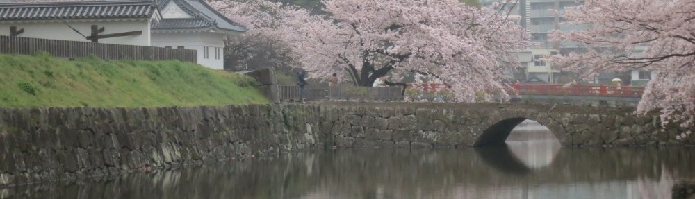
A couple of weeks ago I did my longest ride on the Bike Friday yet – 235 km in a day, across the mountains west of Tokyo to a lake near Mt Fuji during the cherry blossom (sakura) season. This was part of my training for a 300 km brevet ride coming up this month. It was a beautiful ride, one of my most enjoyable so far.

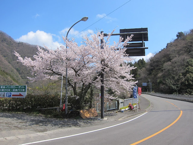
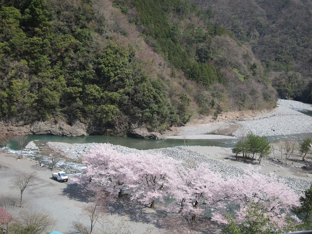
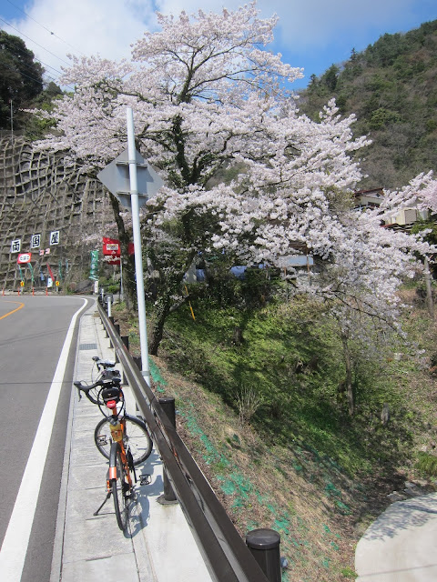
Sakura (cherry blossoms) on route 413:

It took me about 16 hours, of which 14 hours were moving time. I had left home at 05:20 and was back in Tokyo at 21:20 (9:20pm). My Pocket Rocket has a Shimano hub dynamo and a Lumotec IQ Cyo headlamp which provided plenty of light on the last stretch after sunset.

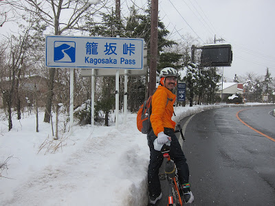
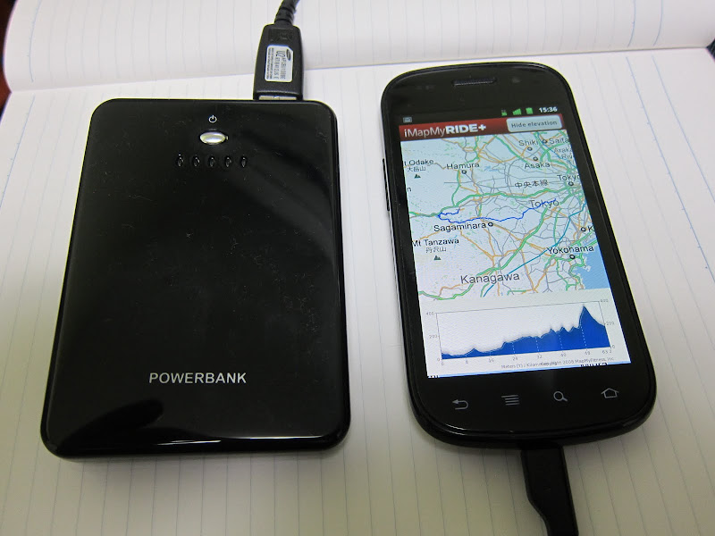
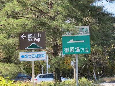
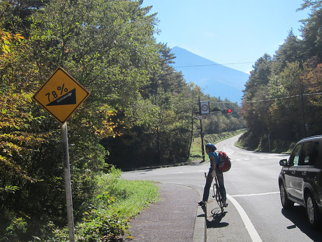
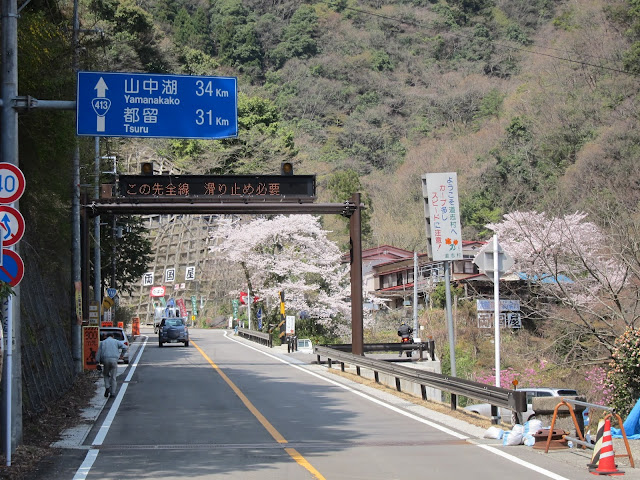
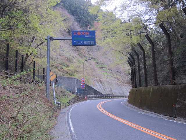
Here is my route. I started from my house in Tokyo after sunrise and cycled out to the mountains some 40 km away, then followed Route 413 up a mountain valley and over a pass over 1100 m (3600 ft) high. I was climbing from virtually sea level (45 m or 150 ft) to 1.1 km high. I was cycling almost continually uphill for the first 96 km (60 miles). After 7 hours (including quite a number of brief stops for food, rest and pictures) I reached the highest pass.
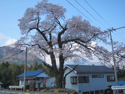
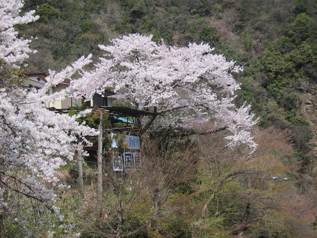
More sakura:

I always want to see the remaining distance:

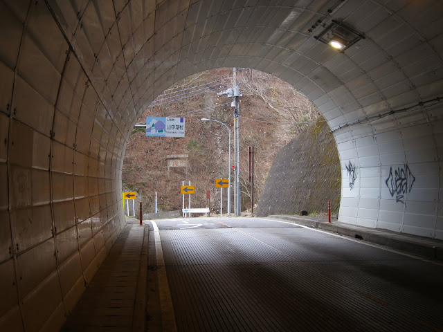
The exit of the tunnel at the end of The Longest Climb: It’s all downhill from here… NOT!

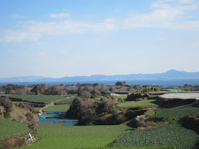
The shores of Lake Yamanaka at the foot of Mt Fuji, over 900 m (3000 ft) above sea level:

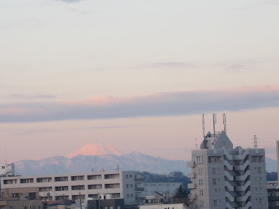
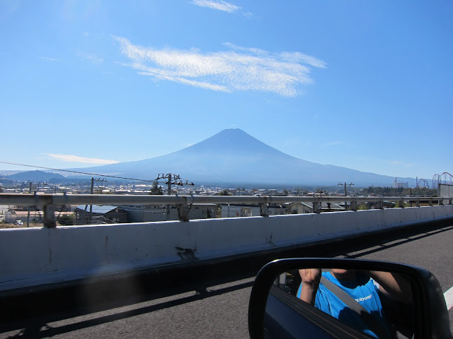
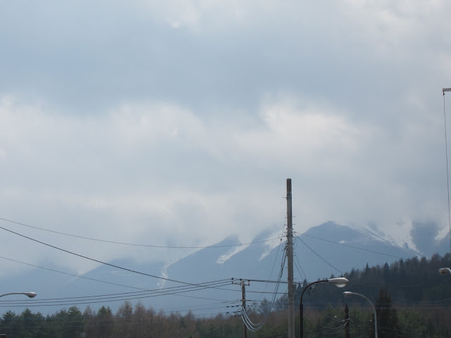
It can be surprizingly difficult to sea Mt Fuji (3776 m high) from just a few km away because of its frequent cloud cover. I cycled 235 km and all I saw of Fuji is this (its foot):

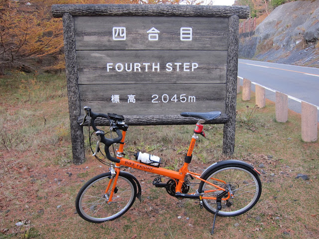
Almost home – at the top of the Mt Takao pass:

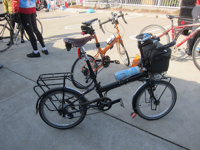
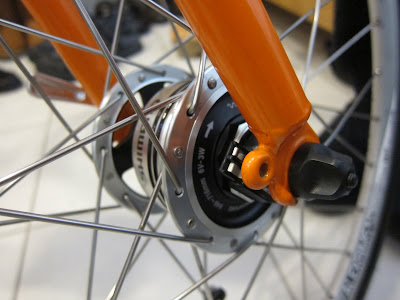
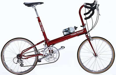
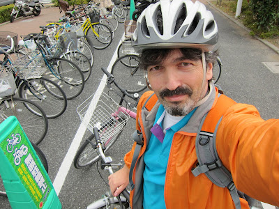
The humble Bike Friday Pocket Rocket:

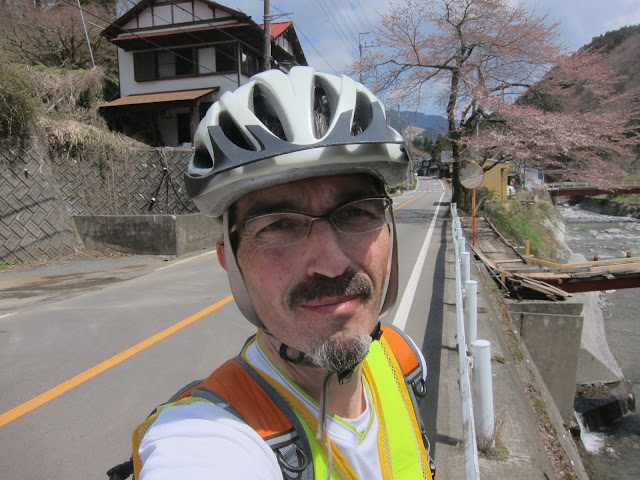
and its crazy rider:

The ABC of distance riding: Always Be Consuming!

There is nothing exceptional about cycling this kind of distance. The key is eating and drinking sufficiently. Most people who first try long distances become exhausted not because of insufficient training, but because they simply eat and drink too little. The energy reserves in your body only last so long. Three meals a day will not cover the continuous energy use of long distance riding. You need to consume about 200-300 kcal per hour and sufficient liquids.

I carried water in two bottle holders, which I refilled whenever I could. Throughout the day I ate: 7 bananas, 6 raisin bread rolls, 360 g of yoghurt, a slice of pizza and several other pieces of bread. I drank about 4 litres of water, orange juice, cocoa, yoghurt drink and sports drink. Don’t worry too much about putting on weight while burning 6500 kcal. I am 10 kg (22 lbs) lighter now than I was the year before I got the bike. I’ve been dropping about one kg a month since I got the bike.

Stick to a speed you can sustain. I am not a fast rider, doing mostly 23-25 km/h on the flat (about 15 mph), with down to as little as 9 km/h (6 mph) on steep climbs, but that doesn’t stop me from going out to see nature, lots of it. I don’t go out there to set speed records, but to see the country, smell the trees and the ocean, view the rivers and mountains and bring back some pictures. Why settle for 3-6 hours when I can enjoy it the whole day?

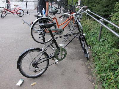
Long rides on a folding bike

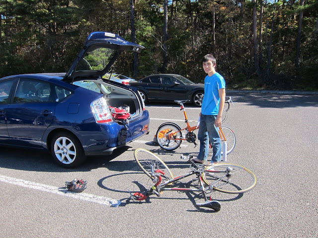
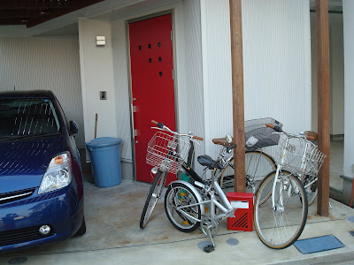
I did this 235 km ride a little over half a year after getting the Pocket Rocket, my first road bike in over 30 years. Some people are surprised that I do these rides on a folding bike. I usually point out that my house is small and a bike with small wheels is easier to store indoors. This is not just my touring bike but also my shopping bike. Almost daily I cycle to shops and carry my groceries home in a back pack. Other people may have a garage with several different bikes for different purposes, but I don’t.

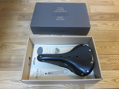
The other part of the answer is that the Bike Friday is no ordinary folding bike. It has the geometry of a regular road bike and it rides like one, but also happens to fold and can even be packed into a regular size suitcase (which I’ve not done yet). It may not fold quite as compactly or as quickly as say a Brompton or Bike Friday’s smaller Tikit, bikes optimized for intermodal commuting, but it is much more suitable for going fast and far. Drop handles offer many different hand positions, which keeps your arms and back comfortable for longer. The wide range gearing with triple chain rings on the front and a 9 speed cassette at the back make it possible to climb steep mountains without too much strain on my knees but still go fast elsewhere. I love my Brooks leather saddle which keeps my bottom happy even after a whole day on the bike.

Ultimately however, it is not about the bike, but about you. If you want to ride more and further, you can do it on almost any bike. A bicycle is a tool. I’ve done a couple of 50 km rides on shopping bikes. When my son was still in Junior High School he once went on a 110 km trip (Yokohama to Enoshima and back) with some friends on a single speed folder. If you have a nice bike, you are more likely to ride it more often because it’s more enjoyable, but whether you ride it at all is still up to you. The type of bike makes no difference if you’re too lazy to ride, as I became once I got into cars, back in my 20s.

If you like longer rides, give them a try on whatever bike you have. If you find that you enjoy these tours and would like a more suitable bike, get a good one and you will not regret it.

227 km a day on my Bike Friday

One month after my 155 km bike ride around Miura peninsula, a friend and I got up very early on a Sunday morning and cycled until after sunset. We went from Machida in the west of Tokyo to Mt Fuji and back. My total for the day came to 227 km (see route).

Why this ride? Earlier this month I had signed up for a 300 km brevet ride (randonnée) organised by AJ Nishitokyo for Sat/Sun, May 19/20, 2012. A randonnée is not a race, but individual riders do have to clear certain checkpoints within prescribed time limits. There’s an overall limit of 13 1/2 hours for 200 km rides and 20 hours for 300 km. For more ambitious riders there are also 400 and 600 km events. The most famous randonee is the 1200 km Paris-Brest-Paris that takes place every 4 years. I would have started with 200 km, but all events near Tokyo were already closed for signup, so I went for the next one up. Given that 300 km was almost twice the distance of my longest ride until then, I knew I needed some training to prepare.

My plan was to follow the 300 km route as much as possible to familiarize myself with it, but to cut it to a more manageable distance by taking a shortcut. The full route heads south from Machida in Tokyo to the Pacific coast in Enoshima (Kanagawa prefecture), from there west along the coast to Odawara, then up to Gotemba (Shizuoka prefecture) near Mt Fuji. It swings clockwise around the mountain into Yamanashi prefecture, then returns east to Machida via a route across the mountains. I decided to head north at Gotemba, replacing the long loop around Fuji with a much shorter section near Yamanaka-ko (Lake Yamanaka) to the east of the mountain. According to MapMyRide.com the shorter route would come to 213 km.

I would take the first morning train from central Tokyo out to Machida, ride several km from the station to the starting point and then follow the route. My friend Jose, an experienced randonneur (brevet rider) offered to join me and I gladly accepted. It would have been a lot more difficult without his company and experience.

We started at around 06:30, but I first needed to replace the batteries in my bike lights, attach my waterproof cue sheet to the handlebar and sort out some temporary GPS problems, which took more than half an hour. It’s better to encounter such problems on the training run than in the real time-limited ride…

As we rode along the Pacific coast from Enoshima to Odawara on this March 11, we couldn’t help thinking of the disaster that had struck the Tohoku region exactly one year earlier. The coast here is just as exposed. About 500 years ago, a tsunami destroyed a temple housing the Great Buddha of Kamakura (daibutsu) near Enoshima, almost a km from the coast. Only the bronze statue itself was left. We won’t know what will happen during the next Great Kanto Earthquake until it strikes.

After Odawara the road started climbing towards Gotemba. From there we climbed all the way to Kagosaka pass (1104 m above sea level), where we crossed into Yamanashi prefecture. It started snowing after Gotemba and persisted until we got to Fujiyoshida. We never really saw Mt Fuji, though we passed right in front of it, because of all the snow clouds. On the pass and around the lake everything but the road was covered in snow. I had to rest several times during the climb. I tried to eat and drink as often as possible in order not to run out of energy or get dehydrated (I was sweating a lot, even though temperatures were anywhere from 0C to 6C).

At the top of the mountain pass I knew we still had about 100 km to go, including two climbs of several 100 m each. I started to seriously doubt if I could really get back to Machida by bike or if I would have to catch a train from somewhere. But then we descended for something like 25 km from Yamanaka-ko and my energy came back as I could take it easy. Jose proposed a different route back to Machida that avoided some of the highest climbs and that’s what we did. There were still many climbs around Uenohara and Sagamiko, but I could manage them. Towards the end we rejoined the original 300 km route and got back to Machida around 20:00, which means I would have been within a 13 1/2 hour overall limit for a 200 km ride.

So what did I learn from this experience?

  • “There is no such thing as bad weather, only the wrong clothes” Jose told me and he was right. We were dressed appropriately and didn’t have a problem with drizzle or light snow. I was wearing mostly Uniqlo: long sleeved Heattech underwear, Jeans, a light Windbreaker. I also wore a folded handkerchief over my ears under the helmet, old socks with holes cut for the SPD pedal cleats over the Shimano shoes (“Belgian shoe covers”) and ski gloves when it was coldest.
  • I was more tired at the end of my 136 km day than after this 227 km. Eating and drinking often enough are key for long distance. Eat before you’re hungry, drink before you’re thirsty.
  • My butt hurt more on my previous saddle towards the end of the 156 km ride than the Brooks B17 towards the end of the 227 km. The Brooks is great!
  • I had some pain in my left shoulder joint, maybe from the cold and my Achilles tendons felt a bit sore the next day. I probably should have hydrated more before the ride and kept my shoulders warmer.
  • Navigating with the brevet cue sheet was more difficult than I had expected. I needed to edit the printout with bigger fonts and some translation from Japanese.
  • I logged the entire ride with the Strava Android app, with the phone connected to my dynamo hub USB charger via a Li-polymer buffer battery. The phone remained fully charged throughout and at the end the buffer battery charge state was 4 out of 5 LEDs, just like at the beginning. I could ride for days without running out of mobile power.
  • As I already learnt on my 136 km Miura ride (Feb 5, 2012), if you want to go far, start early in the morning and keep going as much as you can. You’ll be amazed how many km you can do in a day if you try!

Links:

Brooks B17 Standard saddle for my Bike Friday

A couple of days ago I signed up for a 300 km bicycle ride in May. Besides some training to prepare myself for the event I am also upgrading my Bike Friday folding bike.

The first investment has been a Brooks leather saddle. This British firm has an excellent reputation amongst long distance cyclists. On my last 150+ km ride there were two other riders with Brooks, one of them was Sarah Outen who has cycled from Europe to Tokyo on hers. The other was a friend of mine who had toured for weeks across East Tibet on his. Towards my longest ride so far I found it hard to sit on my previous bike saddle. My upcoming ride in May will be almost twice as far, so I will need to be as comfortable as I can. The B17 Standard is Brooks’ entry level model meant primarily for touring.

So far the impression is excellent: Even though Brooks saddles are supposed to take a break-in period of up to 1000 km, I have felt totally comfortable on mine from the first minute. Definitely recommended!

On the 40 km test ride I had my first puncture in 2000 km, but it was quickly fixed with my spare tube, tools and compact pump.

My second investment for the coming ride is a dynamo light, the Busch + Müller Lumotec IQ Cyo N Plus LED Front Light (175QNDi), which should be more effective than the small battery powered light that I now use. The current light is OK in town, but I wouldn’t want to rely on in the absence of street lights out of town.

More about the B&M IQ Cyo N Plus here once I will have received it and had a chance to test it!

Cycling more than 100 km a day

One year while I was in high school I cycled a total of 7500 km over 150 days (May through September), maintaining a daily average of 50 km. I lived 22 km from my school, so if the weather was OK I could get 44 km of exercise by just skipping the bus. My longest rides then were 160 km and a few days later, 220 km in a day. I had quite a few 100 km days. I’ve always preferred slowish distance rides to fast but short rides.

Recently I’ve done two rides around the beautiful Miura peninsula coastline south of Tokyo in as many weekends, each time setting a new personal distance record since resuming road cycling in October. Since buying my foldable road bike (Bike Friday Pocket Rocket), I have gradually increased my distances. I’ve been aiming for a minimum of 100 km total per week, which is fairly easy to achieve if I have at least one long ride on the Saturday or Sunday.

On November 12 I first used my bike bag for trying out the Half-Fast Cycling (HFC) Miura route on my own (58 km). Four weeks later, on December 11 I did my first ride over 100 km by combining the 60 km HFC West Park Cruise with trips to and from the meeting point in Roppongi and around Setagaya.

On Sunday, Feb 5 I joined James’ Miura “long slow distance” (LSD) ride of 140 km. I ended up doing 136 km in total. This was much tougher, mainly because the first quarter (until I dropped off to continue on my own) was quite a bit faster than I was used to. These Tokyo Cycling Club riders really are something else! But it taught me to start riding early in the morning and showed me some of the routes.


On Saturday, Feb 11 I joined the 58 km HFC Miura ride to visit Sarah Outen who is cycling and rowing around the world. I left home at 6:30 and arrived at Keikyukurihama station near the southern tip of Miura around 10:05 (66 km), a little after most others had arrived by train. The ride was great fun. The speed suited me perfectly. We took many quiet back roads and there were a good many hills. It was my first HFC ride with other folding bikes, as Jose cycled down 59 km from Yokohama on his Bike Friday Pocket Llama, on which he had cycled two weeks across East Tibet last year. There was also one cyclist on a Dahon Vector x27h.

After lunch and photos and a visit to the boat yard where Sarah is preparing for her Pacific crossing by row boat, Jose and I cycled up towards Yamato City. Unfortunately about 30 minutes into the ride I had a crash, but chose to continue despite some blood and bruises. Two hours later Jose and I arrived in Yamato in darkness. He rode home from there while I folded the bike at Yamato station and returned to Setagaya by train with the bike in the bag. The bike is OK and hopefully next week I will no longer look like I got into a bar room fight. Despite the incident the ride was much easier than the previous one. This time I stopped just short of 160 km (an imperial “century”), but I want to go further and go for 200 km. This will get easier as the days get longer and longer with Spring. I just have to keep training. Set off early in the morning, stick to a pace you can sustain and keep going!

I am now 9 kg lighter than I was a year ago, still losing a kg a month and I hardly even worry about how much I eat: I burn it anyway.

GPS-logging my bike rides

Five weeks ago I started logging my road bike rides, runs and mountain hikes using the GPS in my Google Nexus S Android phone. I use the iMapMyRide app which requires Android 2.1 and later (of course there’s also an iPhone version).

Start the app, a few taps on the screen and it starts recording. You can pause the recording any time, say if you stop for food or rest. When you’re done you can easily upload the complete route with GPS coordinates and timing to the MapMyRIDE.com website. Besides bike rides you can also use the app for hiking, running or walking.

As it records it displays basic map information, so it can be used for simple navigation too, but most of the time I relied on Google Maps for that.

Afterwards you can view the workout on your PC. It will show altitudes along the route, including total gain. It shows average speeds for each km of progress. It calculates how many kcals you used based on the route, your weight and your age.

A calendar view shows all days on which you exercised, with distances for each workout, weekly totals and monthly totals. This can be a powerful tool to keep up a certain level of exercise on a regular basis.

Battery usage

As with many mobile applications, battery life is of concern to users. So far my longest recorded hike was 5 1/2 hours and my longest bike ride was 4 1/2 hours. I have not run out of power yet, but I’ve had the battery low warning pop up on occasion.

There are a few things you can do to optimize power usage. I make sure to disable WiFi and Bluetooth to minimize power usage. If I am in areas without mobile data coverage, such as high on a mountain I switch the phone into “airplane mode”, which will still let it receive GPS data but it won’t download map data (which it can’t anyway without a nearby cell phone tower). Disabling these wireless connections prevents the phone from wasting energy on trying to reconnect.

It makes a big difference how much you use the LCD screen. If you often turn it on to consult the map for a new or unknown route that will eat battery life.

In order not to have to worry too much about that and to be able to record longer and further rides and hikes, I got myself a cheap external Li-ion battery on Amazon Japan, into which I can plug the USB cable of my Android phone for extra power. I paid JPY 2,380 (about $30) including shipping. Its capacity is listed as 5000 mAh and it has two USB output ports, plus one mini-USB input port for recharging. It comes with a USB cable for charging, a short spiral USB output cable and 10 adapters to connect it to different phone models (including the iPhone and iPod). Because of the standard USB ports you can use any existing USB cable that works with your phone. It’s like running your smartphone off power from your computer.

The device is about the weight and size of my phone. It came charged to about 60%. It should take a couple of hours to fully recharge it from empty.

If fully charged it should theoretically provide three complete charges for my mobile phone, which has a 1500 mAh battery inside, thereby quadrupling the length of rides I can record. Most likely, I will run out of energy long before my battery does 🙂

My longest distances with MapMyRIDE so far:

  • Bike ride: 71 km, 560 m elevation gain
  • Mountain hike: 14 km, 1020 m elevation gain
  • Run: 10 km in Tokyo

A few rough edges

While the iMapMyRIDE+ app feels fairly solid, it will need fixes for a few problems.

The major issue for me is that the app and the website don’t see eye to eye on time zones. For example, if I record a ride at 17:00 (5pm) to 18:00 (6pm) on a Sunday, the recorded workout title will include the correct time. However, if I view that workout on the computer’s web browser, it is shown on the calendar as having been recorded on the following day (Monday). If I check the details, the start and end times are listed as 8am (08:00) and 9am (09:00): Wrong day and off by 9 hours.

Probably not by coincidence my time zone (Japan Standard Time) is 9 hours ahead of UTC. It’s like the app sends up the start and end time in UTC but the website thinks the data is local time. Yet for determining the date it seems to add those 9 hours again, which takes it beyond midnight and Sunday gets turned into Monday.

I can manually correct every single workout from the website, which also fixes that date on the calendar, but then the app displays the wrong time, which I am prepared to simply ignore.

When I enter my height on the website and then view my details on the app, I am 2 cm shorter than I entered, perhaps as the result of my height having been converted from metric to imperial and back to metric with numeric truncation.

I wish the site would support 24 hour clocks, not just AM/PM. I also wish the site would let the metric size to be entered as cm, not just m and cm separately (probably a hangover from code written for feet and inches).

Note to the app developers out there: The world is much bigger than the US and most of it is metric.

UPDATE 2011-12-13:

I have used the Li-ion battery on two weekend bike rides now. One was 93 km, the other 101 km in length. In both cases I first used the phone normally until the remaining charge level was heading towards 20% (after maybe 4 hours), then I hooked it up to the 5000 mAh battery and continued the ride. The longer of the two rides was about 8 hours, including lunch and other breaks. At the end of the 101 km ride the phone battery was back up to 75% charged, while the external battery was down to 1 of 5 LEDs, i.e. close to empty.

I wasn’t as careful to conserve power with the external battery hooked up. My phone is configured to not go into sleep mode while hooked up to a USB cable, unless I manually push the power button. That’s because I also use it for Android application development, where it’s controlled from a PC via the cable. I should really turn that developer mode off on rides to have the screen blank after a minute as usual even when getting external power. Total capacity with the external battery probably at least 10 or 11 hours, more if I put the phone into “airplane mode”, which disables map updates and hence navigation.

My headlight currently consists of a twin white LED light using a pair of CR2032 batteries that I need to replace every now and then. It’s not very bright, especially where there are no street lights. Probably next year I’ll upgrade the front wheel using a Shimano DH-3N72 dynamo hub,

which can provide up to 3W of power while adding very little drag. A 6V AC to USB adapter will allow me to power USB devices like my phone and the headlights from this without ever having to buy disposable batteries or connecting anything to a mains charger.

UPDATE 2012-01-02:

I have had the front wheel of my Bike Friday rebuilt with a Shimano DH-3N80 dynamo hub. The old 105 hub is now a spare while the rim with tube and tyre were reused. Here is the bike in our entrance hall:

Closeup view of the hub with AC power contacts:

I purchased a USB power adapter made by Kuhn Elektronik GmbH in Germany. It weighs 40 g and measures 8 cm by 2.5 cm. It provides a standard USB-A socket which fits standard USB cables such as the one that came with my Google Nexus S:

USB power adapter with Google Nexus S:

UPDATE 2012-03-14:

At the end of January I started using Strava for tracking rides, in addition to MapMyRides (MMR). I stopped using the MMR app because there is no way in MMR to export GPX files with time stamps, so you can not track your speed or performance on any sites besides MMR. They lock in your data. Instead I either record with Strava on my Android 4 Nexus S or with Endomondo on my Android 1.6 Google Ion. That way I can generate GPX files that will upload to Strava, Endomondo, MapMyRide or just about any other site. The automatic competition feature of Strava is superb. MMR’s best features are its calendar view with weekly and monthly statistics and its mapping feature for planning rides. If those were merged with what Strava can do, it would be a terrific GPS cycling app and site.

Shimano PD-T780 SPD pedals and SH-MT42NV shoes

On Sunday I rode to Y’s Road in Shinjuku to buy clipless pedals and bike shoes. I did not want pure racing gear, but shoes I could also walk around in when I go shopping, as I usually take the bike for that. On my first touring bike in high school I used straps, but clipless pedals are supposed to be more efficient. With either you can maintain a higher cadence (pedalling speed), which optimizes power output compared to pedalling harder at slower pedal RPMs.

I chose PD-T780 SPD pedals and a pair of SH-MT42NV which are mountain bike shoes with recessed cleats. These pedals are part of Shimano’s Deore XT range and are meant for trekking. Because of that they have both a cleat side and a flat side, so you can also ride them with ordinary shoes, plus they’re equipped with reflectors. I like being as visible as possible in traffic, especially at night.

I found clipping in and out with SPD fairly straightforward, but there are some caveats. I’ve heard the warning that when you start using clipless pedals, you will crash at least once until you get the hang of it. It happens when you forget to unclip at least one shoe before coming to a complete stop. So far I’ve done 46 km without falling over, but I’ve been careful and started off with the loosest setting for the locking mechanism. If I find myself in a situation where I may have come to a stop (for example approaching a red traffic light or turning into a street where I might have stop to for traffic or if there are a lot of pedestrians about) I twist one foot to unclip but stay on the pedal so I can easily reconnect once it’s safe to do so, but also support myself if I suddenly need to stop. The other foot can always stay locked in.

If you’re more of a racing type of person, Shimano’s SPD-SL system may be a better choice, but for me SPD works just fine.

Cycling on Mount Fuji Subaru line

I love Mount Fuji since my first trip to Japan in 1990. I have enjoyed numerous views of it from near and far and several times drove up to the fifth station (go-gome, also named “fifth step”) of the Kawaguchiko hiking trail. This is as high as you can go by car before walking to the top.

All Fuji hiking trails are numbered from first to tenth station. The first station is the starting point where pilgrims on foot used to start their journey in the old days. The tenth station is the crater rim, where a Shinto shrine is located.

The Kawaguchiko fifth station at over 2300 metre is the second highest station accessible by car or bus. It lies just above the tree line. The hiking trail from there winds up the exposed volcanic cone above the station.

Fuji Subaru line

Access to the fifth station is by a toll road (2000 yen = about US$27 by car, 200 yen = US$2.70 by bicycle), called the “Fuji Subaru line”. I’m not sure, but I always assumed its name was connected to Fuji Heavy Industries (富士重工業株式会社), the makers of Subaru cars. Officially the road is named after the Japanese name of the Pleiades star constellation (a.k.a. the “Seven Sisters”), but those are also the stars you see in the Subaru car logo, as it is also named after the constellation. The road was built in 1964, so maybe nobody really knows these days. I was passed by 2 or 3 Subaru Impreza WRX on the way up, so regardless of its origin perhaps the name does attract Subaru drivers 😉

Despite running up the highest mountain in Japan, the Subaru line is not quite the highest Japanese road accessible by car, but it doesn’t miss that record by much.

As a staging post for hikers, the fifth station offers car parks, toilets, souvenir shops, a shrine and shops that sell anything a hiker might need who would hit the trail to the peak at 3776 metres. The station offers great views of the “five lakes”, the Southern Alps and many other mountains in the distance, that make it well worth a visit even if you’re not going to climb to the peak. Often you will find yourself above the clouds, like in an airplane. On the other hand, the higher regions of Fuji may be shrouded in clouds even when elsewhere the sky is clear. This makes clear views of Fuji and from Fuji even more precious.

During the peak season in early to mid August, private cars are banned from the road because of insufficient parking space up there. Only buses and taxis can use the road then. In the summer you sometimes have to wait in line for parking. Only when enough cars come down the mountain can you advance further up. Earlier or later in the year the upper sections of the road may sometimes be closed due to snow, but in principle the road is open all year round, with daily opening hours varying by the season.

Going by bike

During my earlier visits I had seen quite a few cyclists on that road. Invariably they were on light-weight road bikes, wearing bike shorts and bike jerseys and they would not have looked out of place in the Tour de France. Somehow, if you get a road bike in Japan, there seems to be an unwritten rule that you must wear the whole kit to look like a pro… Anyway, I felt the greatest respect for these cyclists because I knew how long and steep the road was, even in my car that did all the hard work for me. It’s about 29 km from Fujiyoshida down at the base to the end of the road up there.

In August 2011 I finally fullfilled a long held dream and climbed Mount Fuji. I made it to the top and back down again. Three weeks ago I got my Bike Friday Pocket Rocket, a road bike that folds. Earlier this year my son Shintaro had suggested we should try the Mount Fuji Hill Climb, a bike race every year in June that starts at Mount Fuji Hokuroku Park near the Subaru line toll gate and finishes at the fifth stage. It’s 24 km in total, with a 5% average, 7.8% maximum incline.

After two rides of 48 and 55 km on weekends on my new bike I thought I might give Mount Fuji a try, but was more concerned about getting down again than making it up there: If I got too exhausted, I could always turn around at any point, but if the long descent turned out to be too hard on the bike’s brakes, wouldn’t I be in trouble?

I did some research online and after some valuable advice from members of the Tokyo Cycling Club forum, I decided to give it a try because 5% is still quite manageable. Shintaro was keen to join me. The weather forecast for Saturday was excellent: Clear skies, sunny, with 19C at the bottom, but I knew it was going to be much colder at the top, especially on the way down again, when my leg muscles weren’t going to supply much heat.

After breakfast we packed our two bikes into the back of the Prius and drove to Fuji. With Saturday traffic the 100 km from Setagaya/Tokyo to Fujiyoshida interchange took us 3 hours, so we only got there around noon. After setting up the bikes in the car park of the Mount Fuji visitor center we did some food shopping and ate lunch outside a convenience store near the interchange and the Fuji-Q Highland amusement park. The visitor centre was not too busy this time of the year, but there is also a large car park nearby for the summer season (1000 yen per day), for park and ride with buses. From Fujiyoshida IC it’s about 4 km uphill to the toll gate.

I tracked our ride using the free iMapMyRide application. It runs on my Google Nexus S Android phone, mounted on the handle bar using a Minoura iH-100-S smartphone holder. I used about half the battery charge for the roughly 4 1/2 hour climb, with the phone set to airplane mode because there wasn’t going to be any cellphone reception anyway. When we got back to the car, I reenabled the network and uploaded the data to the TrackMyRide.com website, which does a good job of mapping rides and displaying information such as average speeds for each kilometer of the trip, kcals burnt, altitude profile and gain, etc. My only minor problem with the app and website is that it doesn’t deal properly with time zones, so some rides show up one day off in the calendar and the start and end times are not from your local time zone.

My climbing speed was moderate but steady, mostly between 8 and 11 km/h and I was mostly in the 2nd or 3rd lowest gear. I drank about 1.5 litres of water and stopped several times for some carbohydrates.

On the way up I did a radiation check with my Ecotest Terra-P MKS-05 geiger counter at the edge of the forest surrounding the road and the number was no higher than back in Tokyo where we lived.

Pictures from the ride

Here we were taking a break on the way up at the first stage rest area.

Here we’re just over half way to the top, already enjoying splendid views.

Autumn colours everywhere:

Looks like a thistle:

We’re 80% there: about 6 km and 300 metres of altitude to go.

I loved these views.

Yeah! We made it! 🙂

After 29 km and almost 1500 altitude metres, we’re at the fifth stage.

Entrance to the small shrine between souvenir shops.

The new moon rising over Mount Fuji. Time to head down again before it gets completely dark!

Descending from Mount Fuji

We changed into our warmest clothes and set off for the one hour descent. I mostly coasted at 35-40 km/h, applying the brakes only before curves. I wish I had warmer gloves and a stronger headlight (or even better, more daylight), but we made it down OK.

At 18:00 the visitor centre car park with our car inside was already closed with a chain, but fortunately it wasn’t padlocked. We packed the bikes back into the car, went for some sushi and then headed back to Tokyo.

It was a great experience. Thinking about the Mount Fuji Hill Climb in June, I loved doing Subaru line at my own pace, with time to take pictures. If you do the race, maybe you also want to come back some other time to simply enjoy the great views on this majestic mountain, without 5000 other cyclists around you…

Bike Friday Pocket Rocket

Yesterday I ordered a new bicycle, a Bike Friday Pocket Rocket. It’s a folding bike that rides like a good road bike.

My house in Setagaya, Tokyo is tiny and the three other members of the family already own four bikes between them, so we’re really short of space.

A while ago an Alex Moulton bike in a park in Tokyo caught my eye and that started me looking at small-wheeled fast bikes.

Moulton bikes have suspensions and use small wheels (20 inch or smaller). Some of them use a space frame, like on the TSR model pictured above and can be separated into two halves for transport or storage. Unfortunately, some Moultons are obscenely expensive (for the list price of the top of the range Moulton Double Pylon — JPY 1,795,500 — you could almost get a Honda Insight hybrid car). A Moulton TSR-30, the model I would have been most interested in, sells for JPY 390,000 (about US$5,000) over here, which is way over my budget limit.

Therefore I started looking at various other small-wheeled bikes, including Dahon, Birdy (Riese & Müller, Germany) and Bike Friday (Oregon, US).

I then test rode a Bike Friday Pocket Rocket at Amanda Sports (one of their dealers in Japan) here in Tokyo last summer and liked it. Bike Friday bikes are definitely not cheap either, but the bikes are well designed and well made and carry a life-time warranty on the frame. The company is famous for its customer service. They use a lot of standard parts to make sure their bikes are easy to repair and in all the bike forums I visited, I never read a single bad word about them from any of their owners: Their customers seem very loyal.

I probably would have ordered a Bike Friday this spring, but then the M9.0 Tōhoku earthquake and tsunami hit Japan and triggered the Fukushima nuclear disaster, prompting me to take my family abroad until the situation in Japan had stabilized again a bit. I returned and now I finally placed the order.

With the help of one of Bike Friday’s bicycle consultants, I selected a 27-speed model using Shimano STI integrated shifters, with drop handles, narrow high pressure tires, fenders and a kick stand, in a colour called “Enno Orange”.

The bike will be delivered in early October. Stay tuned for pictures and ride reports with even more pictures!

Cycling since high school

Though born and raised in Germany, I’ve never been interested in football (soccer) or anything that involves a ball or opposing teams. The only sports I really enjoyed were swimming, walking or running longer distances and cycling. These are sports that you can do not only when you’re young, but throughout your life.

When I was in high school I bought my first 10-speed bicycle, a French Motobecane with drop handles. During one summer I did 7,500 km (4700 miles) over a period of 150 days (50 km/day average). I enjoyed going for rides of several hours, especially on weekends. My longest single day distance was 220 km.

Eleven years ago, when I moved to Yokohama, I bought a mountain bike. I gave it away to friend when I moved to my small house in Tokyo last year, because I had no space for it. Since then I’ve been using either my wife’s mamachari (housewife’s bike) or a small rusty foldable with squeaky brakes that we originally got as freebie from SoftBank Mobile when we signed up for iPhone contracts (seen folded in the centre of the picture of my home at the top). I am not a bike snob. I’ll ride just about anything with two wheels and usually the only kind of bicycle wear I put on is a proper bicycle helmet.

In Tokyo, a bicycle will often get you from A to B almost as quickly as a car (sometimes quicker) and you won’t be paying an arm and a leg for parking, plus it’s more fun than driving a car on our notoriously congested city roads. That’s why I do most of my shopping by bicycle these days.