
I rode my third century of January and my first randonnée of the year on Sunday. After completing the 204 km ride (finished in 12:04) I rode home, for a total distance of 233 km. I had done the same event in 2015 – with only minor route changes – and almost the same time (12:06).
The main difference was that on Sunday it was not quite as chilly. Perhaps that was because it was overcast, which preserved more heat from the day before than if the night sky had been clear. It also meant that the sun wasn’t in our faces (and the faces of drivers coming up behind us) when we cycled towards Kawasaki around sunrise. I felt a lot safer because of that.
This brevet is the flattest by far of any events that AJ NishiTokyo (my local club) organizes. On the other hand, the first third and the last quarter had a fair number of traffic lights. Still, there was less pressure to make closing times than on any other brevet I rode.
I had to be at the start by about 5:20 to pick up the brevet card and attend the safety briefing, so the night before I rode 30 km from my home to a cheap hotel near the start where I spent the night. This I could still get almost 7 hours of sleep. Perhaps I’m getting soft in my old age 🙂
After passing by the Yokohama harbour near Chinatown, I took the optional route over the hills. This is where a lot of foreigners set up their homes when Japan opened to the world after the arrival of Commodore Perry’s Black Ships. On the Yamate district up on a hill you see many western style villas, a great view of the harbour and the historic Foreign Cemetery.
From Kawasaki to Yokohama down to Yokosuka the roads were urban, with traffic lights slowing you down. Yokosuka is home to the US Seventh Fleet. Not far from it is where William Adams (the Miura Anjin of James Clavell’s “Shogun”) had his fief back in the 1600s. The peninsula turns rural thereafter.
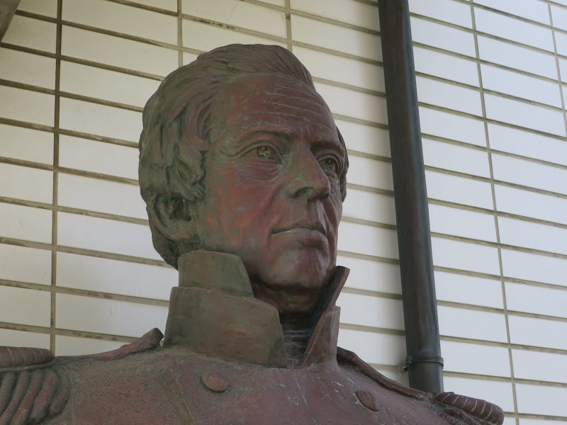
It was too overcast to see the mountains of Boso peninsula in Chiba, on the opposite side of the mouth of Tokyo bay. At Kurihama I passed Perry Park, a memorial to Commodore Perry who landed here in July 1853.
Following the coastline the route passed through seaside towns and fishing villages. Miura peninsula is one of the vegetable gardens of Tokyo, with mainly cabbage and daikon (radish) being grown.
After PC2 in the southwest corner of the peninsula, the route headed up the west coast. This is my favourite part, particularly in the late afternoon, with the sunlight reflected in the ocean, or when it’s cloudy and the sky can be very atmospheric. We passed the Imperial villa at Hayama. Emperor Yoshihito, father of WW2-era emperor Hirohito, died here in 1926.
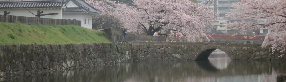
A couple of km to the north we passed by Kamakura, one of the 4 historic capitals of Japan (Kyoto, Nara, Kamakura and Edo/Tokyo). In summer it’s popular for its beach, but even in winter there are many windsurfers (see picture at the top).
The next major town was Enoshima, which offers great views of Mt Fuji when it’s sunny, but not that day. Before the mouth of the Sagami river we turned inland, heading up north to loop back to the start. About 5 km later we reached PC3, that final control before the goal.
By this time I was about 1:15 ahead of closing time, so I could have made it to the goal even with an average of 10 km/h. I still kept up the speed to cover as much distance as possible before the sun went down. I only rode about the last hour in darkness, plus the ride home after the event.
Due to business travel my February distance will be lower than my January distance, but I’ll try to get one century in on the first February weekend, weather permitting. Today it’s snowing here in Tokyo. Usually we only have a couple of days of snow a year and this makes CaM a lot easier here than in many other parts of the planet.
