Replacement Chainrings for Sugino Compact Plus Cranks (OX601D, OX801D)

Since 2016 I have been using a Sugino OX601D “compact-plus” crank on my Elephant Bikes National Forest Explorer. A compact-plus crank offers lower gearing than conventional 50/34 “compact” or 52/36 “mid-compact” cranks. I use 42/26 rings. Another popular combination is 46/30.

These smaller tooth counts allow for lower gears, making hilly courses more accessible to many cyclists of different abilities. This used to be the purpose of triple cranks until they were largely abandoned by Shimano, Campagnolo and SRAM a couple of years ago. In 2013 Shimano dropped triples on Ultegra when it moved from 6700 to 6800. The following year it did the same to 105 with the switch from 5700 to 5800. So-called compact and mid-compact double cranks were supposed to be a replacement for triples, but in truth their gearing never went low enough for many cyclists on all kinds of terrain.

Most road triple cranks used a bolt circle of 130/74 mm or 110/74. That meant the middle could be no smaller than 38T (130 BCD) or 33T (110 BCD), though in practice 39T and 34T were more common. The 74 BCD allows rings of 32T and smaller, down to 24T. Shimano compacts give you only 110 BCD, excluding any inner rings smaller than 34T.

Into this void stepped Sugino with its compact-plus cranks that combined the more flexible gearing of triples with compatibility with double front derailleurs and shifters. They do that with a 110/74 BCD combination with 5 bolts, just like an old touring triple (typical configuration: 48/36/26).

Effectively, a compact plus crank is a triple in which the middle and large rings are replaced by one in-between ring that can do both jobs. So for example, instead of a 50/39/30 you would have a 46/30. You just give up some very tall gears, but those typically see very little actual use outside of road racing.

Eventually Shimano also jumped on the compact-plus bandwagon: It is now offering 48/31 and 46/30 cranks in its GRX group set for gravel bikes, using a proprietary 110/80 BCD setup with 4 bolts.

I’ve been very happy with my Sugino OX601D. The 42T large ring and the 26T small ring in combination with a 11-32 cassette (11 speed) provide just the right gear range for my kind of riding. I ride a lot of mountain routes with grades of 10 percent and more and 160 km or more in a day where I really appreciate being able to spin up a mountain in a low gear. If I push heavy gears, I end up paying for it with knee pain.

Recently I replaced my bicycle chain as it had worn and stretched and noticed in the process that the teeth of the large ring were quite worn too. I had put over 30,000 km on that crank already and should have replaced the most recent chain a long time ago. In any case, I realized that I now needed a new chain ring and it turned out that Sugino no longer makes it. That’s because the OX601D and OX801D cranks have been discontinued, along with the PE110S rings that were used on them.

Sugino only ever sold these cranks with ring combinations of 44T to 50T for the large ring and 30T or more for the small ring. The 40T and 42T versions of the PE110S were made specifically for use with the ZX801D, a Mountain Bike equivalent of the OX801D but Soma/Merry Sales in the US sold them as a combination with the OX601D. That’s where I had bought mine.

Sugino’s current compact-plus offering is the OX2-901D, the successor to the OX901D which in turn was the 10/11-speed version of the 9/10-speed OX801D. My OX601D is a cheaper but functionally identical version of the OX801D – basically just not as shiny. I had no problems running the OX601D in an 11-speed configuration, with an 11-speed chain, cassette and rear derailleur, but I guess there are some subtle differences with the latest versions, such as maybe the spacing between the two rings to optimize it for the narrower 11-speed chain.

The OX2-901D uses CP110S chain rings with the same 110 BCD bolt circle as the PE110S, but they’re for 11 speed. The large rings are offered in even steps from 44T to 52T and small rings (CP74S, CP110s) in even numbers from 30T to 36T. There is no 40T or 42T for the large ring or 24, 26 or 28 for the small ring as there was for the PE110S for the ZX801D because there’s no MTB equivalent of the OX2-901D. Sugono’s only concession to people needing lower gearing is the “Super Hill Climb” CY5-SHC, a 27T 74 BCD inner ring.

One option would have been to buy a CP110S 44T chain ring. Given the close family relationship between the OX2-901D, OX901D and OX801D/OX601D, I am pretty sure it would have worked worked just fine on my older crank. It would have raised the gearing on the large ring by about 5 percent though (44/42). On top of that, the difference in tooth count between the two rings would have increased from 16T (42-26) to 18T (44-28). The specification for my FD-CX70 says its maximum capacity is 16T, but it would probably would have still worked. However, 44/26 at the front with 11-32 at the rear would on paper have required a total rear derailleur capacity of 39, one more than the specification of my RD-6800-GS. That can get tricky.

Exceeding the total rear derailleur capacity theoretically creates problems during cross chaining, as the rear derailleur arm can not take up all the chain slack from switching between the two extreme positions. If the installed chain is kept short enough to not go slack when running on the the small ring at the front with the smallest sprocket at the rear, it risks the derailleur pulley making contact with the spinning cassette when running on the big ring at the front and the largest sprocket at the rear. That could be disastrous. The safer way is to keep the chain long enough for the big/big combination, which I quite often use. At worst your chain will slip in the small/small combination which should be avoided anyway (and which is easy to avoid, you just switch back to the big ring after the first couple of upshifts when you have reached the top of a steep climb).

Sugino rings are not the only choice for compact-plus cranks. French bicycle parts maker Spécialités T.A. also offers a wide variety of high quality chain rings that can be used on many different cranks. Specifically, the TA Zephyr rings are also ramped and pinned for Shimano STI and will work with 10 and 11 speed groups. When you are looking for a large ring for a Sugino OX crank, it is best to use a 110 BCD ring meant for a use as a middle in a triple. That’s because these rings are mounted on the inside of the OX crank spider, not the outside. This matters because some rings have bolt holes that are countersunk for mounting on a particular side, to match bolts with conical heads. So it makes a difference if the bolt enters the bolt hole from the left or the right. In any case, there’s a TA Zephyr 110 BCD middle in either 40T or 42T, making them suitable replacements for the PE110S 40T and 42T formerly made for the ZX801D that are no longer available (EDIT: for the 74 BCD inner replacement I used a TA Zelito, which are available in 24T, 26T, 28T, 30T and 32T).

It’s a pity that Sugino no longer offers chain ring combinations below 44/30, such as 44/28, 42/26, 40/26 or 40/24 which would all be possible with the dual bolt circle of 110/74 mm on OX and OX2 cranks. As long as TA offers the rings we can still create and maintain such combinations though.

Another great option are Rene Herse cranks, which are available in a wide range of chain ring sizes, supporting speeds from 9 to 12 speed. That may be my fall-back position a couple of years down the road.

EDIT: I bought a 110 BCD TA Zephyr 40T as the large ring and a 74 BCD TA Zelito 24T as the small ring replacement (www.bike-components.de/en). The shift quality with the Spécialités T.A. rings is fantastic. The OX601D now shifts better than with the Sugino rings, arguably as well as any mechanical shifting (non-Di2) setup of any brand or model I have ever used. I am extremely happy with it. Dropping the chain ring sizes by two teeth from 42/26 to 40/24 has not been any drawback on the flat or descents but has helped me on climbs.

My team “Maillot 24Tokyo” ride of AR Nihonbashi Flèche 2021

I survived my second Flèche ride from Toyohashi in Aichi prefecture back to Tokyo (on Strava) and my third Flèche overall.


Although we officially did not finish again, I rode 401 km altogether from Saturday morning to Sunday afternoon, including the entire 368 km route as planned, just not within the set hours. A Flèche is a randonneuring event where teams of 3 to 5 machines (tandems only count once) ride at least 360 km in 24 hours towards a central location / meeting point. At least 25 km have to be covered after hour 22 of the 24 hour ride. It was organised by AR Nihonbashi.

We used almost the same course again as last year, only the part close to Tokyo was different. The biggest difference overall was that it didn’t rain all day on Saturday as it had last year. Therefore I rode the whole day in shorts instead of in rain gear and the temperature was much more pleasant too.

To get to the start, I drove to Aichi by car the day before (I can’t rinko my Elephant Bikes NFE). I was joined by my wife and my son. Together we visited Cape Irago (Iragomisaki) on the Atsumi peninsula of southern Aichi. After dropping me off they drove back to Tokyo. The peninsula is beautiful. I was impressed by the natural forests that are a sprinkle of different colors, unlike around Tokyo where much of the current forests are regrown mono-cultures planted after post war clearcutting.

I had dinner with two other team members, then went to bed at 21:00.

The alarm went off at 05:15 and we assembled at 06:00 to get the bikes ready.

It was a 20 minute ride to the official start at a 7-11 on the outskirts, where we set off at 07:00. We head a very pleasant tailwind on our ride through farm country out to Iragomisaki, where we uploaded a group picture in front of a road sign to prove passage.

The view from the road next to the Irako View Hotel (伊良湖ビューホテル) was breathtaking. You could see the coast of Mie prefecture on the other side of the entrance to Ise Bay and various islands in the sea. I took in the view but we didn’t stop for a picture. Here’s a picture from Wikipedia (By Bariston – Own work, CC BY-SA 4.0):

We headed into the headwind that would be blowing in our faces for the next 120 km. Sometimes we took turns leading the ride. Many of the farmhouses had a storehouse between it and the coastal side, probably to block the wind.

There were also many greenhouses. Regardless of shape and size, glass or plastic they all seemed to have fuel oil tanks with the JA logo (Japan Agricultural Cooperatives), so it’s a safe bet that JA sells most of the fuel oil consumed to help grow crops in the cold season. Lots of signs advertising melons which are currently out of season but we came across many kei trucks loaded with cabbages.

There were many wind turbines in Aichi and also Shizuoka, as well as many photovoltaic installations. Their ubiquity there highlighted for me how few of them we have in Tokyo and Kanagawa. Perhaps Chubu Power is easier to deal with for feed ins than Tepco is, especially for wind power.

At noon we stopped for lunch at a ramen and gyoza place about halfway between Cape Irago and Omaezaki.

As we passed the former Hamaoka nuclear power station (it is permanently shut down) we were passed by a group of three cyclists on mamachari. Actually, one was a hybrid bike with flat bars while the other two were bona-fide mamachari. It was team ”マチャリはロング向き!” (“Mamachari is suitable for long rides!”) running in the AR Nihonbashi event and they were steaming ahead of us.

We got to Omaezaki a little after 16:00. By then it was a Century ride (160.9 km / 100 mi), but not even half of what we had set out to do.

As the course turned north here, the headwind ceased and became more of a tailwind again. It got dark near Shizuoka City.

I had felt a bit sleepy after lunch but then felt OK again. Over the next couple of hours others became sleepy as we were riding through the dark and it became more and more of a problem.

I wasn’t able to see Mt Fuji on the drive on Tomei expressway on Friday because of low clouds and now I couldn’t see it because it was night time. After crossing Fuji city and Numazu we started our climb in Izu towards Atami toge. When we finally got to the top, we had to take another power nap break at the tunnel entrance. We put on all our extra clothes for the steep descent down to Atami (13 percent). After that my rear disk brake, which recently had been very noisy and not very effective (maybe due to oil contamination from the chain) has been working perfectly again, as the heat and wear effectively decontaminated it.

Dawn approached as we headed from Atami to Yugawara and Manazuru.

We had burnt up most of our time buffer for the sleep break planned at the 22 hour stop by then, but the sleepiness in the team only got worse. So after another long break at Manazuru we sent in our DNF-notification to the event organiser. We headed to Odawara and had breakfast at the station.

After that, my friends rinko’ed their bikes for the train home while I continued on the planned route to Yamato, then another 26 km to my home. I also needed a few naps to get me home safely.

With this ride, I now have 104 contiguous months of Century a Month.

I may join a 400 km brevet later this spring and a 200 km brevet or two again after the summer.

As for the Flèche that we DNF’ed twice now, let’s see what we can come up with next year. We may just try it again a third time 🙂

One Hundred Months of Centuries

One hundred consecutive months of at least one Century (i.e. a bike ride of 160.9+ km) a month complete! I started doing long distance bike rides in March 2012 and from September of that year started doing at least one Century per calendar month.

This latest ride in Izu covered 172.5 km (on Strava) and also added 24 VeloViewer tiles.

A ride in west Izu in December is almost like a personal tradition for me. As the weather turns drier in the winter there are so many nice Fuji views to be had and you can ride around the entire peninsula without climbing a single hill higher than 300 m.

Well, that’s the theory. But it actually rained for the first two hours and the return route through the center of the peninsula that I took to get back to Mishima had a climb to 650 m elevation and only 7 C in the dark. I had about 1,000 m of elevation gain on the way down to near Iwachi Onsen (south of Matsuzaki), but another 1,200 by replacing the hilly coastal road that I had come on with Rt15 and Amagi toge/Rt414 on the way back.

We met up at 8:00 at Mishima station. It had been raining on my drive on Tomei from Tokyo, but seemed to almost have stopped by the time we set off, so I left my rain gear in the small backpack I was wearing. The rain picked up again, bringing back memories of my rainy Fleche ride from Aizu to Tokyo in mid-October. Our first stop was at a 7-11 on the Izu north coast, before we headed out to the NW corner.

The Honshu coast was completely obscured by rain clouds, no views of Mt Fuji. However, gradually the sky brightened and the rain stopped. We bought some mikan from an unattended roadside stall (9 mikan for 300 yen) which we shared at a viewpoint overlooking Ida village.

First we could make out the side of the mountain, with snow visible at the top of the visible portion, just below the clouds. In Heda we visited the sandspit with the shrine. In clear weather you can view Mt Fuji behind the entrance to the local bay with the tori of the shrine in the woods on the sandspit from a small pier the locals use for fishing. The water there is crystal clear.

Then we climbed the biggest hill on the way to Toi, where we had Chinese lunch (because it was quick and December daylight is short). After that Jochem headed over the mountains to the center of the peninsula to catch a train back while Colin and I continued to Matsuzaki as fast as I could.

The rain had washed off all the chain lube and it was squeaking. I had to re-lube from my little container, which fixed it.

From Matsuzaki, Colin headed inland on Rt15 to get to Shimoda while I continued towards Iwachi onsen / Kumomi onsen. On a hill overlooking the Matsuzaki coast I took pictures when three Japanese road cyclists came up. We started to chat. In the end it turned out one lived in my neighbourhood (within half a km) and I had met with one of the others at a Half-Fast meeting a couple of years ago! The world is such a small place 🙂

Since I was running out of daylight, I headed back north and took the same route Colin had taken. From north of Shimoda I headed towards Amagi toge. My feet were wet the whole day from the rain, even though I had bought a simple pair of socks at a convenience store to change, because the shoes were still wet. My fleece trousers were also moist from not wearing the rain pants in the morning. So I wasn’t very comfortable, despite wearing the rain jacket as an extra layer. Dry feet are crucial for comfort and I resolved I will finally do something about keeping my shoes dry in the rain.

In one place the road passes a corkscrew-like ramp. The whole climb is very steady, mostly 5-7%, so not difficult but just long. It’s about as much climbing as Yabitsu pass, but less steep. The road is kind of remote, with no houses around and I could hear many deer whistling in the forest, but cars were passing quite regularly. North of the tunnel at the top of Amagi pass it was a loooong descent (more than 20 km of coasting). Once that leveled off I could follow the river and main roads back to Mishima, with no significant climbs.

I got back home around 01:00 in the morning, showered and went to bed. It felt good to have done the big ride for the month and extended the streak into the triple digits, which was my aim for the whole year.

Izu is always well worth a visit.

I don’t know how many more Centuries I’ll manage in December but I plan to continue in January 🙂

My team “Maillot 24Tokyo” ride of AR Nihonbashi Flèche 2020

The Fleche Nihonbashi 2020 (フレッシュ日本橋2020) will remain my longest ride of the year, I am sure. I rode 403 km from the hotel in Aichi where we set off on Saturday at 06:30 to my home in Tokyo on Sunday (on Strava). During that time I slept 3 1/2 hours and experienced 18 hours of rain.

In a Fleche, teams of 3-5 bicycles have 24 hours to ride a distance of at least 360 km towards a central meeting point. I had successfully participated in a Fleche in 2019. Two members of the 5 person team this year were different from last year. Like last year, only 4 of them actually rode.

Our event team name was “Maillot 24 Tokyo”, a pun on the fact that we were going to ride 24 hours (“ni shi”) to Tokyo in our new AJ NishiTokyo jerseys. The 2020 run was originally scheduled for April but due to Covid-19 it got pushed to October 17-18. Because virtually no randonneuring events have taken place from April to September, many randonneurs’ fitness has suffered and DNS (“did not start”) is more common than usual.

I had been watching the weather forecast closely. Our start was in Toyohashi, Aichi prefecture and the planned goal in Totsuka, Kanagawa. Normally, the prevailing wind conditions would give you something of a tailwind along this relatively flat course. We had only about 1000 m of elevation gain in the first 2/3 (240 km) of the ride. However, as the date of the ride came closer the forecast became rainier by the day. Ultimately it rained on Saturday from before the start to when we decided to officially DNF (did not finish) in Okitsu, Shizuoka after midnight. The north-easterly headwind that we had for most of Saturday more than made up for the relatively flat course. That and three punctures by one team member meant we could not finish within the time limit. We did finish the ride on Sunday after just a few hours of sleep at a Kenkoland hotel and public bath, riding back to Kanagawa and Tokyo together.

I made my way to Toyohashi by car on Friday. Everybody else took the shinkansen. I drove to Lake Hamana (Hamanako) halfway between Hamamatsu and Toyohashi. There I unloaded the bike after which my wife and daughter headed back in our car for a separate adventure. After 26 km I arrived at the hotel a little after noon. Since I couldn’t get into my room until 15:00 I first had lunch at a convenience store on us tax payers (1000 yen Go To Travel coupon) and then explored the city by bike. Toyohashi has a castle museum, which is free to visit, in what is now the city park (formerly the castle grounds). After I checked into my room the other participants arrived, minus one who chose to DNS due to the weather forecast. What a sensible person! 🙂

While preparing the bike in the morning I decided that I was going to be too warm in my full rain gear, even with 11 C. I wore my rain jacket on top of my base layer and team jersey, but not the rain trousers — just my regular uniqlo shorts (65% / 35% polyester / cotton). Only on the last convenience store stop before sunset did I finally put on the rain trousers, as well as a windbreaker under the rain jacket. That was perfect temperature-wise.

The weather was very gloomy all day, with a steady drizzle and wind. There were no other cyclists around as we headed out 45 km to Cape Irago, the westernmost point of our ride. 7 km later we did our first convenience store stop for a 15 minute break. Then we headed east along the coastal road. After about 105 km we stopped for lunch (ramen and gyoza). It was only 11 C for most of the morning. I think the warmest we saw was 16 C around Shizuoka-shi.

These are two of the 5 bridges running side by side on the southern end of Lake Hamana, where it drains towards the Pacific.

Hamamatsu in Shizuoka is home to both Kawai and Yamaha pianos. You can actually tour the factories by appointment (or at least you could before Covid, not that we would have had time for that). Both Aichi and Shizuoka have a lot of Japanese-Brazilian immigrant workers, so Portuguese tends to be a common second language on signage, like Russian in parts of Hokkaido and English in the rest of Japan:

The Hamaoka Nuclear Power Station in Shizuoka is one of the most tsunami-exposed plants in Japan and mostly upwind from Tokyo. It sits directly above a fault line where two tectonic plates meet in a subduction zone (the most dangerous type of fault line – 9 of 10 of the biggest earthquakes in the last 100 years happened at subduction zones). All 5 units at Hamaoka were shut down in 2011 and a planned sixth unit was cancelled.

After 166 km we passed Omaezaki, another cape. The Shizuoka coastline turns north there. From there we were heading up Suruga bay, with the west coast of Izu across the sea. You could have admired the west Izu coast and Mt Fuji if the weather had been good, which of course it wasn’t. 2 km after we took checkpoint pictures at the cape we stopped at another convenience store. I completed my rain wear and thermal layering as it would soon get dark.

At one point we lost two riders at the back and turned around to find them fixing a front wheel puncture in the dark. Later in the ride the same bike punctured at the rear wheel, twice. Eventually we used up all 700C spare tubes we had (two of us ride 650B and rely strictly on our own tubes).

By then it was getting clear that we could not stick to the time plan and that we wouldn’t make it in time. The headwind and rain were too much of an obstacle to that and the punctures didn’t help. We stopped for dinner at a Cocos restaurant. Our ride leader suggested taking a break for the night at Kenkoland Suruga in Okitsu, where he had rested at brevets before. I was very reluctant to do that as it would effectively have cut my biggest ride of the year in two. For me, technically one ride ends once I sleep in a bed. Ultimately I am very glad though that I finally went along with the change of plan. I would have missed the best part, even if that 403 km ride sort of is two rides now.

Close to 1:00 we parked our bikes in the car park of the Kenkoland. Fortunately rooms were still available and Go To Travel discounted the room rate with breakfast. I set the alarm for 05:30 and was out like a match after my head touched the pillow. When I looked out of the window in the morning the rain had stopped. On the very left I could make out one side of Mt Fuji with fresh snow on top, then many smokestacks of chemical plants near Fuji City, with the Izu coastline to the right. I was very happy about the change in weather. Breakfast started at 06:00 and we were out and on the road again around 07:00.

Within minutes we got great views of Mt Fuji. Our course joined the Old Tokaido road, on which people had travelled on foot between Kyoto and Edo back in the old days.

About 260 km from the start we crossed the bridge over the Fuji river, which is a big turning point in the 300 and 400 km brevet courses of AJ NishiTokyo. Here the ride joined up with rides from Tokyo that I had done before. It’s crazy when you feel like you’re almost home but actually still have to cycle another 140 km! 🙂 Somewhere on the way to Numazu we switched from the road to a bicycle path on top of the tsunami barrier at the beach, which continued for many km. The views from there were fantastic and we took time for pictures, now that we didn’t have an arrival time to beat.

After Numazu and Mishima the road climbed into the mountains south of Hakone to Atami pass. I had crossed Izu only at Hakone or further south between Shuzenji and Ito. More Fuji views in the mountains. On about 10 km we did one fifth of the total climbing of the 400+ km ride. We passed the MOA, an art museum near Atami. The descent to Atami was very steep and treacherous (one minor crash but the rider could continue). I was glad I had disk brakes and wide tires for traction.

Once we got closer to Odawara,traffic got quite bad, as it usually does on a Sunday there, especially as this was a day with decent weather immediately after a rainy day.

As we had officially called in our DNF already, we were all free to go any way that would work for us. The ride leader and another member headed to Odawara station to have a meal together before using their rinko bags for the train ride home. Another member and and I cycled back another 73 km to Tokyo via Rt135 and then Rt246 which again was very busy. But we got home safely about 36 hours after we had started.

A few things I took home from this ride:

Preparation for an event like that is really important. I had all the clothes I needed, all the cables and other electronic gear, no issues whatsoever and I also didn’t really carry anything bulky or heavy that was unneeded on this ride. Recent rides in cooler and partially wet weather had helped me figure what clothes to bring.

Physically I was well prepared due to my recent long rides. It was my 10th ride of 150+ km since the beginning of August. One of them was another brevet (i.e. with time limits), others were rides with faster friends (Thanks, Peter!).

I was very happy with the new GPS. The Wahoo Elemnt Bolt performed flawlessly. I rode the last 160 km without recharging, but on Saturday I could also charge it on the handlebar in the rain without issues. I loved the way it announced turns from the RWGPS cue sheet. The maps on the unit aren’t great but workable until you zoom out too far.

Sleep planning also worked well. I got sufficient sleep the week before. The day before the ride I got up early, which made it easy to go to bed early and fall asleep easily the night before the ride. The short night at the Kenkoland worked out pretty well too.

Two major changes I would make:

I need mud flaps for the mudguards to keep spray off the shoes, especially going through puddles on the road. That would also prevent lubrication issues on the chain. I had to relube with donated chain lubricant on the second morning (I had some in the bottom of the bag but my friends saved me from having to search for it) as the splashing water had washed off too much oil.

And I want some shoe covers for the rain, to definitely make sure my socks will stay dry when it’s wet out there. I had brought a second pair of dry socks which I used on day 2, but I could have done better with proper shoe covers.

I am glad I didn’t stubbornly continue the ride on my own without a hotel stop in the early hours of Sunday. Day Two was much more enjoyable with my friends and safer too.

I would join another Fleche ride in a heart beat. With a good team it’s one of the most enjoyable formats of randonneuring.

See also:

My First Flèche Ride (366 km in 24 hours as a team)


On Saturday/Sunday April 20/21, 2019 I rode the Flèche ride I had signed up for in December. This will probably remain my biggest ride for the year.

The objective in a Flèche is to cover as much distance as possible in 24 hours as a team, with a minimum of 360 km. You can not stop at any place for more than 2 hours and you have to cover at least 25 km in the final two hours of the ride. Teams consist of 3-5 members, with tandems counting as one member. At least three members who have ridden the entire route together have to reach the goal. Traditionally Flèche rides are held on the Easter weekend in France. In other countries dates may differ because of the climate, but the Audax-Randonneur Nihonbashi Flèche did coincide with Easter. I was part of Team NishiTokyo and the ride started from Machida.

There were supposed to be 5 of us, but one person did not make it to start, so only the 4 of us took off at 07:00 on Saturday. The three others were seasoned randonneurs. Ride leader Mr O. participated in Paris-Brest-Paris in 2015. In fact he was wearing the hi-viz vest from that event. I had first met him at a 600 km brevet. Last year Mrs N. won the Audax Japan “Randonneur of the Year” award: She completed a 2400 km brevet around the coast of Hokkaido, i.e. twice the distance of PBP. Mr D. organises brevets for AJ NishiTokyo.

I had little doubt that I was going to be the weakest rider in the team but it was going to be a team effort in which we would always ride within sight of each other, not even WATT on climbs but climbing together.

I rode to Machida the evening before to spend the night at a cheap hotel (Toyoko Inn Fuchinobe, under 5,000 yen per night). Trying to minimize luggage this time and with no rain forecast, I opted for shorts, a short sleeve jersey, a light wind breaker and a t-shirt to wear as a base layer for when it was colder. I wasn’t sure if that was going to be enough. I was the only one in bare knees and my ride mates wore long sleeve jerseys, but it worked out temperature-wise and I never felt too cold while we were in motion. At the Nishi Izu brevet on March 30 I was also the lightest dressed participant.

Mr D. had prepared a cue sheet with average speeds between all the turns and major landmarks. Besides the PCs (points de controle) for which we needed to collect receipts to document that we passed there, he had also picked three Japanese restaurants for 30 minute meal stops. Normally on long distance rides and brevets I only eat food I buy at convenience stores or dried fruit I buy before, as it saves time. So I knew we would have to be riding considerably faster in between the stops. We also cut out all photo stops. All pictures I took we either stopped for a different reason (PCs, traffic lights, etc) or I took shots while in motion. We didn’t even stop at Yamanaka-ko for a group picture with Mt Fuji.

Mr O. had only slept for a few hours before the ride, but he led the group for almost the entire ride. His speed was very consistent. Mr D. was in second place, then me, with the rear covered by Mrs N. who made sure we stayed together. Sometimes she would suggest for me to speed up “if possible” to close a gap with Mr D.

After we crossed from Kanagawa into Yamanashi on Doshi-michi (Rt413), Mr D. started having problems with his knee. He had already abandoned a 300 km brevet the weekend before because of knee problems, which he didn’t want to exacerbate. We traded places, me moving up to Mr O. and him being followed by Mrs N. Even if he had to drop out of the Flèche we could have completed as a team because we still had three people, but I was also worried about Mr. O.’ s lack of pre-ride sleep.

At Michi-no-eki Doshi we had a short break. Like on my training ride to Yamanaka-ko two weeks earlier there were lots of motorcycles about. There were fewer bicycles than I expected. A new cycling base shop had opened not far from the road station, no doubt trying to capitalise on the increasing interest in Doshi road from the 2020 Olympic road race course.

We made it to the Doshi-michi Yamabushi-toge tunnel 10 minutes ahead of schedule, about 60 km from the start and at 1130 m elevation. I expected we’d be OK time-wise if we made it there on time since that first 1/6 of the course had almost half of the elevation gain. The legs got a short respite on the descent to Yamanaka-ko. the cherries were in bloom along the lake but we kept our pace towards PC1, where we only stopped briefly to collect receipts. A few km after that we pulled into the parking lot of a noodle shop. The food was served quickly. We used the toilet after ordering to minimize time.

Along Kawaguchi-ko Fuji was not as clearly visible as before and we picked up a head wind. Via Saiko we climbed to the main road and then Rt71 through the Aokigahara forest. We didn’t stop for the view of Motosu-ko at the pass but headed for the descent towards Shibakawa on the Fuji river. On the west side is was colder and Fuji was totally obscured by haze or clouds. I did put on my wind breaker for the 30+ km descent. We made it to the Familiymart at PC3 almost an hour ahead of schedule. It was now the middle of the afternoon.

We turned east at the Fuji river bridge towards Numazu. First there were a lot of traffic lights but then there were longer stretches in this urban area where we could just keep on going. Everybody had a story to tell where someone had slept by the roadside around here on some brevet or other. For the first time Mr O. slowed down a bit as he was getting sleepy. We turned south into Izu and 35 km after PC3, stopped for another restaurant. While we waited for the food, everyone was sending out pictures from Yamanaka-ko, to let others know we were OK.

Evening approached as we headed into the center of Izu, past Shuzenji and up into the mountains. Mr D.’s knee problems became worse and he had to call for a break. Mr O. probed his leg muscles with his fingers and it seemed to help. We climbed to the pass in the dark, now considerably slower to help out Mr D. but it also made it a lot easier for me. At the top I put on my wind breaker again for the descent towards Ito. We had used up some of our time savings but still reached PC4 ahead of schedule.

We saw fireworks light up above the Izu east coast. Between Toi and Odawara there were 4 climbs of various sizes, the biggest one at Manazuru, where we used prefectural road 740 high above the main road. The pace was relatively slow there as most of us were getting sleepy. Before Odawara we rejoined the main road and the course became mostly flat. 264 km from the start we stopped at a Denny’s restaurant for a meal and a turbo-nap. It was hard to believe we still had another 100 km to go.

Meanwhile the BRM421 300 km Fuji brevet by AJ NishiTokyo had started in Machida at 22:00. I was wondering if or where we would meet participants heading towards Odawara from Enoshima, for their clockwise loop around Mt Fuji. Indeed we came across the staff car parked by the side of the road, waiting for the fastest rider of that event to pass through and to take pictures. The staff members welcomed us with big cheers, took our pictures and we actually witnessed the first rider coming through soon after. As we rode east towards Enoshima we passed all the participants of BRM421 and shouted out encouragement towards them across the highway.

The nap at the restaurant seemed to have helped Mr O. and the flat route was better for Mr. D.’s knee. It became harder again for me to maintain the pace, but that was a good thing because it meant we could finish it as a team. We blazed down the west coast of Miura past Enoshima, Kamakura, Zushi and Hayama. Then we turned away from the coast towards Miura-Kaigan station for PC5, a 7-11.

The first birds could already be heard in the night as the morning approached. A mere 8 km from PC5 we collected another receipt at PC6, a Familymart in Yokosuka, to document we didn’t take any shortcuts. The more important next destination was a Jonathan restaurant in Yokosuka at km 337 where we arrived before 04:00. This was our designated 22 hour spot. We would eat and rest here until 05:00, 2 hours before the ride closing time, before our last ride segment of at least 25 km. The designated minimum goal was the Familymart at Yamashita-koen in Yokohama, just south of Minato Mirai, which was 26 km, for a total distance of 362.4 km.

We had just over an hour at the Jonathan restaurant. After having some food we all took a nap, until awoken by the alarm clock set for 04:50. We paid individually at 05:00, took our receipts and set off for the goal. We had almost 2 hours left to cover 26 km. There were traffic lights but not that much traffic. In between traffic lights Mr O. pulled us again at 28-30 km/h. As we got closer and closer we had an ever increasing margin against bad luck, such as a last minute puncture that could have screwed everything up. When we got close to Yamashita-koen, Mrs N. suggested not stopping there to collect receipts to prove we covered the minimum distance but continuing on towards Tokyo since the spirit of the Flèche is to ride as far as possible in those 24 hours. So we continued on past Minato Mirai and on to Rt15 as the clock moved towards 07:00. We would only get credit for the shortest distance from the last PC (Jonathan) to the 24 hour point, so not all the distance we rode counted towards the result. We all had coffee at a conbini on Rt15, where the 24 hours expired.

After that we collected and sorted our receipts and filled in the PC times on the brevet cards. Then we got back on our bikes again and rode another 27 km to Hibiya-koen in Tokyo, now without any clock ticking but still not much slower. We handed in our brevet cards with receipts for checking at the reception desk. There were teams that had cycled here from Sendai, Niigata or Nagoya. I met several randonneurs I knew from other events. The chairman of Audax Japan was also there. All the teams were called up on stage one by one, to briefly introduce themselves, with the team’s route projected on a screen behind them.

And there we were, all four of us, with a certified distance of 366 km in 24 hours (and over 3,000 m of elevation gain):

The ride home alone from the event seemed like the hardest part. All the adrenaline must have dissipated and the smallest climbs seemed painful. At home I went to bed and slept for 4 hours until dinner.

On Monday the legs were still complaining on the shallowest of grades. The next day they felt almost normal. The third day I felt fine again.

Dekopon, Cherry Blossoms and Some Rain: BRM330 200 Km in West Izu

The dekopon season will be coming to an end soon, but to compensate the shorts-and-short-sleeves season has started! I enjoyed both on Saturday, buying local dekopon (4 big juicy ones for 300 yen) in West Izu. The roadside stand worked on the honour principle: I dropped my coins into the collection box and took one bag of fruits.

I was the only rider in shorts at the start of the 2019BRM330 200 km brevet in Mishima, out of 13 who had shown up, out of 30 who had signed up, the others having been put off by a weather forecast that predicted a high chance of rain in the evening.

I drove to Mishima on Friday night with the Elephant Bikes NFE in the back of my Prius and parked the car in a coin parking lot (700 yen for 24h). I stayed at the Toyoko Inn, which was also going to be the goal of the 203 km ride which started at Mishima station. There were 2 courses, the hilly Matsuzaki course and the insanely hilly Darumayama course. I had tried and DNFed the latter in 2017, so it was Matsuzaki again for me.

Before the 08:00 start I loaded up the course on my GPS unit, but hit an unexpected snag when it reported a file system error that required a factory reset of the unit, meaning I’d lose my stored breadcrumb trail for navigation that I normally use. So I had little alternative but using my phone and the paper cue sheets for navigation. However, I had not brought my usual plastic cover for the phone to protect it on the handle bars in case of rain, nor had I weather proofed the cue sheets. The map bag of my front bag is not totally waterproof.

I used RWGPS to load the course and map and it gave me verbal directions in English throughout the ride. I kept the phone connected to a 10,000 mAh USB battery in my front bag until the goal. I have two USB batteries and two phones. There’s always a plan B and sometimes a plan C! 🙂

When the rain started to come down on the way back near Toi, I covered the phone with a plastic shower cap from a hotel stay which I secured it with rubber bands. I always keep one shower cap in the front bag as an emergency cover for the leather saddle or whatever. When my wet fingers made the touch screen difficult to operate, I used spare dry socks that I also kept in the same bag to wipe the screen dry again.

During a brevet on February 10, 2019 organized by Audax Kinki, a participant was sadly hit from behind and killed by a car in a tunnel. Brevet participants are required to wear reflective vests throughout the ride, but sometimes they wear a backpack which could partly obscure the reflective vest. Thus we were asked to wear the vest on top of any backpack. I actually brought two reflective vests, one to wear and one for my light string backpack (for spare clothes) to “wear”, which made getting changed quicker. I had bought the second at a brevet reception when I had forgotten the original one at home.

Most of the starter group did not spread out much until we turned the NW corner of Izu and the bigger climbs started. I took some pictures of the others and the scenery, but it was too hazy to see anything of Mt Fuji or even much of the mainland coast of Shizuoka on the other side of the bay. Mt Fuji remained totally hidden for the entire day.

As it got warmer towards noon I started fading a bit. I would have been really uncomfortable in long pants and thermal jacket. I was now riding on my own but comfortable in the knowledge that I was 50 minutes ahead of minimum pace at that point, which should normally ensure that I would complete the ride under the time limit.

There were a fair number of cherry trees, but most of them weren’t in full bloom yet, many quite sparse at the top still, so I didn’t take too many pictures of them.

There were only two timed controls on this course between the start and the goal, with 161 km in between. Near the southernmost point of the ride there was a photo check: We had to take a picture of a viewing platform on a mountain road together with our brevet card to prove we passed there. I climbed the mountain road together with a young couple. They had already suffered a puncture in NW Izu that had cost them time, while I frequently stopped for pictures.

From there I enjoyed a long descent to Kumomi Onsen. I had visited there in December and then climbed Mt Eboshi, which offers a breathtaking scenery of the coast. We passed Iwachi Onsen, where I had often visited by car when our children were still little.

I was trying to make it to near Heda village by sunset, where a staff member was taking pictures of all of us as we passed, but my own pictures took priority. At the last conbini in Toi before the wilderness it started raining and I put on my rain gear. On the descents I had to be a lot more careful. The wet asphalt soaked up all the light.

The rain became quite intense and I couldn’t help thinking of the 17 non-starters who had listened to the weather forecast… but with my time buffer I expected I’d still make it in time, unless I had bad navigation problems in the last 20 km. The phone became difficult to use when its touch screen got wet. Once, the RWGPS app somehow ended up back on the route selection and I had to restart the Navigation, which seemed to have cost me my downloaded maps 🙁 Now I could only use the turn by turn instructions to follow the course, but no map view. Fortunately, those turn by turn instructions worked flawlessly, even if the sound volume wasn’t always high enough to be clearly audible. Worst case I had to check the screen. Twice I went off-course but it soon let me know and it recovered when I backtracked to the wrong turn.

After more than 3 hours of riding in the dark I finally got close to Mishima station. When I stopped at the traffic light across from the Toyoko Inn, a staff member waved at me and handed me a note with the finishing time after I crossed. It was 21:19, only 11 minutes under the cut-off time. At the goal reception I presented my brevet card, the receipts from PC1 and PC2 (both 7-11 stores) and showed a photograph of the viewing platform. I had successfully completed! The young couple also made it. They arrived a mere 2 minutes before closing time. Another cyclist who had punctured on the last part of the ride in the rain was over the time limit.

On the drive back to Tokyo I stopped twice at Tomei expressway service areas for some rest, as I was too sleepy. When I got home I unloaded the car, took a shower and went to bed at 02:00. Two more weekends before the 360+ km Fleche ride for which I’m preparing.

2019 AJ NishiTokyo 200 km Miura Peninsula

This is one of the last views of Mt Fuji I had last Saturday (2019-01-19), when I rode my first brevet of the year, BRM119 NishiTokyo 200 km Miura Peninsula. I also saw Mt Fuji from the Yamate area of Yokohama (near the Foreign General Cemetery), from the waterfront south of Yokosuka and from various spots on the west coast of Miura, including just before Enoshima.

This 200 km ride around Miura peninsula from Machida to Machida is one I have done before, though much of the course outside Miura was different from last year’s. There’s a 13h 30m time limit (6:00 start, 19:30 close), with two timed checkpoints and a third location for a picture check. I finished in 12h 42m. Together with my ride back to Tokyo it came to 237 km (on Strava).

First Brevet of the Year

January brevets here are always very popular and fill up quickly when the signup period opens. BRM119 by AJ NishiTokyo was no exception. It filled up the first evening.

For a 200 km ride this course has minimal elevation gain (less than 1200 m) so it’s not quite as physically challenging as other 200 km brevets (hence maybe easier for people you didn’t ride much since the end of the 2018 brevet season in October), but there are no easy brevets. In this one you trade mountains for traffic lights and some busy roads. The January chill definitely will suck your energy, especially before sunrise and after sunset. You will be using a lot of energy just to stay warm, even when simply breathing in cold air!

The temperature on the ride ranged from -1° C at the start to 19° C near Jogashima, before dropping back to 5° C at Machida. This is a huge swing that’s difficult to dress for. I have a large front bag with sufficient space for clothes (and food), but I don’t know how others handled it — probably by feeling very chilly for the first few hours and very warm during the day!

The temperature swing aside, the weather was near perfect. The sky was nearly cloudless for almost the entire day. We were spoilt by ocean views and Fuji views.

I rode from my home in Tokyo to Machida the night before, as I had booked a room at a ToyokoInn to better cope with the early start time (06:00). This is a chain of inexpensive hotels. The rooms are clean and offer all the essentials. The ride reception to pick up one’s brevet card opened at 05:00, with a pre-ride briefing scheduled for 05:30. I went to bed at 22:00 to get more than 6 hours of sleep. My alarm went off at 04:10 and I left the hotel 40 minutes later.

I was well prepared for this ride. It was my third Century (160.9+ km) ride of the month, all three of them started no later than 06:00 so I knew the temperatures before sunrise and how they would feel in what I was wearing.

These are my improvised shoe covers, a pair of old merino socks with strategically cut holes for the SPD cleats, during testing the week before:

I had more than enough clothes with me, for example a choice of a winter jacket or a windbreaker to wear on top of my LS merino jersey and I used both, at different times.

I wore most of my clothes at the start at 06:00 from Machida:

The only time I really did feel cold was when riding back to Tokyo after the event, as I hadn’t bothered to change back into my thermal underwear and base layer and consequently felt the wind chill on my hands. I improvised some poor man’s Bar Mitts ™ out of plastic bags and rubber bands that kept my hands toasty warm for the rest of the ride.

Pacing myself

During the descent towards the Tamagawa river from the west I could see the whole of Tokyo below me in the dawn, including the skyscrapers of Shinjuku and Tokyo Skytree, the 634 m broadcast tower on the opposite side of the city.

About an hour into the ride, the sun rose. It was dazzling us at times. Near Kawasaki station we hit rush hour traffic, but after that we switched to a cycling path by the riverside. After 48 km we reached PC1, the first control. Here I took off some of my layers as it was warming up.

Between there and Tsurumi we were cycling near the port area, with many trucks carrying heavy shipping containers on the road.

In Yokohama we passed Minato Mirai with its old brick warehouses and other historic buildings. After a Yamashita park we climbed up to the Yamate area, also known as the Bluff, a hillside that was home to the first foreigners who arrived in Japan for trading when Japan opened to the world in the final years of the Tokugawa shogunate. I got a surprising view of Mt Fuji from just outside the Foreign General Cemetery on the hill.

With a large group it’s always tempting to try to hang on to faster riders and I probably ended up doing that, riding a bit too fast for the first 60 km or so of the ride. Then my legs gradually started to complain and I dropped the pace and stopped for food near Yokosuka. I kept a more sustainable pace for the rest of the ride and felt pretty good. I also stopped often for pictures.

After Yokosuka you get good views of Boso peninsula on the opposite side of Tokyo bay. The scenery becomes more rural. By now the temperatures were much milder. I was riding without my winter jacket and later even removed my base layer under the long sleeve jersey.

I passed Hayama, Zushi and Kamakura on the west coast, enjoying views of the ocean and Mt Fuji. After Enoshima the road turned off the coast and headed north. I had a comfortable time buffer and didn’t have to worry about control closing times.

It was still daylight at PC2, the last control. From here it was 31 km to the goal. Once the sun set, the silhouette of Mt Fuji in the dusk was still visible to the west and I stopped a couple of times for more pictures.

I arrived at the goal with about the last fifth of the participants still behind me. AJ NishiTokyo staff served hot drinks and snacks. We talked and took some pictures of each other and the arriving finishers.

Outlook into the season

My next brevet will be a 200 km ride in west Izu at the end of March which will be a lot more hilly, but before that I will do at least one Century ride in February. In April I will be participating in a Flèche as part of a mixed 5 person team riding 360 km in 24h to meet up with other Randonneurs in Tokyo. Most likely I’ll also be riding a 400 km brevet in May.

I am not aiming for a 600 km ride or for completing the Super Randonneur series (200, 300, 400 and 600 km) this year, let alone participating in Paris-Brest-Paris 2019 in August. Rides up to 400 km are enough of a challenge for me 🙂

Velocity Dyad 650B Custom Wheel Set by GS Astuto

Last year, I went bicycle touring in Italy with my son Shintaro. I borrowed his Araya Federal while he used his Panasonic touring bike. The Araya is an inexpensive randonneur bike that uses 650A wheels and down tube shifters. The fork with the front wheel and fender attached can easily be removed as a whole to pack the bike for travel by train or air. It performed very well for me. Unfortunately, on the return trip to Japan the front wheel got bent out of shape, probably by rough baggage handlers.

I finally decided to get new wheels built for it by Tim Smith of GS Astuto in Kawasaki, near Tokyo. I received them last week.

Though the custom wheel set was originally meant for the Araya Federal it will now keep two bikes on the road 🙂

The wheel set is based on the 650B version (584 mm) of Velocity’s versatile Dyad rims. By switching the wheel size from 650A (590 mm) to 650B (584 mm) I will get a much better choice of tires on the Araya. I love my 42 mm Compass 650B tires! The brakes had enough adjustment for the slightly different rim size (3 mm less radius).

The wheel set is built up with a Shimano DH-3N80 dynamo hub at the front I had already been using with my Bike Friday since December 2011. That was my first GS Astuto custom wheel. When I converted the Bike Friday to a disk brake at the front in 2015, Tim built me a disk brake wheel based on a Shutter Precision centerlock hub and the DH-3N80 became available as a spare which is finally being reused.

The rear hub is a Shimano FH-RS505, an inexpensive 10/11-speed compatible centerlock hub available in a 36 spoke version. Its only drawback was that it’s only available in black, but Shintaro and I deanodized and polished it so it now matches the silver front hub. The Araya came with a 135 mm rear hub with an 8-speed cassette, but as a disk hub the RS505 is the right width and it works for 8/9/10 and 11 speed (give or take a few spacers). Because I specified a hub with both a spline for attaching a centerlock disk brake rotor and 11-speed compatibility, I am also able to install that wheel on my Elephant Bikes National Forest Explorer (NFE) if I need to.

For now I’m only using the front wheel on the Araya to replace the damaged front wheel while the new rear wheel is doing duty on my Elephant Bikes NFE: As I found out earlier this year, my Velocity Blunt SL rear rim on the NFE had developed cracks around several spoke holes. This flaw is probably the reason why the rim was withdrawn from the market by Velocity soon after I had bought them for my NFE.

Velocity will replace the cracked rim with an Aileron 650B, which wasn’t available at the time of my NFE wheel build. Until then I can use the new Dyad rear wheel built for the Araya as my NFE rear wheel, since the hub supports centerlock rotors. Once I get my NFE rear wheel rebuilt with the Aileron 650B rim, I will use the Dyad rear wheel with the Araya’s rim brakes, with the unused rotor spline hidden under a rubber cover.

I also have a B&M Cyo Premium headlight to go with the dynamo hub on the Araya. The easily removable front fork makes the Federal rinko-friendly, so I may be using it in place of the NFE on some long distance rides starting or finishing further from Tokyo.

Chichibu Adventures: Mitsumine Shrine and Gelateria Hana

“The best way to be a frugal traveler is to learn to truly love the things that don’t cost a lot of money, like eating honest, simple food, gazing at unfamiliar scenery or making new friends.”

(Matt Gross, New York Times)

Almost every year I’ve been doing a bike ride in Chichibu, a rural basin surrounded by mountains in the west of Saitama prefecture, to see the autumn leaves there, but I also enjoy it in other seasons. A week ago I had planned to head back there, but changed my plans due to the rainy Saturday forecast, as the rainy season was still not over. Since then the summer heat has invaded us with high humidity and temperatures of over 30 C every day.

Instead of that Saturday ride I joined two friends on Monday for my first true summer ride this season. The temperature hit the high 30s. I drank plenty of water, but was still exhausted when I got home. In the latter part of the ride I passed Senzoku-ike, a lake in Tokyo that I had never visited before. I took pictures at a Shinto shrine (Senzoku-ike Benzaiten) on a small island accessible via a bridge. There were ajisai (hydrangeas) growing at the park and the bright red shrine looked relatively recently renovated. I enjoyed discovering a new spot I had not seen before.

The following weekend my friend Jack, with whom I had ridden in Chichibu several times before, announced he would head back there for a some cycling with a friend, so I decided to join him. We initially wanted to do the old “Ghost Town Loop”, a ride past a deserted mining town, but then found out the road leading there was closed due to repair work on some tunnels. A phone call to the office in charge in Chichibu confirmed that the repairs would still take a couple more months. Our friend Mike suggested we might head to nearby Mistsumine shrine instead, which neither of us had been to before.

On Saturday morning I loaded my Elephant NFE into my Prius and drove out to Chichibu. Unlike with my Bike Friday, I still don’t have a good way of taking my NFE on trains, due to its front rack and fixed fenders that don’t make for easy disassembly to get a smaller package that’s easier to carry on.

After a 2 hour drive I parked the car in the parking lot of the Michi-no-Eki (Road Station), which has ample space and is not far from Seibu-Chichibu station, where Jack and his friend would arrive. After unloading the bike, changing into my SPD shoes and putting on my helmet, I filled up my water bottles at the tap of nearby public toilets. Next to the toilets there was a public fountain where people were filling up as many water containers as would fit into the back of their car. You see this kind of thing a lot. Even though tap water in most places in Japan is very good, some people swear by specific sources in the mountains and use the water from there for making tea or cooking soba noodles, for the very best taste. They will even drive there regularly, like every week.

Next I stopped at a nearby convenience store to get some food and have a cup of coffee, as I was still early: I had left enough time, just in case the roads were congested but they hadn’t been. It was only the second time I had taken to the car to Chichibu for cycling and the first time on this particular route (via National Route 299 from near Hanno).

Then I cycled the last km to the station and looked for Jack. He and his friend soon arrived. It turned out to be Kuba, who I had known online for years, but who now lives oversees. He had been a very strong cyclist in the past but recently he had not been riding much. Consequently we picked a very moderate pace, which suited all of us fine in this heat. It was a sunny day, with a forecast high of 34 C, but usually with the tarmac soaking up the sun the air temperatures above the road will be hotter than the forecast, unless the road happens to be shaded.

We followed the familiar route west out of town towards the ghost town, avoiding the main road as much as possible in favour of small back roads. That made it easier to ride side by side and to talk. After about 24 km we got to the t-junction where a right turn used to take us to the ghost town and for the first time we turned left, unto an unknown road signposted for Mitsumine Shrine.

At a shaded place up the road with one of the ubiquitous drinks vending machines we stopped and filled up our water bottles and talked for a while while we cooled off again.

Soon we got to Futase dam and Chichibu lake behind it. After taking a few pictures we followed the road across the top of the dam and started climbing on the other side. It was a steady uphill, some of it quite exposed to the sun. We all climbed at our own pace but reassembled every now and then, to cool off in the shade together and talk. It was around 35 C and not even noon yet. There were quite a few cars and the odd bus heading up towards the shrine, which we knew was a major tourist attraction.

The distance numbers on the road signs were getting smaller and finally the climb leveled off as we got close, now at about 1,000 m elevation, about 750 m above where we had started. The shrine was not visible from the road, only a big car park with cars, motorcycles and buses. We headed in there to use the toilets and to fill up our water bottles again.

We discussed visiting the shrine, but Jack was also interested in visiting Gelateria Hana after we’d get back to Seibu-Chichibu station. On several rides to the ghost town he always made it back too late to still be able to do that. So we decided we’d give the shrine a miss and instead head on, to increase our chances of ice cream, pizza and espresso at Hana.

There was almost no traffic on the road beyond the shrine (I had heard that side was closed to cars but saw no sign prohibiting entry to motor vehicles and we did actually encounter a handful of cars). After 2.5 km we reached a tunnel through the mountains at about 1150 m above sea level. The cool air inside felt so pleasant. We could almost have staid there, but then we wouldn’t have seen the views that awaited us… Such as the stunning panorama presenting itself after the tunnel exit!

We were high above the valleys below, near the peak of Kirimogamine (霧藻ケ峰), and could see the Chichibu basin spread out to the north. For me this one view alone was worth riding a 70 km loop and riding uphill 10 km on a hot day 🙂

As we continued, there was a lot of sand on the road, perhaps still left over from the winter service. I proceeded very carefully until the road was clear again, as I didn’t want to wipe out in a corner. My companions got ahead of me but I knew they would wait for me somewhere.

This side of the mountain was beautiful, very green and shaded. After a while the road joined a mountain stream which then merged into the wild Ochi river. We descended for over 10 km, giving up about 750 m of elevation.

Climbing up this way would be scenic but hard. I’ll try a reverse loop one day!

Eventually we crossed the Arakawa and rejoined the main road. Since it was almost all downhill from there to Chichibu, we could keep going pretty fast and didn’t take the same back roads. Still, Jack concluded that by the time we got back to the station, if he were to visit the ice cream shop before taking the train back, it wouldn’t leave enough time for their existing evening plans, so he dropped Gelateria Hana — again.

Meanwhile, I was intrigued enough about it that when we finally made it to the station after 16 km in the sun on the main road, I told my friends that I’d give the cafe a try.

Chichibu is famous for its many temples and shrines, which inspire both pilgrimages and shrine festivals (o-matsuri). I passed a shop displaying traditional masks used at shrine festivals.

Route 11 to the cafe was easy to follow and flat until the last few km, but once it started climbing, it also entered the shade of the forest and the air felt pleasantly cool. Nice!

Soon I arrived at the cafe, which is popular with cyclists. There was a bike rack in front. I got a table on the deck outside in the back with a view of the river.

I tried some blend coffee with plain waffles and their chocolate-mint ice cream. It was a nice treat after the ride.

The staff was very friendly. The waiter had asked me where I was from. When I went to pay, his colleague expressed regret about Germany’s misfortune at the football (soccer) world cup 🙂

His sympathy for my country’s team was a nice gesture, but to be honest I’m not actually interested in football. This is not as uncommon in Germany as the stereotypes would have you believe: According to consistent annual opinion poll results, of the German-speaking population aged 14 and over some 36% are “not particularly” or “not at all” interested in football, outnumbering both the less than 35% that are “especially” interested in it and the not quite 30% that are “also but not that much” interested.

There you have it, only a minority of Germans has a strong interest in football and that’s whether their country’s team wins or loses!

The ride back to the car was easy. There I changed back into my non-cycling shoes and got into the car. I decided that, before I drove home, I’d still visit Mt Buko, the tall mountain that dominates Chichibu city. One side of it is scarred by a huge limestone quarry. It really stands out in the mountainous skyline of Chichibu from far away and it looks like something out of The Lord of the Rings to me… It was an interesting drive, but I’ll save that report for another time 🙂


2018 AJ NishiTokyo 400 km Fuji Big Loop

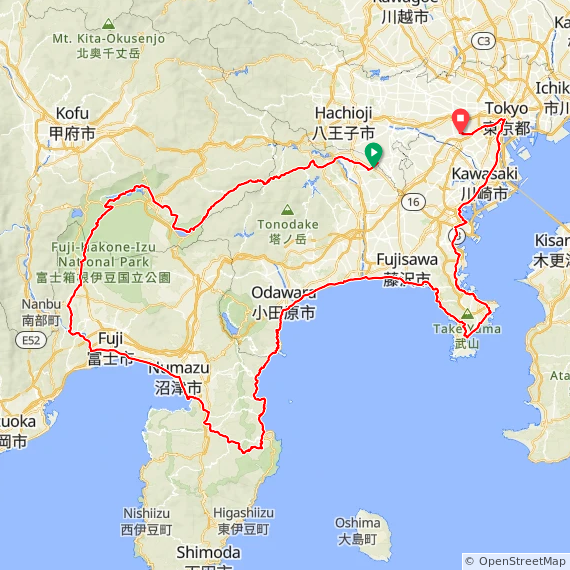
On Saturday/Sunday, May 12/13, 2018 I finished BRM512 (BRM512富士大回り400km), at 400 km my biggest brevet of the year. After having abandoned the 300 km BRM414 AJ NishiTokyo brevet around Mt Fuji due to atrocious weather conditions on April 14/15, 2018 (see report here), I had been a bit nervous about this one. It does an even bigger loop with more elevation gain (3500 m vs. 3000 m) and in my case, because I’m a slow cyclist, more time spent not sleeping.

I love the splendid Fuji views and the great variety of scenery that AJ NishiTokyo’s 400 km brevet offers. It covers 4 prefectures (Tokyo, Kanagawa, Yamanashi and Shizuoka). In both years in which I had completed the 400 previously (2015 and 2016), I pre-rode it as a personal ride on my own two weeks before the event, which really helped to prepare myself (2015 and 2016 reports).

On the day of this ride my father, who passed away from cancer about 5 years ago, would have turned 80. As a keen hiker, he would have appreciated the views and the camaraderie of this event. I was thinking of him a lot this day.

Preparing for the ride

The abandoned 300 km in April shook my self-confidence, since it was the first time I had abandoned a brevet on a course that I had successfully completed before, even if it was due to an external influence such as extreme weather. I then decided on a crash course to get into shape for the May ride, still doing only one long ride a week, but picking difficult ones.

Cycling legend Eddie Merckx is often quoted as having advised: “Don’t buy upgrades, ride up grades!” Personally I somewhat doubt he would have said that, given this English play on words would not work well in other languages, that Eddie was from the Dutch-speaking part of Belgium and back in those days he was far more likely to be interviewed by French, Italian, Dutch or German-speaking journalists than English-speaking ones. Nevertheless, as advice it is spot on 🙂

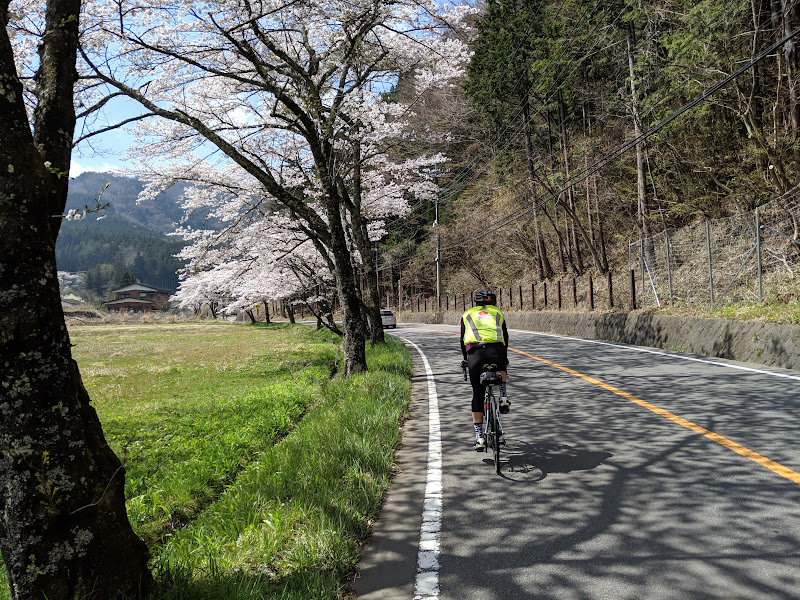
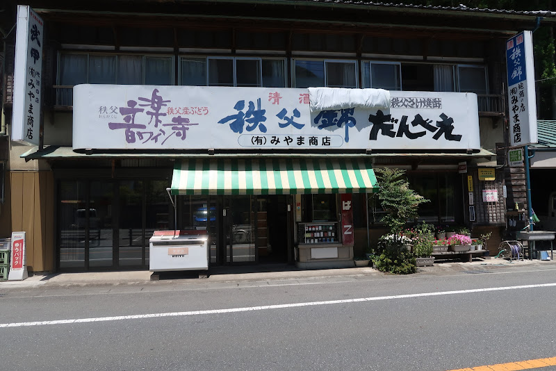
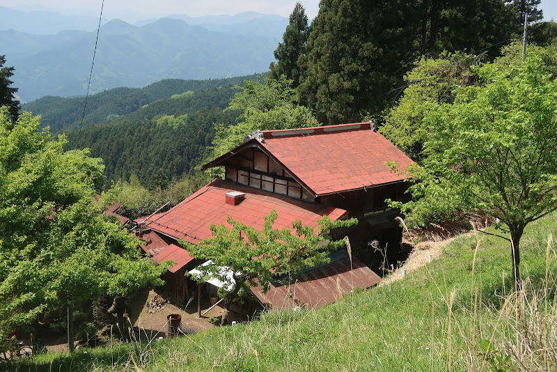
There are a couple of courses that I tend to ride only infrequently (such as once a year or less) because they’re so hard. One of those is the Oume Temple Loop, a mountainous course near Hanno conceived by my friend Deej. Most years I only rode it once, if at all, but then in 2017 I ended up doing it twice just one week apart, each time with a different friend. I really thought that exercise helped me on my subsequent Fuji 300 brevet, which I finished with a personal best time despite insanely hot temperatures.

So for this year I put the Oume Temple Loop back on the menu. One week after the rained-out Fuji 300 I cycled to Oume to pick up six other people and we rode the course. One highlight is the Takayama climb, a big climb of 8 km that gets steeper and steeper and tops out at over 20%.

You will pay for this effort on all subsequent climbs on the ride. The scenery is beautiful though. Many of the rindo (forest roads) are exceptionally quiet. It’s a world apart from Tokyo.

Two days later I announced a repeat of the ride for the next weekend and was rejoined by one of the participants from the first time and three others. Again it was very hard. I don’t know if the memory of the previous ride helped or discouraged, but we did it.

The next weekend I organised a ride up the Kazahari rindo, a forest road in Hinohara with up to 19% that has a reputation for being painfully steep, followed by a visit to the Nippara Limestone Cave.

Altogether I did 5 rides of 178 km or more on the 5 weekends before BRM512. I think especially the Temple Loop rides were excellent training, both physically and mentally.

In the week before the ride I tried to avoid staying up too late and took a nap on some days if I had got too little sleep for some reason. I also watched the weather forecasts for Saturday and Sunday for several locations around Mt Fuji, to make sure there was no chance of rain.

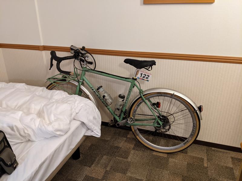
The Monday before the brevet I took my Elephant Bikes NFE to Tim of GS Astuto to install new brake pads and check the rotors as I knew the pads were pretty worn out. It turned out the rear pads were actually worn down to the metal. With fresh resin pads the brakes are fantastic again.

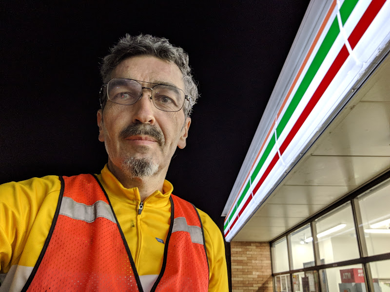
On Friday evening I loaded up the bike to cycle 29 km to Sagamihara, where I had booked a room for the night at Toyoko Inn, so I could get plenty of sleep and would only have to cycle 3 km to the start of the event. Despite having rested the whole week I didn’t feel particularly energetic on the way to the hotel, but it always depends on how you feel the day of the ride. A good night’s sleep can make a lot of difference.

25 hours of adventure

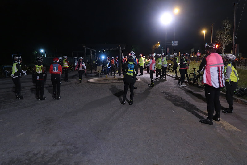
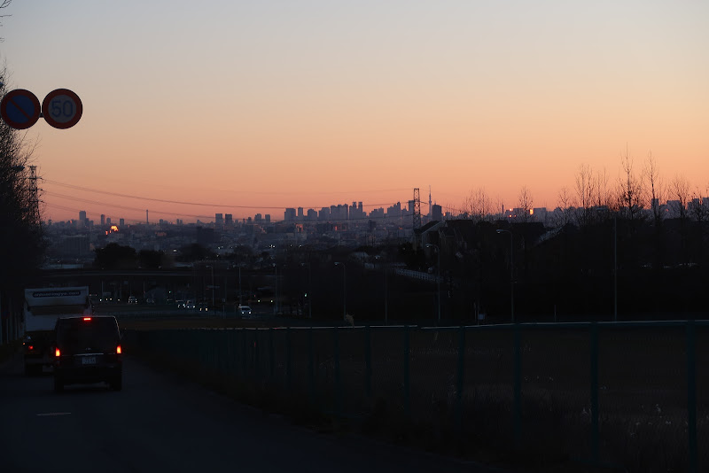
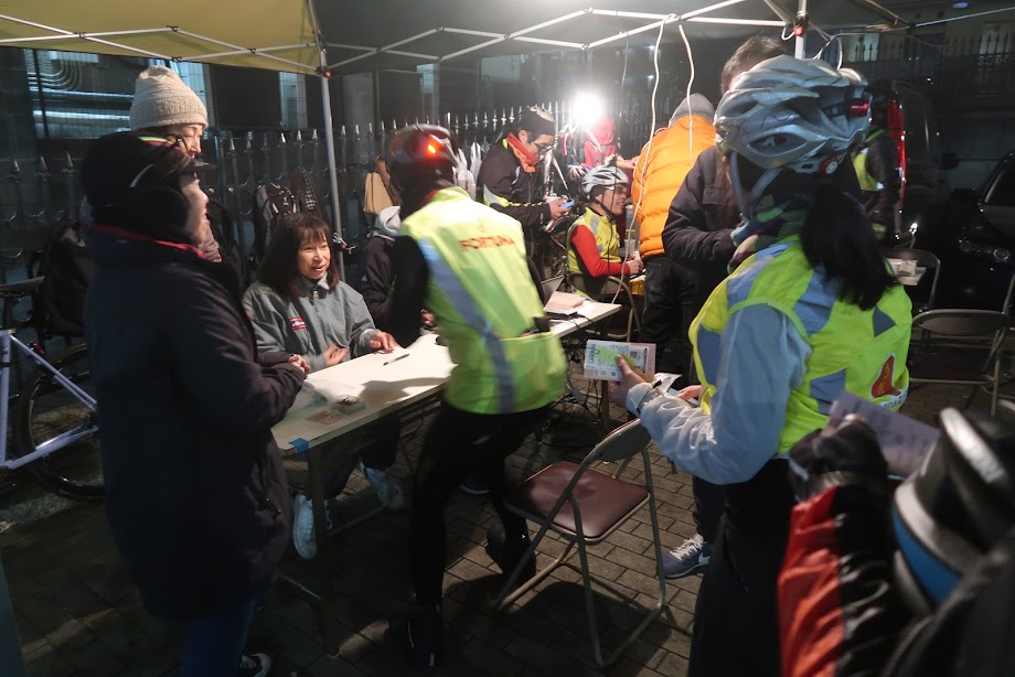
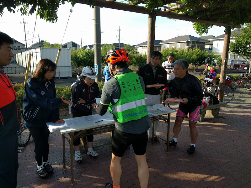
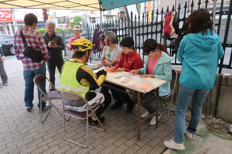
My alarm went off at 05:40 in the morning. I had gone to bed around 22:00 the night before, but woke up twice during the night. I took a quick shower, got dressed and picked up my things to check out. Soon I was on the road. 10 minutes later I arrived at the park for the brevet start. I greeted old friends and picked up my brevet card at the AJ NishiTokyo reception. A lot of the conversations as we were waiting for the briefing were about the last brevet, the washed-out Fuji 300 km. 57 people who had signed up were sensible enough to not even start. I met two of only 8 finishers out of 23 starters. Fortunately the forecast for BRM512 was much more favourable – no rain, a high of about 27 C and a low of about 13 C.

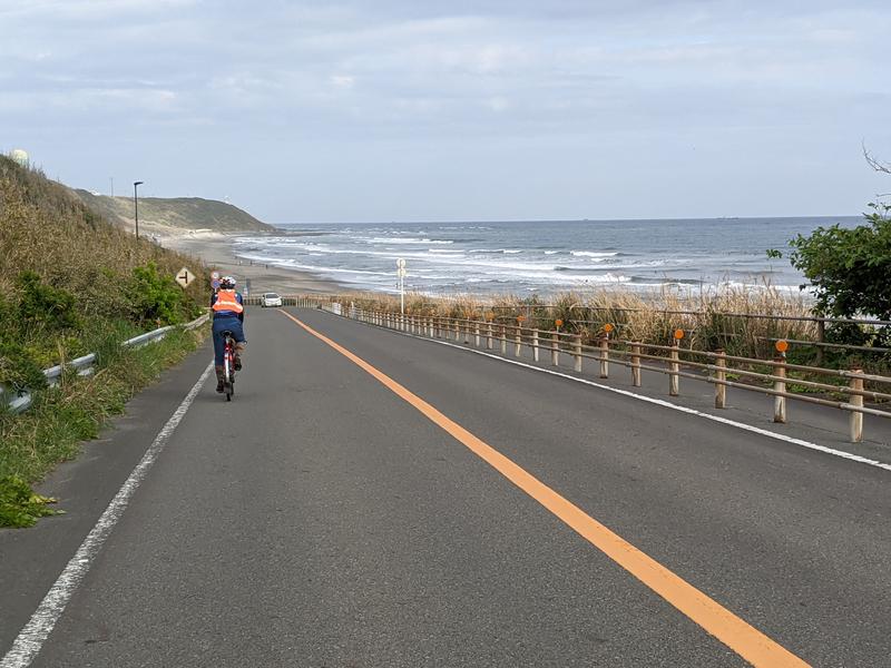
After the briefing and safety check we were off. I think there were about 70 of us. Before we got out into the countryside, we had to stop for a number of traffic lights. At one of them, the lead cyclist wanted to turn left following the course of the brevet in previous years, while the new course went straight. As I pulled up next to her, I pointed out the three areas where the route had changed from the years before. Perhaps she had not studied the new route in detail. I had sat down in front of two computers with two monitors, comparing the old and the final new route side by side about a week before the ride.

I also always make sure to download the route as a GPX file to my GPS so I can follow a breadcrumb trail on its screen, a virtually foolproof way of navigating a course.

Despite the length of the course, even out in the countryside I was often within sight of other cyclists, and sometimes drafting or leading someone. That’s always reassuring, as it tells you that your performance is reasonable enough.

The organisers had replaced one untimed check on the way to Yamanakako with a timed check point near Kawaguchiko, at about 900 m above sea level. Previously PC1 (point de contrôle 1) had been only after the descent from Motusoku, at much lower elevation again, which allows one to make up time lost climbing from sea level to the elevation of the Fuji Five Lakes.

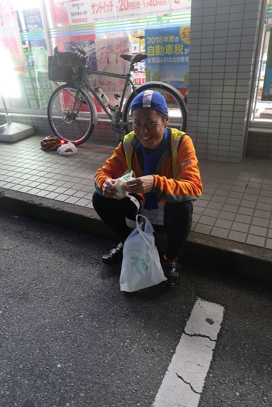
I stopped at one convenience store before entering Doshi road (national route 413) to buy food and some bottled milk tea, then again at the Doshi road station (Michi no Eki Doshi) around km 51. The climb from there to the tunnel felt hard. I was feeling my legs, but I knew the biggest climb would be out of the way and if I could only maintain any time buffer ahead of the required minimum speed that I was left with by then, I could finish the ride by maintaining slightly less than a 15 km/h average, as long as I didn’t get too sleepy.

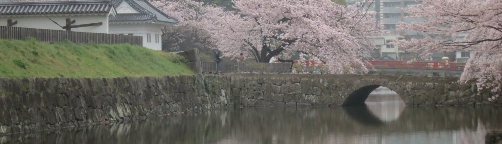
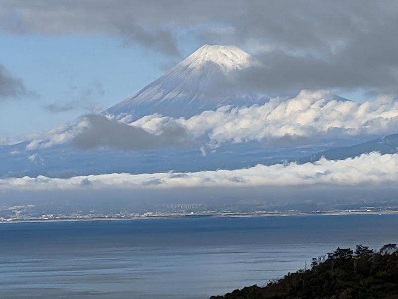
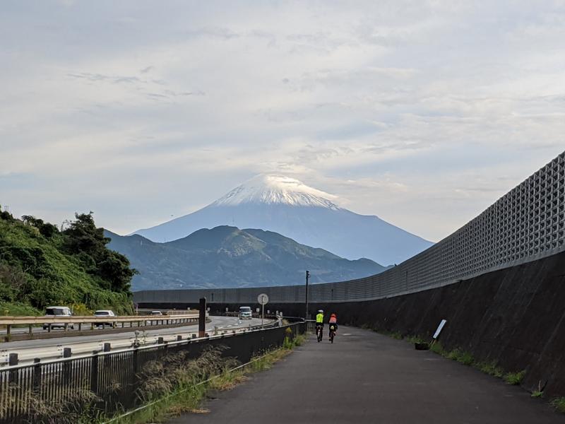
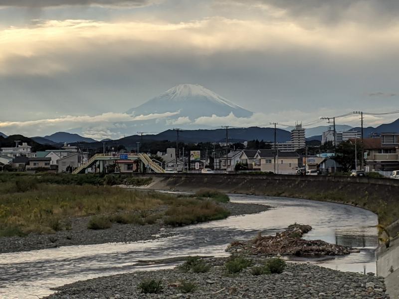
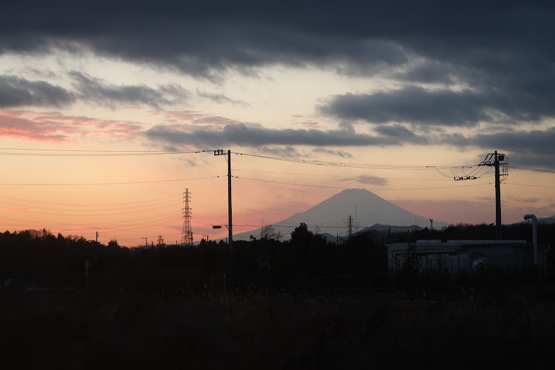
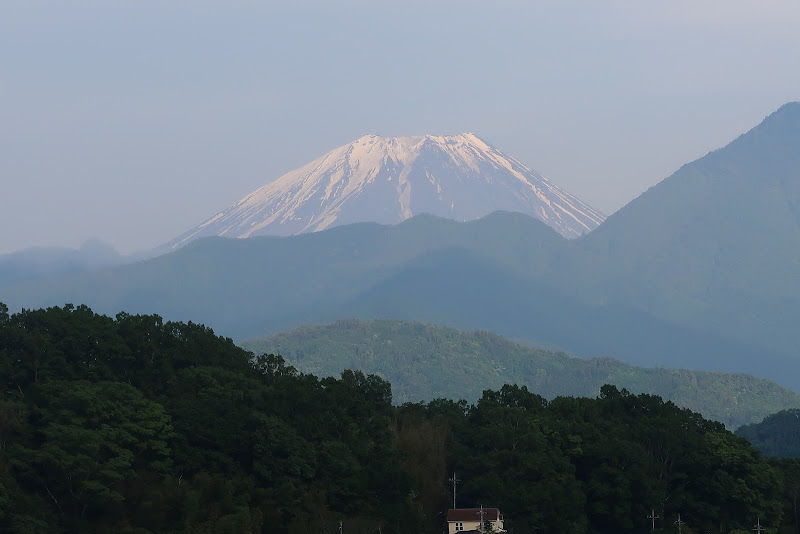
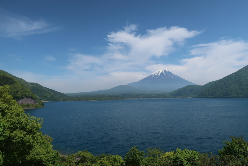
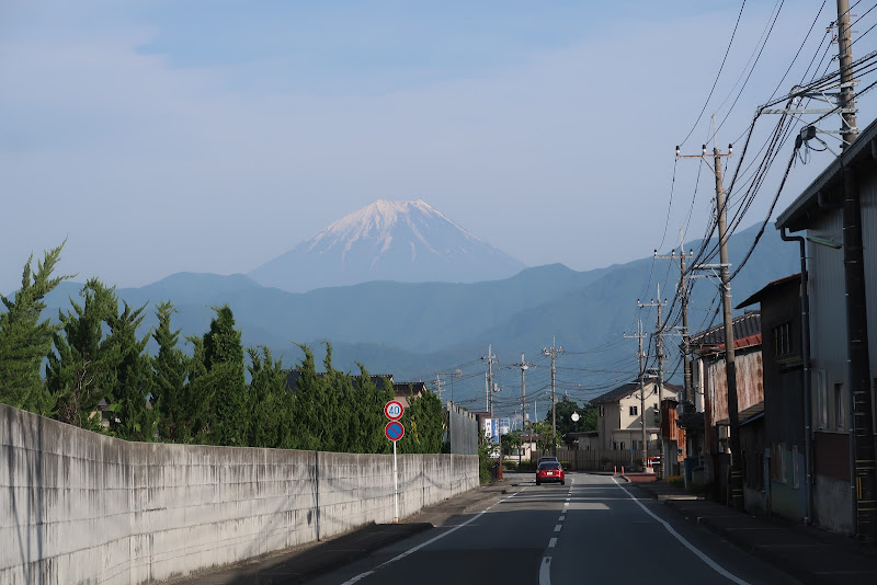
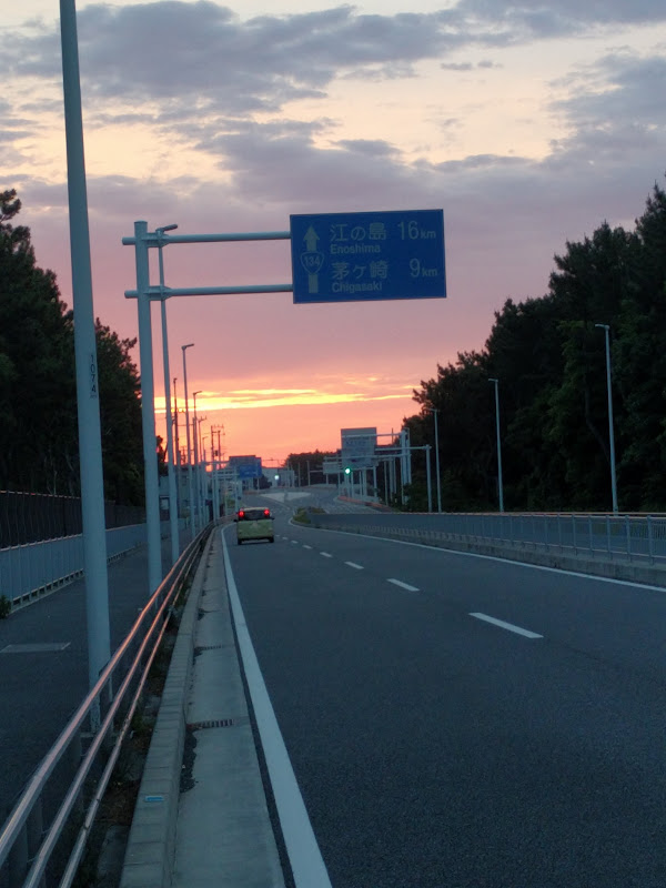
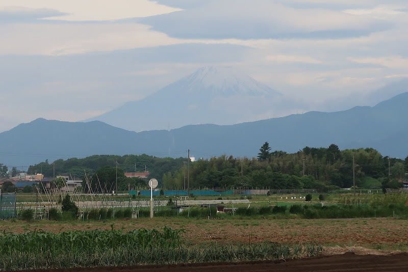
I saw the first Fuji view around Doshi village and was surprised how clear it looked, because there were some clouds in the sky. Nevertheless, on the other side of the pass, the views got even better.

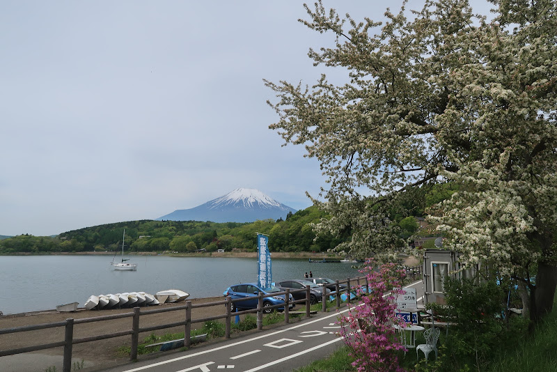
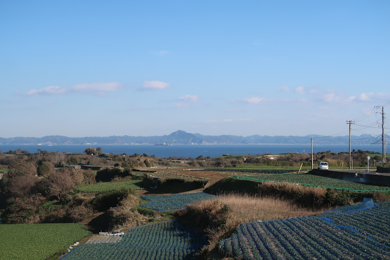
On the shore of Yamanakako (Lake Yamanaka) I could see the snow-capped peaks of the Japanese Southern Alps, which is actually fairly rare. Half the time you can’t even see Mt Fuji from the lake that lies right in front of it! It was a gorgeous day for views.

From the north side of the lake we followed a minor route, away from national routes 138/139 that we had taken in 2015/2016. The roads were much more quiet. We passed forests and a flower park. Most of it was downhill too. Finally PC1 came up, around km 82. I was 41 minutes ahead of schedule, which was not bad. I bought some food and kept the receipt as proof of the passage.

This 7-11 store was right in front of the entrance to a 2.4 km long tunnel. As I was eating and talking to staff and other cyclists, I saw two cyclists in reflective randonneur vests enter the tunnel without stopping for the PC. Later, as I had almost crossed the tunnel, I saw them come back towards the PC inside the tunnel as they must have realized their mistake.

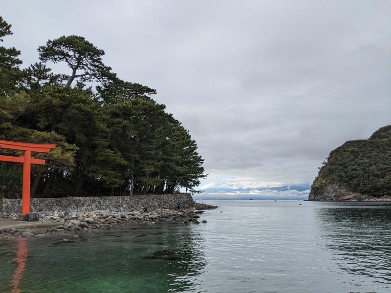
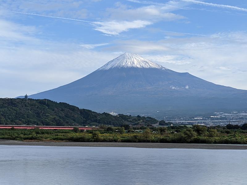
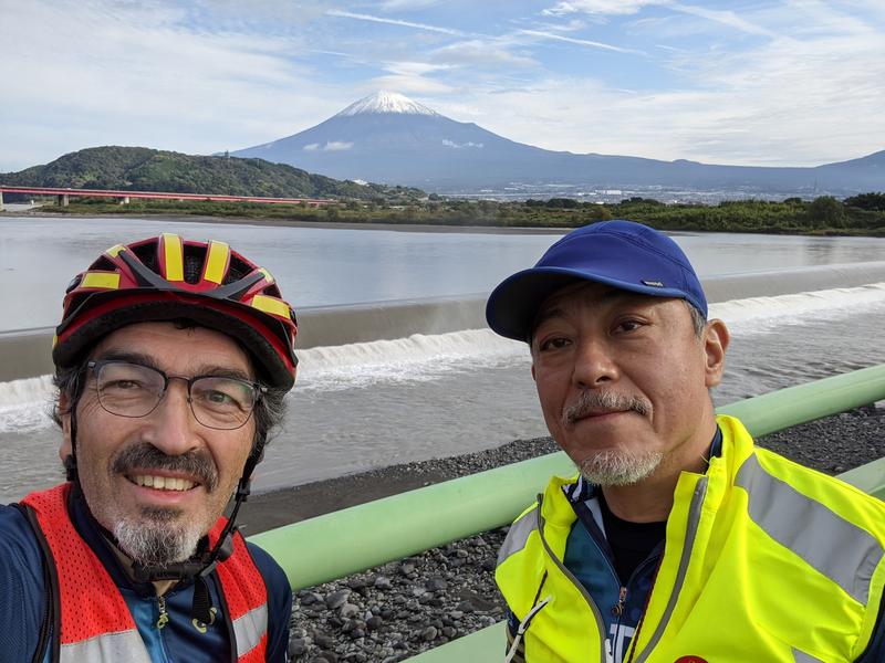
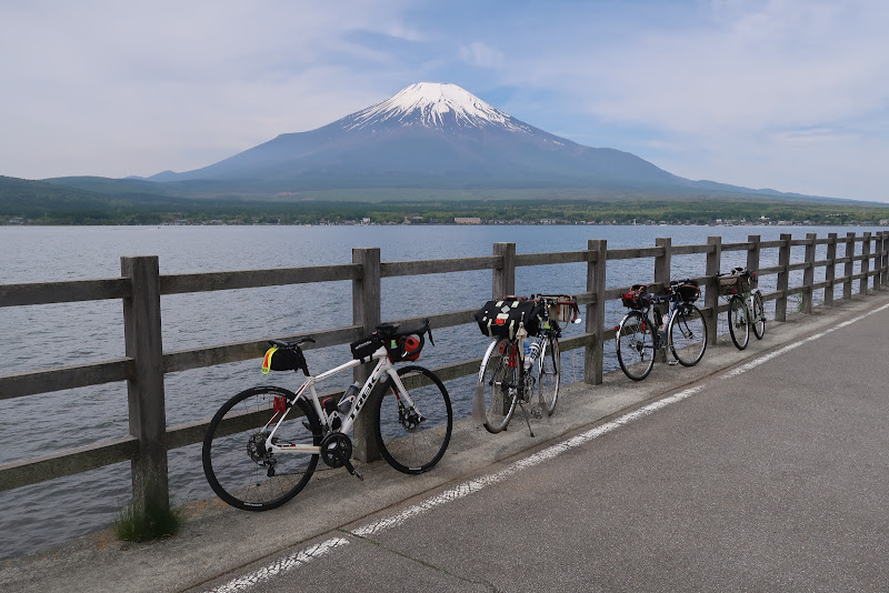
After the tunnel the route followed the north shores of Kawaguchiko and Saiko, again offering beautiful Fuji views and opportunities for photographs. Then the road climbed to meet up with Rt139, but only followed it for 6.5 km, with the Aokigahara forest on our side.

I was looking forward to the national route 300 turnoff for Motosuko (Lake Motosu). There’s a famous spot facing Mt Fuji where you get the exact same view of it as you see on a 1,000 Japanese yen bank note (well, except for the seasonal amount of snow and the reflection of the mountain on the lake surface depending on how smooth it is with wind, etc). Everybody stopped here to take a picture.

Right after that we entered the tunnel for the Motosu road descent, the biggest and fastest descent on the entire course. On a previous event one of the participants had a bad accident here and had to be airlifted to a hospital, so AJ NishiTokyo staff will always point out to be careful on this descent.

There are some nice views on this descent too and I stopped again for pictures. After the steepest part we turned off for Yamanashi prefectural route 9, which crosses over to an adjacent valley, then another long descent all the way to PC2 near km 133. After the time gained on the fast descent, I was now 1:25 (85 minutes) ahead of the minimum pace.

There were no big climbs on the way to the untimed checkpoint near Minami Alps at km 156, so progress was good. In fact, we even had a nice tailwind. Though this would turn into a headwind on return, the return route also starts with a fair bit of descending that initially more than compensated for the headwind.

I passed a TDK factory in Minami Alps that had beautiful rose bushes facing national route 52.

The checkpoint on top of a loop-shaped ramp provided a nice view of the wide mountain valley at the heart of Yamanashi prefecture, including Mt Fuji. Though it was still almost another 50 km to the half-way point of the ride, it felt like we were already half way there.

There I met my friend Mr O., usually an extremely strong rider, who was resting and looking exhausted. He had not had enough chance to cycle this year to prepare himself. He decided to do the safe thing and retire from the ride.

The return route passed through small towns with a nice descent.

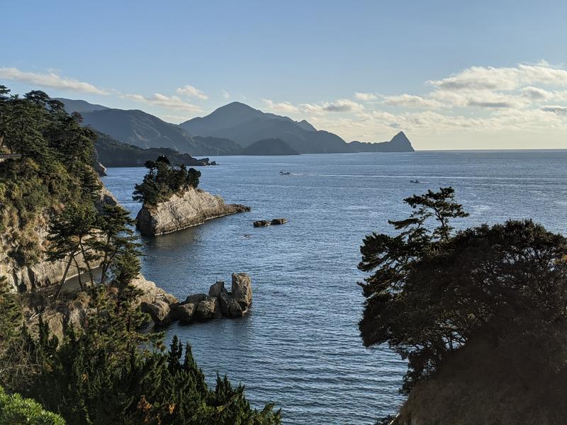
I could still enjoy the Fuji views from the Minami Alps side, which were as clear as from Yamanakako and Kawaguchiko.

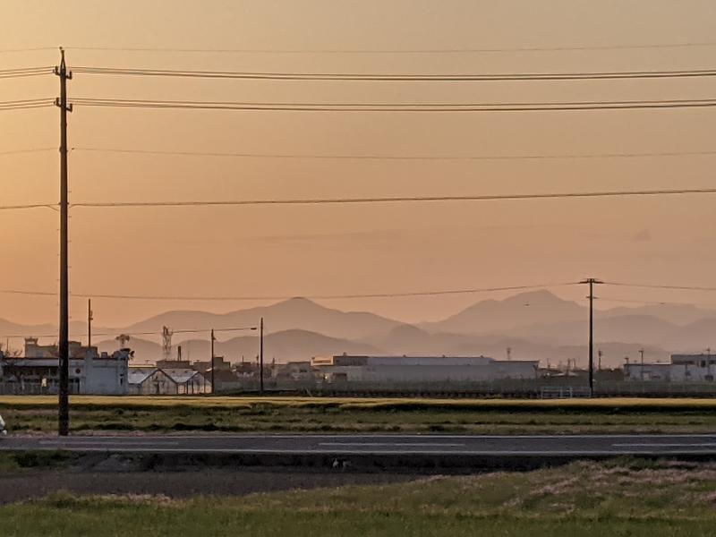
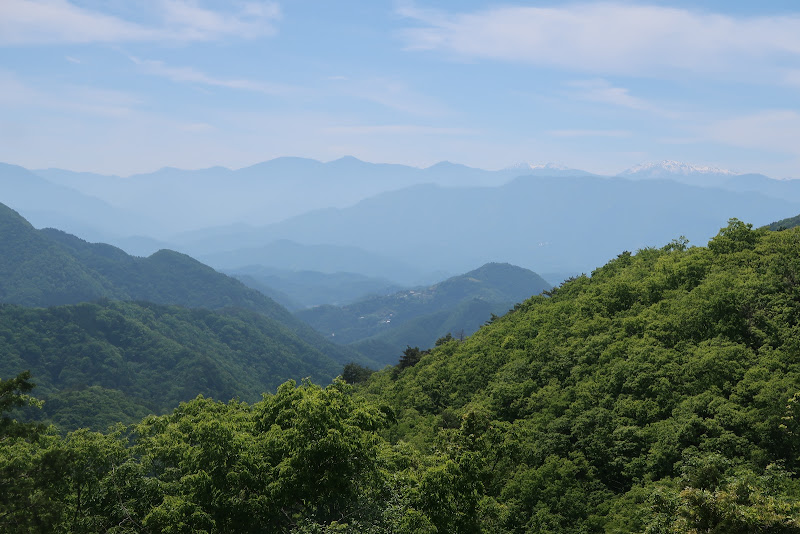
Gradually the road became more level and the wind more noticeable, especially after we rejoined Rt52 along the Fujikawa river to the coast. Then we crossed the river near Minobu and followed the Minobu railway line. The road became more hilly and evening approached. There’s a lot of construction going on for the Chūbu-Ōdan Expressway that will connect Chūō Expressway to Shin-Tōmei Expressway when completed.

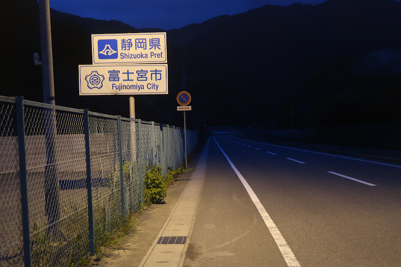
I don’t really like those hills along the Minobu railway, especially after dark when there are no more views, so I was glad when about half an hour after sunset I reached PC3 in Shibakawa (219 km from the start), 2 hours and 14 minutes (134 minutes) ahead of closing time.

From here it wasn’t far to the coast and I crossed the river, now heading east towards Numazu.

At daytime there would have been more Fuji views, but at night it was just city streets. Every now and then I came across other cyclists who passed me.

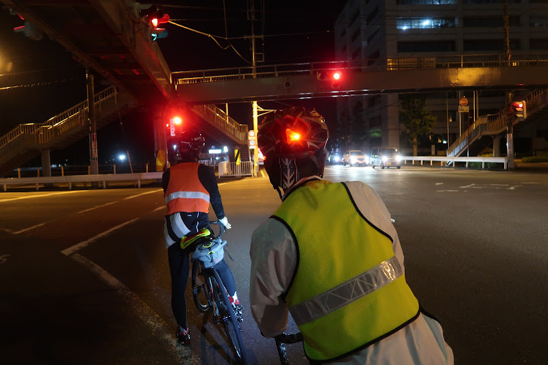
I was just keeping a steady pace, every now and then yawning or standing up to relieve my bottom, which was starting to complain about the amount of time spent on the bicycle saddle.

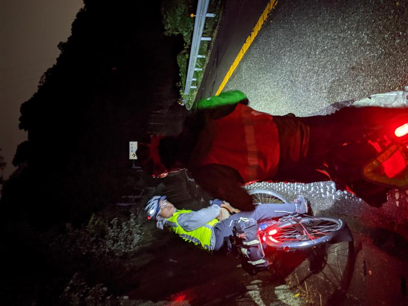
In Numazu the route turned south into Izu. After Shuzenji it became more rural. I was looking forward to the tunnel at the top of the pass and the descent towards Ito. I made it to PC4, 290 km from the start, a little after midnight, now 2 hours and 15 minutes ahead of closing time. I took a 5 minute nap on a chair inside the convenience store. Others were sleeping too.

For the night ride I was wearing long johns under my shorts and also a base layer under my jersey, but no windbreaker which remained unused for the entire ride. It never got cold enough.

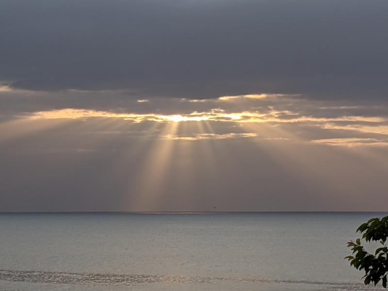
It felt great to descend to the east Izu coast line and to finally hear the ocean waves. It was still dark and I could admire the many stars above the ocean, since there was a lot less light pollution than in Tokyo.

Even after the descent there are four significant climbs between Ito and Odawara, the biggest one being for the road high above Manazuru which lasts for about 4 km. I was feeling safe in the knowledge of having made good time so far. I did yawn every now and then, but the nap had helped. My legs felt OK, not particularly strong but not suffering either and my bottom was OK as long as I made frequent efforts to stand instead of sitting throughout.

It was still dark in Odawara but dawn gradually arrived on the ride east to Chigasaki.

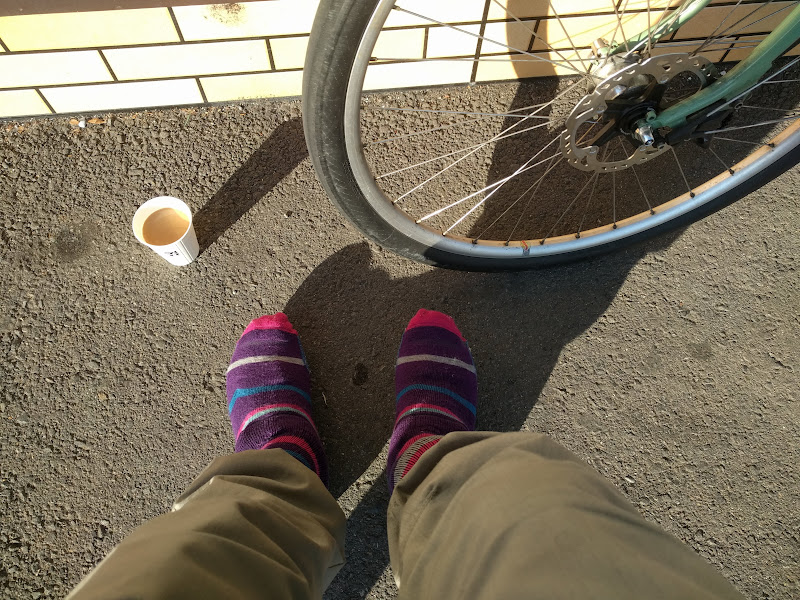
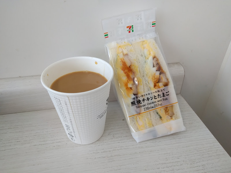
I saw newspaper motorbikes deliver morning papers and the odd surfer heading to the beach already. Soon after Rt 30 split off the coastal road I saw the 7-11 sign that announced PC5, the final control (367 km from the start). To get my receipt and to use the toilet, I bought a cup of coffee and a sandwich.

I had only 36 km left and was 2 hours and 4 minutes ahead of closing time. I basically had 4 1/2 hours to get to Machida. Two years ago, I had been one hour ahead of closing time at PC5 and still made it despite a puncture 16 km from the goal that chewed up most of the time buffer.

There were still more Fuji views on the way to Machida. Rain was forecast for the late afternoon and I could see clouds and occasionally feel raindrops, but rain was still a long way off.

Sunday morning traffic and traffic lights slowed me down but looking at the remaining distance and time, I figured I had a chance to make the goal by 08:00, a full two hours before goal closing time at 10:00, so I pushed harder. It was not easy after 24 hours on the road, but I tried anyway. I didn’t know if I would make that time until the very end. It was only when I rolled up in front of the Cherubim Bike Shop, greeted by AJ NishiTokyo staff who confirmed 08:00 as my arrival time, that I knew I had completed the course the full two hours under the limit!

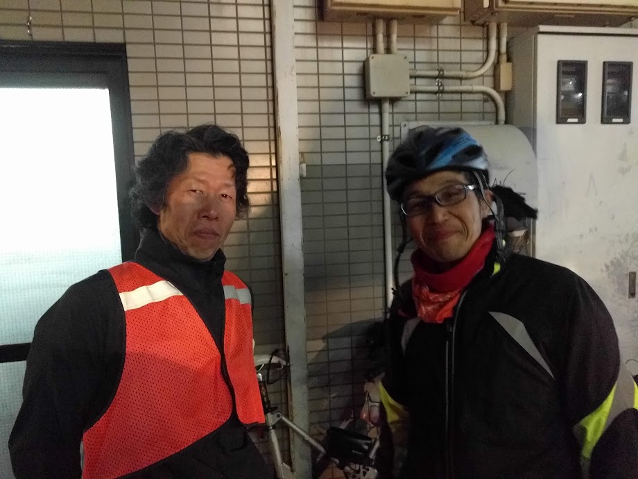
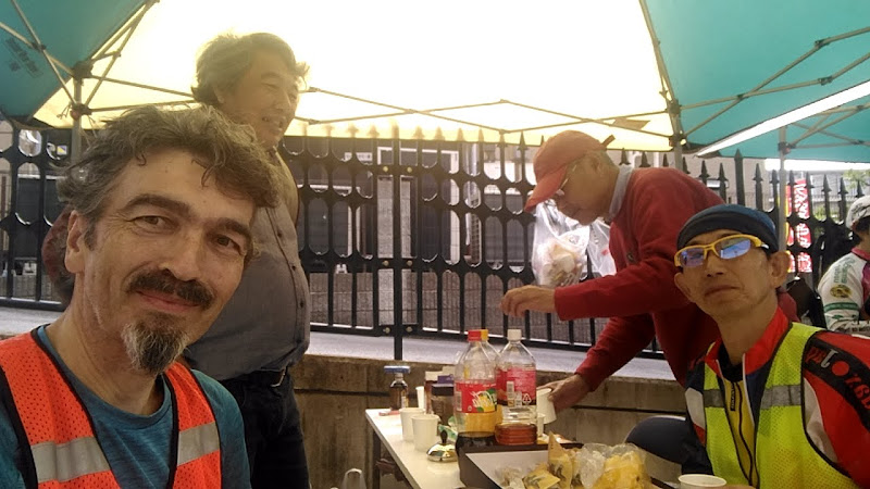
I parked the bike and got out my brevet card and receipts to have them checked. After signing for the result, I opted for the medal (1,000 yen extra). Then I had some coffee and snacks and chatted with staff members and fellow participants about the course and about bikes.

About riding long distances

It’s hard for normal people to comprehend how someone can ride 200, 300 or 400 km in a single ride, but each of these rides builds on previous rides in physically and mentally conditioning you for the next challenge. We dare to do more challenging rides only because we successfully rode other, initially also intimidating rides.

Any road cyclist who has done 50 km rides can do 100 km rides, and anyone who has done 100 km rides will find 200 km rides within reach. As long as you keep the effort sustainable and keep eating and drinking and ride a bike that fits you, you can keep on going for a very long time. At some point, sleep will become the limiting factor, which then becomes a question of average speed vs. control closing times and your tolerance for sleep deprivation.

This 400 km course may actually be becoming my favourite AJ NishiTokyo course, rivaling even the 200 km West Izu (Shiokatsu) course that I also love for its views.

Though it’s longer than the smaller 300 km Fuji ride, I don’t think it’s necessarily any harder. Certainly, in recent years I’ve been able to finish the 400 km with more spare time than in the case of the 300. Perhaps that’s because the effort in the 400 is more concentrated in the first part, when the legs are still fresh, while the 300 saves its biggest climb for halfway into the course. Also, while the 400 has one third more distance than the 300, it only has about one sixth more climbing. This should allow for a higher average speed.

Beyond the 400 km brevet

I won’t be riding the AJ NishiTokyo 600 km brevet to Lake Suwa and back in early June because I’ll be away on a business trip. So there probably won’t be any brevets for me until September or so. Instead I’ll be just riding with friends again, maybe explore some new routes.

Again this year I won’t go for Super Randonneur (SR) status, which involves riding 200, 300, 400 and 600 km distances all in one season. 600 may be beyond reach for me under all but the most favourable conditions, because it’s hard for me to build up enough spare time to sleep enough to keep functioning. Gaining SR status in 2019 is also the qualifying condition for participating in the 1,200 km Paris-Brest-Paris event next August, which I am not currently aiming for.

I very much enjoyed my bicycle tour in Italy with my son Shintaro a year ago, where we only covered about 90 km each day, but had nice meals in little restaurants in the countryside.

If I were to try more cycling in Europe or elsewhere overseas, this is more like what I would like to try, while keeping up randonneuring as a challenge here in Japan.